Tasman Peninsula an unforgettable trip of spectacular proportions. 

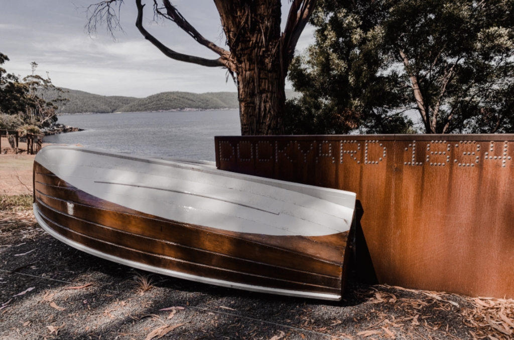
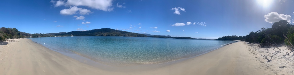
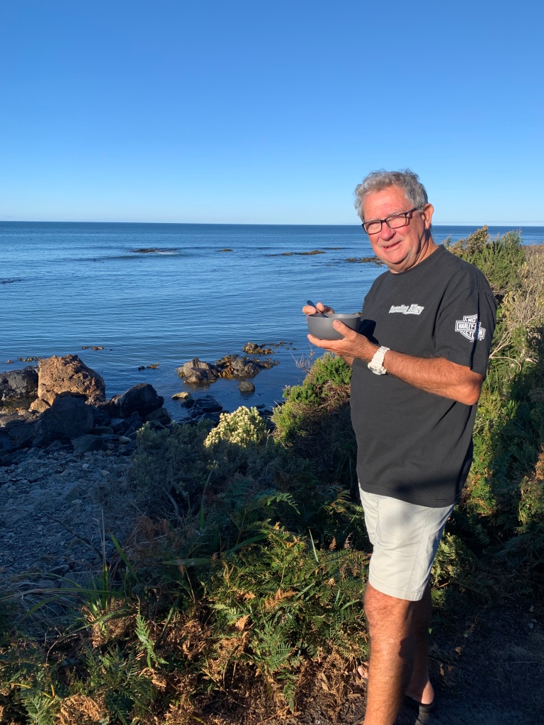
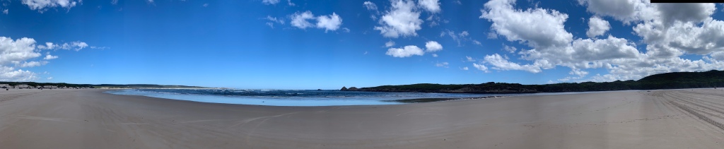
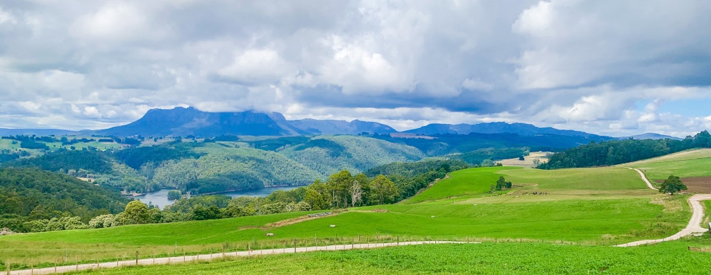
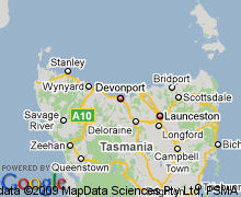
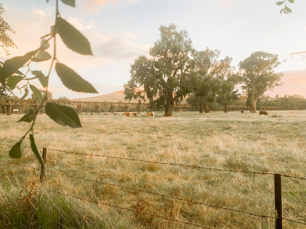
This coastline is the Tasman Peninsula, officially Turrakana / Tasman Peninsula, and is located in south-east Tasmania, Australia. With its lush forests, sheltered bays, beautiful beaches and close proximity to Hobart, the Tasman Peninsula offers an abundance of fun for the adventurer. Every year, this nature rich Tasmanian jewel provides nourishment and shelter to thousands of sea creatures. Humpback and southern right whales, dolphins, seals and sea eagles are everywhere.

Have you ever been totally gobsmacked at the sheer beauty of nature around you. Has it been one of those overwhelming experiences that you just feel you could never put words to the beauty to explain it to someone else. We if you have you will know the difficulty we are having to explain just how magnificent the Tasman Peninsula is. 

Sure you can tour it by car or by walks, but to experience it’s sheer awesomeness is to see it from the ocean. Ok right you know we are sailors so you would probably expect a comment like that from us. But it is truly the only way to see this incredible coastline with the highest vertical towering sea cliffs in the Southern Hemisphere, there are waterfalls, unusual rock formations, archways and deep-sea caves and an abundance of sea life and for us it was all up close and personal. 

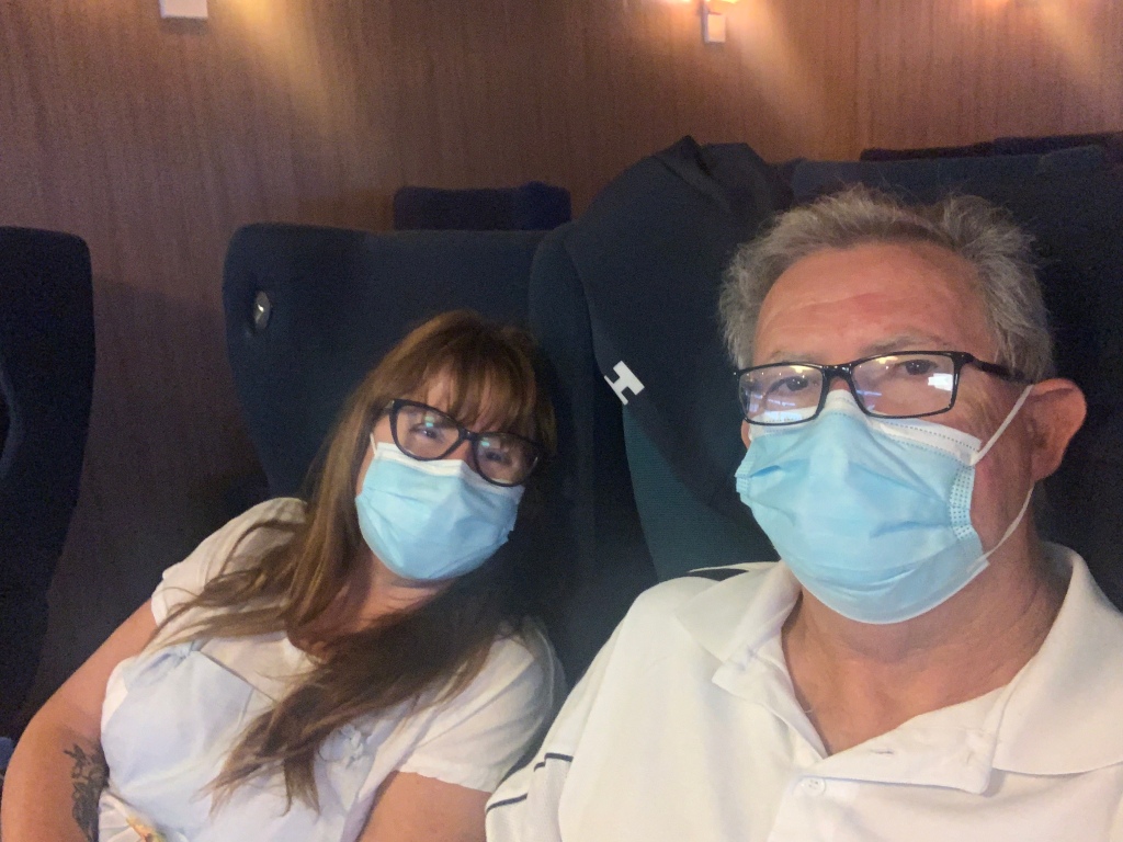
We saw it all the feeding frenzy of diving gannets, albatross and sea eagles wheeling on the wind, cliff-nesting cormorants and peregrine falcons and a playful pod of dolphins surfing the bow wave of the boat. We had the front seats to Mother Natures show. Dressed in our red condoms to ward off the bitter cold wind we embraced this amazing opportunity to take in everything we could that this wild seascape offered. 

Yep Red ❣️ condoms head to toe.

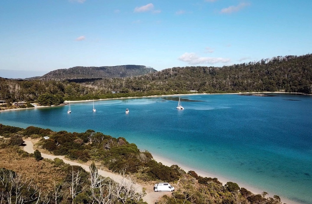
We started our tour just down the road from where we were camping in the NRMA Park. From the tour office we took the option to take a 15 minute walk to where the boat was moored in Stewart’s Bay. Once dressed (in our red condoms) and seated onboard we were asked to place all belongings off the floor and to fasten our seatbelts for a ride like no other. This purpose built boat offers covered but open to the air, tiered seating with an excellent all-round view to connection with the environment. The boats are comfortable and gentle on the environment due to their fuel efficiency and low emission operation. 

Being environmentally friendly is of particular important to the operators of this tour company, family run with a 21 year history, Pennicott Wilderness Journeys has become a highly acclaimed environmental tourism operator and has won 29 Tasmanian, 1 Victorian and 14 Australian Tourism Awards. Driven by a desire to share their success and give back to the environment and community, they established the Pennicott Foundation as a flagship for important philanthropic activities. A portion of our cruise ticket goes to the Foundation, which has contributed to eradicating feral cats from Tasman Island and rats from Big Green Island. Since the successful eradications, over 100,000 breeding seabirds are saved each year, and breeding is now well established back on the Island. The foundation continues to work and support many projects close to it ethos. 

Leaving the dock at Stewart’s Bay, we first toured Port Arthur the skipper gave a running commentary which we must say with the wind in our ears was very hard to hear most of the time. From Port Arthur itself we headed along the protected shores overlooked by Arthur’s Peak. This is where we picked up some hitchhikers on the bow wave and they were certainly in a playful mood.

One of the most fascinating behaviors of dolphins is when they ride the bow pressure waves of boats. There is often quite a bit of jostling for position at the bow, as dominants of a group edge others to a less favourable position, or as one is displaced from the bow by another one approaching. It was great fun to lean over the bow and watch these interanimal antics. For us we have seen it many times but you never tire of seeing it and it was a delight to hear others onboard seeing it for their first time.

We continued on with the dolphins staying with us for quite sometime, but as we neared the open water the swell increased and the dolphins probably knowing that we had more to see peeled off one by one into the deep ink blue sea. Coming out through the heads of Port Arthur there was certainly a change in the sea conditions we were all asked by the attentive crew member if we were all feeling ok. Everyone was doing fine, though the swell had increased it was a moderate day with no white caps to be seen just a good size ocean swell, the weather gods had looked kindly on us today. It’s worth mentioning at this point that the cruise is weather dependent and the route that you take may vary due to weather as well. But it was all good so far. 

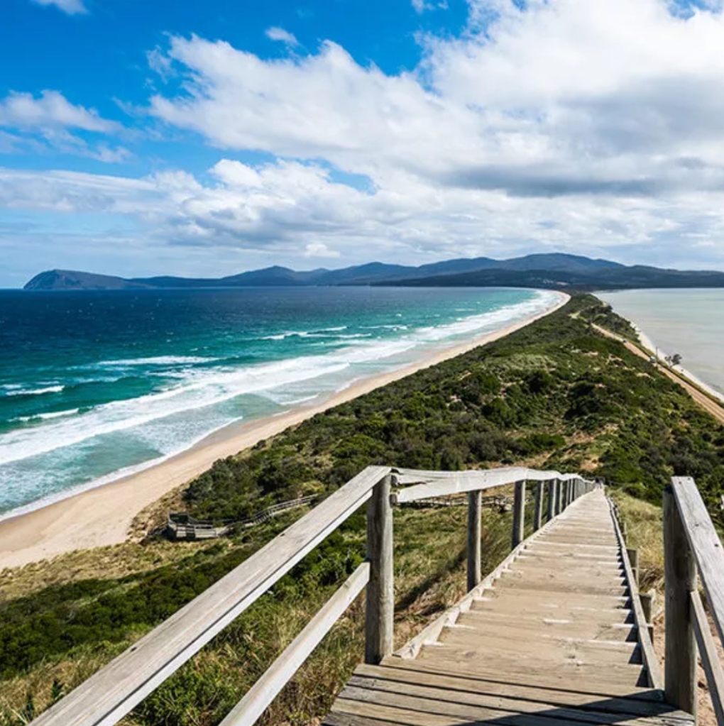
At the start of Tasman Passage we encounter the sheer dolerite cliffs rising 280 metres from the sea. Beyond The Blade is Tasman Island, and ahead we could see Cape Pillar in the distance, what a spectacular sight.

Continuing on through Tasman Passage we encountered our first of the sea birds, sea eagles circling high catching the thermals and looking for prey. On the cliff faces we saw nesting cormorants perched high on the smallest of outcrops. How can they sleep and not fall off. Then we turned the corner to see Tasman Island. One of the most isolated light stations, the island is now part of the Tasman National Park. 

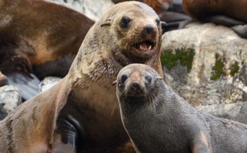
Separated from Cape Pillar by the narrow Tasman Passage, the island’s formidable appearance is awe inspiring. With the highest operating lighthouse in Australia, since 1906. Automation of the lighthouse was in 1976 signalled the end of light keeping as a way of life with keepers withdrawn in May 1977 Tasman Island is an icon of Tasmania and is known as the home stretch for the world famous Sydney to Hobart race. Now a safe breeding sanctuary for fairy prions and safe haven for a seemingly endless number of and sea life. It is here that we see our first seals, leisurely taking in the sun rays beating down on the rock ledges they really didn’t take much notice of the ooo’s and aah’s of the tourists on the boat so close I could feel I could reach out and pat them. 

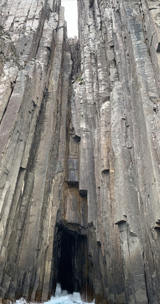
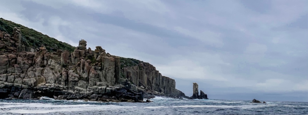
Now it is time to follow the spectacular sweeping coastline to Cape Pillar. Cape Pillar is the jewel in the crown of the Tasman Peninsula’s colossal coastline, with cliffs rising to 300m high. The rock is Jurassic dolerite, the remains of a drowned escarpment, with kilometres of columns, stacks, chasms and great walls rising abruptly from the deep ocean waters, but with just as much below the waterline. Cape Pillar itself is quite extraordinary and descriptions such as “awesome coastal scenery, once seen, never forgotten”, “one of the world’s most fearful sea cliffs” are the quotes that come back to me as I stare at this magnificent landscape before me. It is simply breathtaking.

Climbers abseil down to then climb the Pillar
Can you see the climbers

From Cape Pillar we ventured our further into the ocean to spot more beautiful creatures of the sea. These boats move fast so you real do get a lot packed into your 3 hour tour. Heading back towards the coast you get a true perspective of the grandeur of this landscape. This is as close as we would dare bring Our Dreamtime to the coast and this cliffs still look huge. We are now going into see some unusual rock formations, if we hav yet seen some 😜

Tessellated Pavement this unusual geological formation gives the rocks the effect of having been rather neatly tiled by a giant. The pavement appears tessellated (tiled) because the rocks forming it were fractured by earth movements. The fractures are in three sets. One set runs almost north, another east north east, and the third discontinuous set north north west. It is the last two sets that produce the tiled appearance. This tessellated pavement is one of the largest in the world. This was very hard to photograph from the ocean with the wrong tide, but this is a photograph taken from Eaglehawk Neck on our walk.

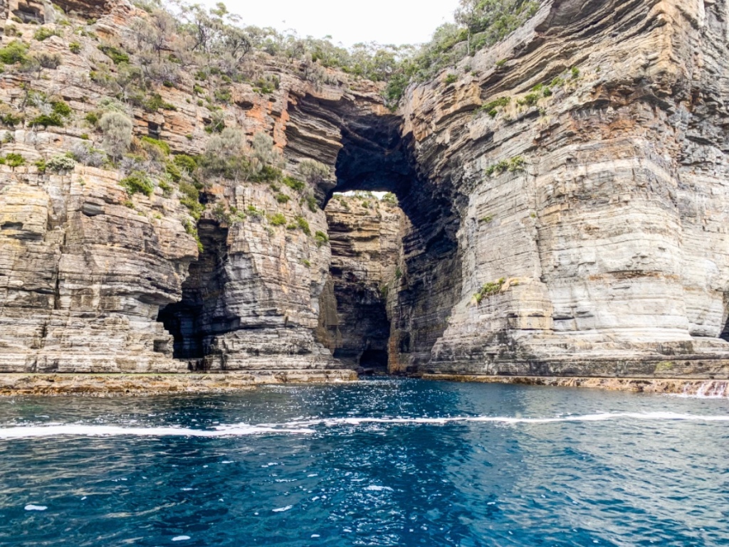
Tasman Arch A natural arch which is an enlarged tunnel running from the coast along a zone of closely spaced cracks and extending inland to a second zone that is perpendicular to the first. The roof at the landward end of the tunnel has collapsed but the hole is too large and the sides are too high to form a blowhole. The tunnel was produced by wave action. The arch ceiling is 52.7 m above sea level. Most people only see the land-side view – but from the boat alongside the coastal cliffs offers a different and amazing perspective of the arch.


Tasman Blowhole the largest blowhole on theAustralian coastline, it takes the form of a long tunnel which opens out into a large collapsed cavern into which the waves of the ocean blow. On days where rough seas occur, the water can spurt over 10 metres high. It is best seen at high tide, but is attractive at any time. We were there on what is considered a calm day. Because of this we were able to get up close a personal to all of these amazing costal features.

The sea was very calm today so the blowhole wasn’t in action

This has truly been an unforgettable journey to the island’s most south-easterly tip.

In summary, we totally enjoyed this cruise and recommend doing it, however it is expensive and for some it maybe out of reach but if you know the costing before venturing to Tasmania you could budget for it in advance and we believe totally worth it.

Photo above provided by Pennicot Wilderness Cruises
this shows how close to get to this magnificent landscape
Take a camera with a good lens to capture the wildlife. The boat is constantly moving and this is an iPhone pic you can see the difference.

If you would like to ride along with us whether it be on the high seas or on a dusty road out west, consider being a patreon find out about it here Dreamtime Patreon every little bit helps to keep us on the road producing Youtube and writing blogs as we hope you enjoy them. 

Please subscribe to the blog so you will be notified each time we post. To subscribe head to our home page.

We love to read your comments so if you have any questions pop them below, we will be sure to get back to you.

If you are interested in the products we used on our van build, our product page has a list. Many of these items we sourced secondhand, others we purchased from the manufacturer or retailer. We have found them online and listed them for you. Some of the links supplied we have an association with and we will receive a small commission if you purchase through the link, but it is free to look and do your research we can not promise all links to work as retailers may remove items, but we will do our best to update them

Join us next time when we discover Launceston.

‘Some Stories Last More than a Lifetime’: Port Arthur

Photo showing the ”new” Penitentiary and hospital prior to fires destroying the site. Photo Courtesy of Port Arthur Historic Site.

Established in 1830 as a timber station, Port Arthur was a secondary penal colony. By “secondary” it meant that the prisoners were repeat offenders. The men and women who ended up at Port Arthur were those who had committed crimes after they had arrived in the colonies; The worst of the worst were sent here and the site was chosen for its remote and inhospitable location. Making escape impossible for the unlucky convicts who were imprisoned here was a priority at the time. Escape was almost impossible, with a line of vicious dogs guarding the only way out, a 100-metre-wide strip of sand at Eaglehawk Neck.

It’s one of Tasmania’s most popular tourist attractions, but the story behind the Port Arthur Historic Site is anything but easily digested, It’s been more than 140 years since the Port Arthur penal colony shut after 44 years of brutal slavery and punishment of the ‘worst of the worst’ sent from the motherland, some as young as 9 years old. Most were hardened criminals, others insane or you could say just unlucky. Some made it out. Hundreds did not.

There is so much already documented about Port Arthur that we will not give you another history lesson here. However we will give you 5 interesting facts to ponder.

1. The convicts built their own prison walls. 
Really ….. No thanks.

It’s hard to imagine that they would really care about leaving a few bricks loose!

The initial industrial penal settlement was built of timber from the surrounding forest and was home to key factories, such as ship building, shoemaking, smithing, and timber and brick making. But by the 1840s, Port Arthur was home to more than 2000 convicts, soldiers, and free officers (and their families), and by 1848 the first stone was laid by the prisoners for the separate prison, which stands as a central attraction today. 

The new Penitentiary even in ruins dominates the site.

This is the most photographed building on the historic site. The new Penitentiary as it was known had 136 separate cells on the bottom two floors for those whom one Commandant called ‘the lions’ – ‘prisoners of bad character under heavy sentence’. They had to be separated from each other and from the better-behaved.

The ”new” Penitentiary as it stands today.

The convicts ate and slept here but worked around the site and across the peninsula. Above the cells was a dining hall (which doubled as a school room at night), the prisoners’ library of ‘useful and entertaining books’ and a Catholic chapel. On the top floor was a dormitory for 348 better-behaved men.

2. An ambitious experiment….. but did it work?

Believe it or not, despite all of the cruelties that went on at Port Arthur, the Governor was trialling an ambitious experiment around the philosophy that prisoners could reform while still being punished.

Religious and Moral Instruction was given at church services.

The authorities’ aim was to offer its prisoners the opportunity to turn themselves into useful citizens of the future by building a system on punishment and discipline, classification and separation, religious and moral instruction, trade training, and education. In combination, they were to provide the convict with opportunities to turn himself into a useful future citizen. We can actually say that Port Arthur was Australia’s first TAFE. 

A sculpture of a ship now stands on the slipway where hundreds of boats were built. Master Shipwright Mr Hoy who was originally at Sarah Island, came to work and train the convicts at Port Arthur.

There were many benefits for learning a trade, apart from the obvious one in improving ones life. Convicts that were good at their trade also received privileges like tea and sugar, and some skilled prisoners were even rewarded for good work with a ration of rum.

However for those who did not tow the line. Harsh punishment in the form of solitary confinement was issued. Now we were lead to believe in school that these prisoners were kept in the dark for 23 hours a day. But in fact they worked in their solitary confinement quarters for 23 hours a day with one hours exercise. But they were not to utter a word or make a sound. They were kept in a state of silence. This represented a move away from physical punishment to a focus on psychological punishment. 

Isolation, confinement and total silence was the
punishment for the untameable

3. Convict tattoos… more than just for decoration.

It’s nice to know some things are woven through history. Go back 180 years, and even convicts had a thing for tattoos. And just like today, they were for many and varied reasons. From purely decorative, to a tribute to a loved one, and even a reminder of a trial date, or in fact when their sentence would be complete.

While some of the most common tattoos were that of a woman, a cross or crucifixion, a heart with the initials of a loved one, a man, and a mermaid – the most popular was that of an anchor, which was a symbol for hope.


How do we know about these tattoos? The government of the day were very precise in their record keeping. Identifying a prisoner was of importance so detailed descriptions were made.

4. Drawing the short-straw… the life of a soldier

There was no glory in guarding convicts. Speak to most soldiers and they say they train for battle to defend their country and that of their allies.

So imagine being called up for duty when there is not only no chance for any of that, you’re across the other side of the world in a place called Van Diemen’s Land. Most regiments posted at Port Arthur regarded it as a low point in their history. Their main job was obviously security, watching over the convicts working in the bush or building boats, and of course chasing after escapees.


With their accommodation next to the Commandant’s house, it wasn’t all bad news. Senior offices and their families apparently had busy social lives and enjoyed dinner parties!

5. The care of the older and infirmed


Most convicts lived a life of heavy labour, and for those already skilled they would be put to work in their trade. But for those men who were too weak for the heavy lifting, you’d find them in the gardens or performing light duties at Garden Point.

The hospital as it was prior to destruction by fire.
The hospital in ruins today

During the 1860s Port Arthur entered what is becoming known as its ‘Welfare Phase’. This period saw the construction of the Pauper’s Depot in the Hospital (1863-64) and the Asylum (1864-68). The result of an ageing and increasingly infirm prisoner population, these were the centres of Port Arthur’s somewhat benevolent leanings. Another result of the ageing prisoners was that the profitable convict-driven industries like timber-getting and agriculture took a downturn.

In keeping with the era, treatment for the patients, many suffering from depression or mental disability, was rudimentary at best. Convict patients were provided with a ‘soothing’ atmosphere, where they were allowed exercise and mild amusement. Work, though limited, was mainly tending the gardens, or chopping firewood. 

The NRMA caravan park where we stayed is the location of the convict gardens where they once flourished. Convicts walked the 50 minute return trip each day after attending to the vegetable gardens, which feed the 2000 occupants of the site.


Port Arthur Historic Site is one of the those few attractions where even when going in with high expectations, it still managed to excel. This is a historical site of untold disappear. As you run your fingers slowly across the hand-made clay brick remains of once imposing structures built on the blood, sweat and tears of convicts at the notorious Port Arthur Historic Site, you feel an energy, a deep melancholy and unexplained sadness.

The unease contradicts the view about you. The day is warm and peaceful with the leaves of broad ancient oaks and gum trees chattering in the breeze. Bumble bees hover over colourful flowerbeds and cherry and apple trees are bursting with fruit.

You can’t feel good walking about this monument with its horrific past that was enforced upon this land. A history that tried to be forgotten by so many even changing the towns name to Carnarvon to wash away the past. But nothing could erase the past, not even the bush fires that ravaged it. It has succeeded regardless. What has triumphed though is the stories of individuals who served their time, reformed, escaped or died. They left a history that we should never forget.


We have been to Tasmania on many occasions, but we have been unable to visit the Port Arthur site. It is 26 years since the Port Arthur “Massacre”, (how we hate that word). 26 years ago 35 innocent people lost their lives, and 23 others wondered, families were destroyed and dreams were never fulfilled. Kate Scott was one of those vibrant young lives, never will she grow old and never will she nor any of others be forgotten. We were finally able to pay our respects to Kate and those taken from us on that fateful day.

Rest in Peace


Your entry fee includes a 2-consecutive day pass, a free introductory tour and a free harbour cruise. Make sure you don’t miss the tours.

We would also recommend booking extra tours if you’re budget allows. We added in the Commandants Tour & Isle of the Dead Tour. The tour guides are all excellent – natural, passionate and knowledgeable. 

If you want to visit all the buildings at the Site, take in the museum and do all of the tours., you will need more than one day. We managed to have an action packed day from 8am till the close of the iron gates, but we were on a march.

Discover more about Port Arthur and Tasmania at www.discovertasmania.com.au

Following is a pictorial of our visit to Port Arthur. Some have been photographed in sepia. Let us know what you think by leaving a comment below.

Church of non denomination


The Catholic Chaplain’s house became a hotel as above. As a hotel it saw many film stars through it’s doors
Below you can see it restored.


The accountants home

Commandants house and below interior photos
Wall paper in the hallway
View from the Commandants House
The ”new” Penitentiary
The watch house and baracks


Join us next time when we go on an exhilarating boat ride to explore the highest Cliffs in the Southern Hemisphere.

If you would like to ride along with us whether it be on the high seas or on a dusty road out west, consider being a patreon find out about it here 👉 Dreamtime Patreon every little bit helps to keep us on the road producing Youtube and writing blogs as we hope you enjoy them. 

Please subscribe to the blog so you will be notified each time we post. To subscribe head to our home page.

We love to read your comments if you have any questions pop them below, we will be sure to get back to you.

If you are interested in the products we used on our build on our product page is a list. Many of these items we sourced secondhand, others we purchased from the manufacturer or retailer. We have found them online and listed them for you. Some of the links supplied we have an association with and we will receive a small commission if you purchase through the link, but it is free to look and do your research 😊 we can not promise all links to work as retailers may remove items, but we will do our best to update them 👍

Taste Testing Tasmania’s Best (part 2)

From Bruny Island to Port Arthur.

Oh no it’s raining, the wind had blown stronger throughout the night but we didn’t hear the rain. “Le Frog Box” is so well insulated that we hadn’t realised that it was raining until we opened the door, and it was freezing! Our plan today is to drive closer to Port Arthur sampling wines and produce all the way along. No set plan had been made on where we would pull up stumps for the night. Karen had marked a number of free campsites along the route we would just see how far we travelled.

Our first stop was Get Shucked for a dozen of the mixed oysters for breakfast! Yep oysters for breakfast, the best (cheap) beautiful fresh oysters for breakfast.


Yep Oysters for breakfast … why not

So fresh we could hear them being unloaded this morning as we stayed right next door last night at Bruny Island Landscaping. So good in fact there was a dozen natural purchased to be taken away. Next a double back to Bruny Island Cheeses yep we know we were there yesterday but we know they have fresh Sourdough sticks just about ready to come out of the wood fired oven.

After we collected these essential items and secured them safely it was onto the barge for the return trip to the mainland. TIP: Just a reminder here, if you catch the ferry from the mainland to the island at the “Supersaver” time slots it costs a lot less, you can return at any time to the mainland even at peak times and it won’t cost you anymore.

As mentioned our plan was to taste Tasmania on this leg. We were going to be passing a lot of distilleries, wineries, cheese makers, fresh produce shacks and we intended to try everything, well as much as our bellies could take. Also remembering drinking and driving is very much frowned upon, so Karen will be drinking and Rob will driving.

In the harsh early days of the colony, convicts, soldiers and free settlers all favoured a drink or two as well. Presented with an abundance of pristine mountain water and land perfect for growing barley, the colonists were soon producing their own spirits, with sixteen legal distilleries and countless small-scale farmhouse operations by 1824. 

In 1838 a new governor by the name of John Franklin decided that spirits were a bad influence on the colony, (BOOOOOO!) and banned distillation outright. (Double BOOOOO!!) This prohibition would last for over 150 years. But in 1990, Bill Lark managed to get the law overturned and established Lark distillery in 1992, launching the modern Tasmanian whisky industry.

Historical Photo of Sullivan’s Cove.
Photo Courtesy Tasmanian Government Archives

Sullivans Cove Distillery was established in 1994 at its original location at the old brickworks at Sullivans Cove, making it the second oldest whisky distillery in Tasmania. In the early days, the reputation of Sullivans Cove was poor to say the least, but in 1999 new ownership vastly improved the quality of the whisky being produced. 


The Barrel room. Tours of the Distillery are available,
bookings are essential.

This was the first distillery of our choice to visit, located now in Cambridge it was on our foraging trail today. Tasting took place in their beautifully appointed cellar door where you are asked to take a seat in leather wing-backed chair or on a Chesterfield lounge, very boys club.

Cellar Door and tasting room

We were guided at leisure by one of the knowledgeable cellar door staff members who talked us through the various whiskies on offer and answer any questions we had. We of course had many. After your chat about the Whisky they ask, you to choose from three different tasting flight options which include 3 x 10ml samples (approx. 1.2 std drinks): Karen chose the whisky flight with three of the core range/cask variations. Karen is a scotch drinker and likes a fine drop, but in her words “these are out of this world”.

Karen taking one for the team and tasting the Sullivan Cove Whisky

The attentive staff member answered all of the questions she had and then offered her a special tasting of a limited edition trail barrel that had just been bottled. Did this have something to do with us filming for YouTube or did Karen’s charm work a treat on this young man. Whatever the case we paid for Karen’s tasting $30 and left empty handed, Karen only really liked the $400 bottle, typical.

On existing the tasting room we find, thankfully that the skies have cleared. Onto our next destination and “Le Frog Box” led us right there. Frogmore Creek. The highly acclaimed Frogmore Creek wines are from the genuine cool-climate of southern Tasmania, where grapes benefit from a long growing season amongst a pristine environment. These slowly-ripened grapes develop pure fruit flavours, fresh natural acidity and are perfect for making world class cool-climate wines. We were truly looking forward to trying these wines.

Where to find Frogmore Winery, easy trip from Hobart.


Frogmore Creek vineyard


Elegant Cellar Door, breathtaking views,
beautiful wines and a restaurant we didn’t get to eat in.

This winery is home to both the Frogmore Creek and 42 Degrees South wines, the vineyard is situated in the produce-rich Coal River Valley wine region. The tasting room and restaurant is set amongst the vines, with breathtaking views over the surrounding valley and waterways. It is a perfect place to get acquainted with some of Tasmanian award winning wines.


Our Sommelier guided us through a variety of wines encouraging us to try various varieties that we would not have normally tasted. With her guidance we found new and exciting wines that could well become our favourites.

Well on this occasion we didn’t leave empty handed. Where to store all this wine? You can always store wine right! We didn’t stay for lunch as much as Karen would of loved to try a number of the menu item’s. We had a few more discoveries to make along the way.

With wine goes Cheese. High on Karen’s list to visit was Wicked Cheese Co. Wicked Cheese are boutique cheesemakers based just outside Richmond. They have emerged, in a few short years, to gain recognition as one of the most impressive, high-quality, hand-made cheese ranges in Australia.

love their label 💋

They have won numerous awards including best Brie in Australia, champion goats cheese two years in a row and Supreme Champion cheese at Royal Melbourne Show. Not only do they showcase their own produce but they have teamed up with other small local produces, making their destination a one stop shop.

Tastings at Wicked Cheeses


You can view the product being made onsite

It is an amazing outlet to find, jams, small goods, chutney, sauces, Australian native spices and herbs. After a generous cheese tasting experience, Karen filled her basket and we were off to find a place for lunch, to try some of her purchases.

Timing was right for us to enjoy Richmond and maybe have a lunch stop at the popular Richmond bridge. Richmond is rich in history and architecture, with more than 50 historic buildings, mostly from the 1820s. This is a wonderful town to explore and to learn about Tasmania’s past while enjoying visits to galleries, museums, cafes, retail therapy in gorgeous historical landmarks.

Beautiful streetscape
Lots of wonderful shops, cafes and restaurants
Australia’s oldest intact jail.

But in it’s past it was an important convict station linking Hobart with Port Arthur, and Richmond is known for housing fascinating landmarks, such as Australia’s oldest intact jail (1825) and Australia’s oldest remaining Catholic church, St. John’s, built in 1836. 

The most photographed landmark in Richmond is the oldest bridge in Australia that’s still in use. Built by convicts in the 1820s, it is made of sandstone and was completed in 1825 when Richmond was the 3rd largest town in what was then called Van Diemen’s Land.

And here is just one more photo taken to add to the collection.

We doubt that the convict builders ever envisioned the types of vehicles that now use this historic bridge, let alone the weight it carries. But here it stands testimony to their great engineering skills. This is where we decided it was time to eat, into the galley Karen went and a cream of Mushroom soup made from some wild fungus that she had purchased along the way, served with a sourdough stick fresh from Bruny Island this morning accompanied by cheeses from Wicked Cheese Co and a shared bottle of Pagan Cider, life is good.


After that feed it was time for a tour around town and to catch up on some history lessons. The Richmond Jail, is the oldest gaol in Australia. Built in 1825, it was in use until 1928 and gives glaring insight into the difficulty of convict life in the 19th century. It’s open for self-guided tours daily, and as you explore the cells you can learn about the stories of some of the notorious inmates, including the famous convict “Ikey Solomon”, who many say was the model for the character of Fagin in Charles Dickens’ novel “Oliver Twist”. you could wander this beautiful town for days, photographing every building, it is so picturesque.

Our thoughts turned to where are we going to rest for the night. As mentioned we had earmarked a couple of potential free and low cost campsites for the night. Tomorrow is our first day to explore Port Arthur so we certainly wanted to be close enabling a full day at the historic site which opens at 8am. We drove into the Dunalley Hotel, which if eating and partaking in an ale camping is free or they ask for a donation.

As found on WikiCamps, Dunalley Hotel would be a
great stop in different weather.

There were quite a few already in for the night and still plenty of room for us. However the wind was howling up there. Affording fabulous views also sometimes means if the wind is coming from the wrong direction you don’t have shelter. One stop to keep noted for another time with much more favourable weather conditions.

We both looked at each other and said “we are so close to Port Arthur let’s just go on through”. We had booked at the NRMA caravan park in Port Arthur for two reasons, there is no close free camping and we wanted to be close to the historic site to take full advantage, and we needed to know our site would still be there after touring all day. We called in to see if they had room for us tonight…. No sorry we will see you tomorrow. So what do we do now. There is a free camp spot on a gravel/dirt road 20klm away or we could try the other caravan park. Trying the other park was a wise decision. A non powered site set us back $30. The park is right on the beach and the amenities were spotless. We pulled in made dinner and fell into a deep sleep with the sound of the waves washing up on the beach …. Perfection. 

Join us next time when we explore the Historic Site of Port Arthur and surrounds.

If you would like to ride along with us whether it be on the high seas or on a dusty road out west, consider being a patreon find out about it here 👉 Dreamtime Patreon every little bit helps to keep us on the road producing Youtube and writing blogs as we hope you enjoy them. 

Please subscribe to the blog so you will be notified each time we post. To subscribe head to our home page.

We love to read your comments if you have any questions pop them below, we will be sure to get back to you.

If you are interested in the products we used on our build on our product page is a list. Many of these items we sourced secondhand, others we purchased from the manufacturer or retailer. We have found them online and listed them for you. Some of the links supplied we have an association with and we will receive a small commission if you purchase through the link, but it is free to look and do your research 😊 we can not promise all links to work as retailers may remove items, but we will do our best to update them 👍

Taste Testing Tasmania’s Best (part 1)

Bruny Island is a small island accessed only by ferry off the south-eastern coast of Tasmania. It is a microcosm of the Tasmanian mainland. Blessed with an extraordinarily diverse range of distinct environments – spectacular coastlines, geological wonders, beaches, rainforests, mountains, lagoons, waterfalls, abundant flora and fauna. 

The island is about 50 km long but appears on the map to be two islands with North and South Bruny joined by a narrow strip of land called The Neck. This isthmus is an important habitat for native wildlife.

Tourists are drawn to Bruny Island for many reasons but the main attraction is the amazing walks through the South Bruny National Park with towering cliffs overlooking long sandy beaches, coastal heathland, and underwater gardens of kelp seaweed with some amazing bushwalks to take it all in.

However in recent years Bruny Island has been promoted as a foodies heaven and this is what has drawn us to spend some extended time on the island. It is home to producers specialising in oysters, cheese, wines, honey, berries, spirits and chocolate. What more could we ask for?

First however we need to get to the island and this is via a vehicular ferry. A 20-min crossing from Kettering, around a 35-min drive south of Hobart. The service runs seven days a week. Now there are ways of saving money on the ferry by taking it during off peak times and for us being seniors we also received a further discount. Sometimes age is a benefit. Bruny Island Ferry Information

We hadn’t booked anywhere to stay on the island. We were planning to stay in one of the National Park campgrounds. Whilst on the ferry we discussed what our stay on the island would entail.


There is no public transport on Bruny Island, with the island  50klm long, we needed to drive to all of the tasting sites we wished to visit. One of the disadvantages with having a van and touring, is you take everything with you when day tripping, leaving nothing at your campsite. So when you chose to stay in a National Park, which is first in gets the site, you are not always guaranteed of having a site when you return after your day out. We have a free standing annex and this is a great solution for this situation, as we can leave it standing in our campsite.

We however did checkout the National Park Campsites. Very close to the beach with lots of wildlife roaming freely.
our free standing Annex see our product page for more information


However we were expecting rain on the last day of our stay, and really didn’t want to repackage a wet annex. Our solution was to stay at one of the caravan parks or the local Landscape Supplies. Strange as it might sound this local business has sites available for self contained vans. On calling them we discovered they had lots to offer, so we booked for two nights at $25 per night. 

On arrival our host was very welcoming and showed us to our site. All sites have power, water, level and are grassed. There are only 5 campsites and are well spaced. They provide an awesome camp kitchen which has a wood fired pizza oven and a great outdoor fire pit for social gatherings.

So naturally after a quick set up we grab a bottle of red wine and head over to meet our other campers. This is certainly one of the highlights of Vanlife, meeting people from all walks of life that are enjoying life on the road.

So after a few wines it was back to “Le Frog Box” for a great nights sleep. We woke in the morning to a beautiful day, now time to enjoy the famous local produce; Bruny Island is pretty well known for the amazing local produce. Indulging in fresh oysters, seafood and artisan cheeses was high on our priority list for the next few days. Karen had made provision for extra $$ in our budget for eating at all these gastronomical delights. We didn’t have an early start, that maybe caused by the couple of extra reds last night but we are soon on the road to our first stop Bruny Island Cheese. Mmmmmm …. 3 coach-loads of tourists are there before us, ok let’s come back. 

Apart from tempting your taste buds Bruny Island is full of natural wonders and history. We had marked on our must sees as the place Captain Cook arrived and placed a plaque on a tree to commemorate his landing, that simply read “Cook 26th January 1977”. Does that date ring a bell with Australian’s? It is quite a significant date and is now a national holiday we call Australia Day. 

A Bicentennial Memorial to Captain Cook, at the far end of the road around the bay, which was the site of a plaque which marked the site of Cook’s Tree.  

On arrival at the site we learn that the plaque was lost. In 1989 it was reported that barely the roots remained of the tree which had stood forgotten above a beach, weatherworn, vandalised and burnt. 


In 1930 it had stood over three metres tall, with Cook’s carving still intact. The site has recently been cleaned up by ‘Friends of Adventure Bay Inc’, with Callistemons (Bottle Brush) planted beside it. The small piece of trunk that remained was removed to the Bligh Museum for safe keeping. The Bligh Museum is a small building a few hundred metres away, so off we trundle to see this famous stump. 

The Bligh Museum
Historic photo of the vandalised tree.
Photo courtesy of the Bligh Museum
The remains of the stump in the Bligh Museum
photo courtesy by the Bligh Museum

Bruny Island figured prominently in the early exploration of the southern seas, and was partially charted by Tasman in 1642. It was inhabited by the Nuenonne band of the South East tribe of Aborigines. Truganini. The Museum is small but is packed full of interning history from the first discovery of Van Diemen’s Land and if you are a history buff well worth the visit.

Samuel Clifford, ‘Adventure Bay where Captain Cook landed in 1771’, c 1873 (W.L. Crowther Library, SLT)

Adventure Bay, which is the large bay on the eastern side of the isthmus that joins North and South Bruny Island, could be called the birth place of Van Diemen’s Land – Tasmania. Its list of 17th and 18th century European visitors reads like a who’s who of leading Pacific explorers from the golden age of world exploration. British navigators James Cook, Tobias Furneaux, Wiliam Bligh and Matthew Flinders all visited Adventure Bay during their exploatory voyages. Adventure Bay became a centre of the whaling industry with whalers using the Bay as early as 1804. By 1829 the Bay supported some 80 to 90 men, two sloops and up to twenty whale boats. 

But today Adventure Bay and Bruny Island’s other pristine beaches are a playground for holiday makers to watch and marvel at these majestic giants of the ocean not harpoon them and for a bit of beach combing or swimming.

Adventure Bay to the left of “The Neck”

With the history tour over it was time to find some of that great seafood. We had been told not to miss the platters at Bruny Island Hotel. I’m not sure what you conger up when you think about pub food but ours is soggy parmy and chips. The hotel is a very unassuming 1970’s lowset building, our thoughts were still “soggy parmy” …..

Bruny Island Hotel

Well DON’T miss the platters at the Bruny Island Hotel. Though the day was blustery and we couldn’t sit outside we were shown to a table with the view of the water across the road. And the food was superb, no soggy chips to be found. Everyone seat was commenting on the food, not sure we even saw the view once our Fish Platter arrived. Did we mention DON’T miss the platters at the Bruny Island Hotel. 

Fish Platter Bruny Island Hotel
Cheers to another great day of #Vanlife

With our bellies full it was easy to curl up and have an afternoon nap, but we had other things in mind. Wine …. Carved from bush and pastureland on the outskirts of the sleepy little island settlement of Lunawanna. Richard and Bernice Woolley bought the Wayaree Estate property in 1997 and they established their vineyard the following year, planting Pinot Noir and Chardonnay vines. This family owned winery now has a beautiful tasting room and restaurant. As we had already filled our bellies, wine tasting was all we partook in.

Wine tasting room

The vineyard produces premium quality, cool climate wines. Bernice has been making the wine on-site since 2004 and has now passed on her knowledge and love for wine to her son Joseph. Mid to late April all grapes are hand-picked on an annual picking day which attracts around 100 pickers in a day of vintage celebrations. Oh what fun that would be. All wines are made on site and include such varieties as Chardonnay, Riesling, Sauvignon Blanc and Pinot Noir. After enjoying a tasting of their premium selection we headed to do some sightseeing and then back to finish our day with some artisan cheeses.

The historic Cape Bruny Lighthouse, built in 1836, is the only southern Tasmanian lighthouse open for tours.
Beautiful vistas at every turn
If i could give you anything in the world what would it be?
Stairs to The Neck lookout
Pristine Beaches

On arrival at Bruny Island Cheeses we found it was still packed with people. Unfortunately when something is so very popular you need to share. We lined up to speak to the “Fromager”. We were taken through each of the cheese’s that were available for tasting that day. Even though there was a considerable line behind us, we didn’t feel rushed and each of our questions were asked fully. Bruny Island Cheese Co was foundered by Nick Haddow in 2003. It was started after Nick spent 10 years working with specialist cheese makers in many different countries around the world.

Traditionally Matured

As a traditionalist, who recognises that great cheese was made for centuries before modern technology. His cheese’s are made and matured using traditional techniques, the range of cheeses changes seasonally. Reflecting the seasonal nature of the Huon Valley dairy farms and the companies own herd of rare breed cows.

FREE tasting board at the Bruny Island Cheese Co
What to choose?

These cheese’s are truly unique to Tasmania. We made our many purchases both at the cheese counter and from the range of other Tasmanian products on offer and head back to the campsite for well another glass of Tasmanian wine and cheese’s. We can alway diet tomorrow.

Follow along by subscribing to our blog to find out what we devour next ….. 

8 Top Things to do and see Bruny Island – from this blog

Visit The Neck – Free

Follow the History of the Explorers that discovered Australia Free / $ – Captain Cook Memorial Free – Paid entry fee of $5 into Museum

Lunch at the Bruny Island Hotel $ – Shared Fish Platter $45

Wine Tasting – $15 per person Wayaree Estate Bruny Island Premium Wines

Adventure Bay – Free Beach walk, watch for Whales, beach combing, take a swim.

Visit the World Sculpture – Free

Bruny Island Lighthouse – Free / $ you can enjoy the grounds of the lighthouse or you can take a tour.

Cheese Tasting – Free / $ Enjoy free cheese tasting at Bruny Island Cheese Co. Then purchase your favourites to take home.

If you would like to ride along with us whether it be on the high seas or on a dusty road out west, consider being a patreon find out about it here 👉 Dreamtime Patreon every little bit helps to keep us on the road producing Youtube and writing blogs as we hope you enjoy them. 

Please subscribe to the blog so you will be notified each time we post. To subscribe head to our home page.

We love to read your comments if you have any questions pop them below, we will be sure to get back to you.

If you are interested in the products we used on our build on our product page is a list. Many of these items we sourced secondhand, others we purchased from the manufacturer or retailer. We have found them online and listed them for you. Some of the links supplied we have an association with and we will receive a small commission if you purchase through the link, but it is free to look and do your research we can not promise all links to work as retailers may remove items, but we will do our best to update them

Bruny Island Cheese Co

A Pilgrimage to the most Southern road in Australia


Cockle Creek sits on beautiful Recherche Bay at the edge of the Tasmanian Wilderness World Heritage Area and is the furthest point south that one can drive in Australia. It’s a place of tranquil coves and sandy beaches. Distant mountain peaks, make a spectacular backdrop to the calm waters. This is one of those anchorages yachties dream about and we were thinking that Our Dreamtime would look perfect anchored out there in the bay. 

Tip: You will need a Tasmanian park entry pass to enter the National Park. It is easy to organise before you arrive in Tasmania here

It is here that tannin-rich streams meet the ocean, ending their meandering journey through buttongrass plains. The sheltered coastline and forested hills are home to an abundance of wildlife including shorebirds. That unlike other birds of the same species don’t want to steel your chips but are happy with the fresh catch from the sea.

A rich cultural history exists, being the homeland of the Lyluequonny Aboriginal people. For centuries this was their harvest ground for the once abundant cockles, oysters and mussels found at its mouth as it enters the sea. Middens in the region speak of the aboriginal presence here, well before  Europeans arrived.

The encounters between the indigenous people and Europeans is well documented, thanks to a French expedition, that sailed into Recherche Bay in 1792 on a mission to find the lost explorer La Perouse. However Bruni D`Entrecasteaux’s voyage had another purpose beyond the rescue of La Perouse. The voyage was also invested with the task of recording and documenting the environment and the people of the new lands that they encountered.

The expedition carried scientists and cartographers, gardeners, artists and hydrographers – who, variously, planted, identified, mapped, and marked the countries that they visited. They first visited the southern region of Tasmania in April 1792, and, desperate for water, they harboured in a bay that they later named Recherche Bay, after one of their sailing ships.

The ship Recherche that the bay was named after

The meeting of the local indigenous people and the crew were very harmonious. The readings from this voyage are very interesting and it was portrayed as a joyful experience meeting, conversing and learning from the local inhabitants. The remains of a garden planted by the French were found here in 2003, resulting in the creation of a reserve to protect the area. 

But the area was not settled but the French. The British initially settled in the area as a base for whaling, timber and coal industries in the early 1830’s, the settlement was given the name Ramsgate, when land was officially surveyed and subdivided. The many whaling stations were manned mostly by free settlers and ticket-of-leave convicts. Whilst many of the early habitations were crude and short-lived, some dwellings or buildings made use of convict-made bricks from Southport; some remnants can still be seen, such as the whaling hotel at Fishers Point.


Once a settlement with over 2,000 residents, its rich history is found today in Aboriginal sites, abandoned tramways, gravestones and ruins. Sheltered among the tranquil cove of Recherche Bay, Cockle Creek has campsites and basic facilities but no shops or services. There are two separate camping areas and each provide a number of campsite options. These days it’s a departure point for treks into the South West National Park, or for those wanting to kick back and relax. A simple stroll along the beach at Recherche Bay is enough to take in the peace, quiet and beauty of this remote place.


There is even more of Tasmania, south from Recherche Bay, including Australia’s southern most point. So often we hear of the legends of Cape York Peninsula, those who have made the trek north to one of Australia’s ‘last frontiers’. But how often do you hear of those who have been to the most southern point in Australia. Google it and see what you find. For two pages you will find that the reference talks of the southern points on the mainland. Little is said about one of the most southern points in the world before Antartica.  

Photo from the internet credit to Hobart and beyond.

And many Australian’s couldn’t name it, it is simply known as South East Cape. It is said ”Drive to the end of the road at Cockle Creek, then a well maintained walking track takes you to Tasmania’s South Coast. Stand on the cliffs of South East Cape bay, a bracing wind blowing from Antarctica, surf rolling in from the Southern Ocean. You are the southern most people in all Australia”.

As sailors it is one of the inherently crazy things that is talked about whenever the subject arises of circumnavigation. South East Cape being one of the 5 great capes of the southern ocean, and yet so few know of its existence.

We were fortunate to score the most southern campsite, we were quick to make came and then settle in to watch the sunset on another magnificent day of travel.

The following day we woke to the sound of the waves lapping the shoreline. Time to discover more of Cockle Creek. After a long walk along the beach to take in the beauty of this remote place. We then continued to Fishers Point Navigation Light and Pilot Station Ruins visiting the Whale monument along the way. Where we stood at the whale sculpture at Cockle Creek, 30kms south near South East Cape, we were in fact closer to Antarctica than to Cairns, and were feeling it too, despite it being summer. Cockle Creek is the most southerly point able to be reached by road in Australia. From nearby South East Cape, if you were to somehow sail due west, the next landfall you’d make would be South America, and to the east it would be the narrow sliver of New Zealand with nothing beyond that until South America came around again.


We decided that we weren’t going to do the walk to the South East Cape, we have been on the go it seems since we arrived in Tassie and this place was so quiet we wanted to just sit and take it all in. Maybe we will regret not doing the walk but some times it’s not about ticking a box but truly enjoying the moment.

For those wanting the information about the walk to South East Cape, this is the info friends of ours who live in the area told us. Behind the Rangers’ hut, there is a walkers carpark and walk registration both.


The first 3km the trail undulates across rocky ground and light forest, then becomes duck board as it crosses the buttongrass moorland. Wonderful wildflowers in late spring.  A little more undulation and coastal scrub, until you suddenly emerge onto the windy cliff top overlooking South East Cape Bay. Brace yourself for the wind here blows up from Antarctica, surf rolling in from the Southern Ocean: As an optional extension, continuing down the staircase provided on the western side of the cliffs. South Cape Beach is about 1km long to the western end where there are toilets. For those interested in a challenging hike there are organised trekking in Tasmania and one of their popular treks is the 3 Cape Track. located on the south-east coast, the route opened in December 2015 and remains one of Australia’s most coveted and essential hikes. Just 48 people are allowed on the track each morning. The four-day, three-night journey begins at the historical penal colony of Port Arthur.

Following are a collection of photographs of this magical place.

Rob making YouTube
Take nothing but memories and leave only footprints
Our Campsite Cockle Creek
View from our campsite
The most southern campsite
Waiting for sunset we phone sailing friends on SV Whoosh to tell them about this amazing anchorage.
Curious wildlife

Camping information

Cockle Creek is a very popular destination for families, offering a variety of recreational activities such as bushwalking, swimming, snorkelling, kayaking, fishing and bird-watching.

The shady campground within the Southwest National Park is known as Boltons Green. Approximately 10 sites are available here for tent and caravan camping. Although caravans can access this campground, please be aware that the road is rough and flat campsites are limited.  

An additional 3-4  small tent sites can be found further along the road before you reach the ‘NO TENTS beyond this point’ sign.  Beyond this point there are limited sites available which are only for self-contained RV campers. Sites are not numbered so please try not to spread out too much, allowing for other groups to utilise the campground.

Basic facilities include pit toilets and a water tank at Boltons Green. Water is untreated and must be boiled before drinking. There is a public pay phone available at the visitor information shelter.

The Southwest National Park is a fuel stove only area​, no fires are permitted. 

Dogs are not permitted once you cross the bridge at Cockle Creek and enter the Southwest National Park.​

The following map shows the zones outside the Southwest National Park where dogs are permitted, where dogs must be on lead and the off lead dog zones.

  Map of Designated Areas- Southern Section – Cockle Creek – Recherche Bay NRA   (4Mb)

Other campsites

If you prefer to have a campfire or are bringing your dog on a lead, you can choose a campsite north of the bridge within the Recherche Bay Nature Recreation Area. 

There are a number of camping areas on the northern side of the Cockle Creek bridge and further north at Catamaran, Finns  Beach and Gillams Beach. See Recherche Bay camping for these sites. 

If you would like to ride along with us whether it be on the high seas or on a dusty road out west, consider being a patreon find out about it here 👉 Dreamtime Patreon every little bit helps to keep us on the road producing Youtube and writing blogs as we hope you enjoy them. 

Please subscribe to the blog so you will be notified each time we post. To subscribe head to our home page.

We love to read your comments so if you have any questions pop them below, we will be sure to get back to you.

If you are interested in the products we used on our van build, our product page has a list. Many of these items we sourced secondhand, others we purchased from the manufacturer or retailer. We have found them online and listed them for you. Some of the links supplied we have an association with and we will receive a small commission if you purchase through the link, but it is free to look and do your research 😊 we can not promise all links to work as retailers may remove items, but we will do our best to update them 👍

Join us next time when we discover Bruny Island.

East bound taking in Queenstown, Derwent Bridge and Mount Field National Park

Up early we leave Strahan to allow time to checkout a few of the tourist hot spots along the way to Mount Fields National Park. We have had a mix of weather on the west coast and have used more winter gear than we do in a whole winter in Queensland so we were looking forward to the 30 degrees that Tasmania promised us today.

Nestled in a valley between Mount Lyell and Mount Owen, Queenstown is the largest town on the West Coast. Surrounded by dramatic hills that provide stark evidence of a history that once made it one of the richest mining towns in the world.

Today, Queenstown is experiencing a rebirth with a growing tourism and arts culture. But it will never rid its past for its unique landscape was formed by Copper smelting and excavating stripped the hills around the city bare and has stained them with unnatural colours. The hills have had a hard time regenerating so much that the moonscape is still there all these years later for you to enjoy. It’s a beautiful but rather haunting reminder of man’s greed and his responsibility to Mother Earth.

East of Queenstown we have the 99 bend challenge…. The staging ground for one of Targa Tasmania’s toughest sprints, the 99 Bends may not actually have quite as many twists and turns as its moniker suggests, but it is still an incredibly challenging drive that any hillclimber will love.

However Karen reminded Rob “we are not in a Porsche, but a distant European cousin called “Le Frog Box”, watch them sharp bends boy”. You can thank nature for shaping the winding roads that cover the island state – and the stunning, movie-set views you see from them. Believe it or not, the speed limit through the 99 Bends is 100km/h.

We wouldn’t suggest you try hitting it given the big drops off to the side – the elevation change in these 4km of

driving is around 200 metres. Surely someone is taking the p …. out of us, with those speed signs.

Our next stop has become quite a phenomenon in Tasmania. Wherever we went people remarked “have you seen the wall” … well no we haven’t and it hadn’t really come up on our research radar. Mmmm …. what is this wall about. Only the night before had we been told “Oh you must book, they don’t allow walk ups”. So onto the internet and sure enough “Bookings are now essential. To avoid disappointment book online before midnight the day before”. We booked and pay for our tickets $20 each, our only problem was we could only get a 1pm booking, once booked we received our booking confirmation, including very strict details on conditions of entry no photographs, no video and if we missed our time slot by 15 minutes we would forfeit our tickets. Oh dear best be there on time, which unfortunately meant we would be missing a particular walk that was on the way to Derwent Bridge, as we couldn’t risk being late. 

Derwent Bridge is at the southern end of the Cradle Mountain-Lake St Clair National Park and surrounded by wilderness country. There are a number of accommodation options for walkers and those wanting to play in the winter snow. On arrival at “The Wall in the Wilderness” down the very long driveway we came across an extremely long building in the middle of nowhere. The building itself is impressive so it set our expectations high.

We think this hawk is the most photographed piece of artwork at the wall.

The Wall itself was created amidst adversity. The artist Duncan and his wife sold all they had, purchased the land and, as he says, “went for it”. It was a huge gamble. Was it too far out in the middle of nowhere? Would people travel? Construction issues also plagued the first years with Duncan building a lot of the shed himself in harsh winter conditions. The gamble has definitely paid off with more than 75,000 people visiting The Wall each year, 

The artist’s statement reads “On the 1st March 2005 in one of the most beautiful parts of Tasmania I set out to undertake sculpting a wall that would be 3 metres high and over 100 metres in length. The material would be Huon Pine. Through an often arduous at times but also immensely satisfying journey and over a decade and half later I welcome you to visit what is simply known as The Wall”. – Sculptor Greg Duncan

This fascinating piece of instillation artwork was created from the determination and ambition of the artist, to pay homage to the history of the Central Highlands of Tasmania and the grit and resoluteness of the people who make up its history.

The wall, features beautifully scented and rare Huon Pine, represents an ongoing project in which the artist has sculpted the story of the area. He depicts the history right from the beginning when the indigenous population lived in the area, to the pioneers who began harvesting timber from the ancient forests. Following the pioneering era, there are images of the pastoralists, miners and hydro-electric scheme workers, shown along with the many animals found in the area and the horses who worked alongside pioneers. Throughout the work you can read the political statement the artist is making about the environment and mankind’s effect on earth.

Though you are not permitted to take photographs the internet is full of them and following are a series of photos available.

Artist at work.

After doubling back to the local servo to fill the tank of very expensive diesel we devoured the best chunky steak and mushroom ”hot” pies from the Hungry Wombat Cafe, in the front cab of froggy with the heater on …. Where is that promised 30 degrees …. It’s currently 17.

As the winding road ascends through Mount Field National Park the stunning natural flora transforms, offering a constantly changing view as you climb to higher altitudes. Known as ‘the park for all seasons’, Mount Field is Tasmania’s first National Park and part the Tasmanian Wilderness World Heritage Site and home to some of the world’s tallest eucalypt forests, as well as a unique array of alpine vegetation.

There’s a wide variety of wildlife in the park, including many of Tasmania’s native mammals and endangered species, such as the eastern quoll and the eastern barred bandicoot. Eleven of Tasmania’s twelve endemic birds can be seen here, too. Spectacular glaciated landscapes compete for attention with cascading waterfalls, including the breathtaking, three-tiered Russell Falls arguably Tasmanian’s say one of the most impressive waterfalls in Tasmania. 

We pull in late to the campground to find it absolutely full. It’s a Sunday what’s going on we haven’t seen this many people forever it seems. Karen goes over to the ranges hut to see if there is availability at another ground, Oh it’s a public holiday weekend, well that tells a story.

Ok back to our trusted APP WikiCamps. Just down the way is “Left of Fields Campground” their marketing spiel reads “So much more than just a campsite but a destination itself, boasting beautiful gardens, a unique 18 hole golf course, regular live music and generous space”. Yep it’s quirky to say the least. The sites are big, you are encouraged to have a campfire, it is a must to have a game of golf and to soak in the fireside bathtub. Oh and don’t forget to feed the chickens and if you find any eggs they are yours.

Fireside bath tub
Fire pits are supplied for you to use at Left of Field Campground
The chooks are very friendly at Left of Field Campground
Free eggs 👍

It Valentines Day, and not that we need to remind ourselves of the special relationship we have but it is rather fitting that we are going to visit what Tasmanian’s call their most romantic waterfall. Now it is going to have to be good to out do Lovers Falls and our very own private waterfall at Trial Harbour

Beginning our Mount Field visit with a leisurely hand in hand walk through the towering tree ferns and giant eucalypts on the short walk to Russell Falls sounds just the thing lovers should do.

Gentle Giants stand as sentries

Russell Falls is the star attraction and even featured on Australia’s first stamp. It deserves allthe attention it is simply breath taking. It is very popular so having the falls to yourself is difficult. However if you wait for all the lovelies to get their instagram pose just right you to can try one with your selfie stick.

Russell Falls cascades over three drops
Abundance of wildlife
These Fairy Wrens are a joy to watch as they flit about

The falls are only a short, wheelchair accessible journey from the visitor centre, through enormous fern forests and some of the world’s tallest trees. The wildlife is abundant with the potaroos enjoying the fresh shoots and seeds by the pathway.

Easy pathway to Russell Falls

But …. If you have had your weetbix this morning start the climb of numerous flights of stairs to take in the breathtaking view over Russell Falls to the valley below.

Ok there are steps to climb, lots of them.

Now that we have your breath back, If you continue the climb you will be rewarded with Horseshoe Falls and then beyond to Lady Baron Falls.

The top of Russell Falls
The view from the top is worth the climb
Horseshoe Falls are just up stream
Horseshoe Falls may not be tall but they are delightful
Baron Falls cascading

With stunning vistas, great walks, abundant wildlife and excellent visitor facilities we understand why with an easy drive from Hobart, Mount Field has been popular with nature lovers for well over a century. If you are here during the winter season, Mt Field National Park becomes a whole new playground offering downhill skiing and snowboarding, with tows operating and good cross-country skiing across the higher plateau. We were happy to see the blanket of green not white.

Join us next time when we camp in the most southern campsite available in Australia oh and it’s free. 

🌟TIP🌟 It pays to have your Tasmanian National Parks Pass. Apply online prior to travel save $$$$

Following are some more photos of our time at Mount Field National Park.


The national parks have included information
boards on fauna and flora along the walkways
We kept a watchful eye for platypus but unfortunately we didn’t spot any


If you would like to ride along with us whether it be on the high seas or on a dusty road out west, consider becoming a patreon you can find out about it here 👉 Dreamtime Patreon every little bit of support helps to keep us on the road/sea producing Youtube and writing blogs as we hope you enjoy them. 

Please subscribe, like and share to the blog so you will be notified each time we post. To subscribe head to our home page.
We love to read your comments if you have any questions pop them below, we will be sure to get back to you. 
If you are interested in the products we used on our build on our product page is a list. Many of these items we sourced secondhand, others we purchased from the manufacturer or retailer. We have found them online or the retailer and listed them for you. Some of the links supplied we have an association with and we will receive a small commission if you purchase through the link, but it is free to look and do your research 😊 we can not promise all links to work as retailers may remove items, but we will do our best to update them 👍


Through Hell’s Gate where it was said …. “you will never return from the notorious Sarah Island”

In about 1815, when James Kelly sailed through Hell’s Gates to be the first European to visit Macquarie Harbour, he named Sarah Island after Sarah Birch, the wife of the merchant who had paid for the voyage.

Sarah Island was established in the remote reaches of Macquarie Harbour in 1821. From 1822 to 1833, Sarah Island was the home of a harsh convict settlement. It is Tasmania’s oldest convict settlement and reputedly one of the severest penal establishments in the history of transportation to Australia. 

Once a thickly wooded outcrop in Macquarie Harbour lashed by the Roaring Forties, it was selected as a place of ‘banishment and security’ because of its isolation. It was a bleak place reserved for the worst of British felons. Sarah Island has a notorious past. Flogging and hanging was frequently used as a punishment and more than 180 escape attempts were made. Convicts laboured under the harshest conditions in the rainforest, felling Huon pines for boat building. 


Remotely located, the island sits in the southern part of Macquarie Harbour on Tasmania’s west coast. Of all the possible sites to choose, Macquarie Harbour would have been the most windswept and barren but it was also the most secure.


Any convict trying to escape Sarah Island had not only to get across the harbour but to hack their way through the impenetrable rainforests of the west coast …… to where exactly. Despite its isolation and grim function, Sarah Island was for a time the largest shipbuilding yard in the colonies.

With the opening of the Port Arthur penal settlement in 1830, the use of Sarah Island was phased out. It operated for a year as a convict probation station when it housed a party of convicts sent to cut Huon pine. Economic and ‘moral’ problems forced its closure.

Towards the end of the 19th century the haunting ruins and natural beauty of Sarah Island became popular with tourists. The island was gazetted as a tourist reserve in 1926 and nearly 50 years later is part of the Tasmanian Wilderness World Heritage Area and Macquarie Harbour Historic Site. Today, the convict ruins give a chilling insight into the cruelties of convict life and are especially unsettling given the overwhelming beauty of the surrounding wilderness.

Sarah Island

A walking track links important sites. The best way to visit the site is on one of the several wilderness cruises operating out of Strahan. We chose the family owner and operated World Heritage Cruisers (red boat).

They took us on a journey following in the footsteps of the convicts from their passage through Hells Gates the narrow entrance to Macquarie Harbour named by the convicts on their way to Sarah Island to their daily life on the island; Entering the harbour through Hell’s Gates meant navigating waters so treacherous that many lost their lives here. For them it may have been their salvation because what awaited those who did make it was much, much worse than death. Conditions at the penal settlement on Sarah Island in the southern part of the harbour were so harsh that one convict, only known as Trenham, went as far as stabbing a fellow inmate, reasoning that this would get him executed and he wouldn’t have to spend more time in this hell.

Going through in the modern large catamaran on a calm day was concerning enough. At just 120 meters wide and notoriously shallow this dangerous channel is the entrance a harbour twice the size of Sydney Harbour. Hell’s Gate must of been an intimidating site as ships navigated though with no propulsion other than the wind. Convicts described their arrival through the entrance as the “entrance to hell”. The dangerous conditions caused by the “Roaring 40s” would also contribute to the well deserved title, that is still used today.

Hells Gate at 120 meters wide isn’t somewhere we would like to be navigating in a square rigger.

Once thorough Hells Gate we cruised along Macquarie Harbour passing high-tech aquaculture where hundreds of thousands of Tasmania’s famous Atlantic Salmon and Ocean Trout are farmed;

Fish farms in Macquarie Harbour


enjoying the very interesting commentary from the Captain and experienced guest speakers about the history and goings on in the area. Once docked we stepped ashore at Sarah Island to see some of Australia’s oldest convict ruins.

Beautiful broad walks have been constructed for our convenience

A settlement which pre-dates Port Arthur by decades. Created to put the ‘fear of God’ into the convicts of Van Diemen’s Land, this tiny outpost of 18th Century British penal history hides a fascinating tale of human triumph over adversity, brought vividly to life by expert guides of the Round Earth Company. 

Our guide on the ground from Round Earth Company, Kiah was simply brilliant in her delivery of the historical facts in a theatrical way to bring the people to life.
Many drawings and paintings are still in existence from the convict time.

Over time Sarah Island has gained a reputation as a place of unspeakable horrors and a living hell, largely due to the exploits of one of the island’s ‘colourful’ characters, Alexander Pearce, the Cannibal Convict, and a novel For the Term of His Natural Life written about 1860 by Marcus Clark. The novel, although based on actual events, is a fiction which set out to create Sarah Island as a living hell for its hero, Rufus Dawes.

A scene from the 1927 film of For the Term of his Natural Life.

Altogether about 1200 men and women were sentenced or sent to Sarah Island. Most of them had committed further offences while serving their original sentences; others came as ‘remittance men’, skilled tradesmen who worked at the settlement in exchange for remission of their sentence.

They were supervised by military detachments of several regiments (up to 90 soldiers at one time), and by a variety of Civilian Officers, Supervisors and Constables, many of whom were ex-convicts. Ships’ crews were regular visitors, tradesmen were co-opted and often bribed to work at the Settlement. There were women and children: some convicts working as servants; some wives of soldiers and officials; some wives and children of convicts.

Well constructed walkways keep visitors off the historic sites

The Muster in 1828 was a total of 531, including about 380 convicts, 95 military, 14 women, some civilians and 27 children.

The early work of the Settlement was timber-cutting and hauling, work that could be done largely by unskilled gangs. But shipping out the valued Huon Pine proved more of a problem than expected: one solution was to build ships at the Settlement to transport the timber.

Solitary confinement block

Soon Sarah Island was more than just a prison. It was also an industrial village: gardeners, timber cutters, sawmen, boatmen, tanners, bootmakers, blacksmiths, tinsmiths, carpenters, boat builders and shipwrights, fencers, bakers, cooks, medical orderlies, quarrymen and stonemasons, brick makers, lime-burners, coal miners, clerks, accountants, artists and draughtsmen.

The remains of the New Penitentiary

Today there are a few obvious ruins. Most of the buildings were of timber construction which has been removed or rotted. Some deliberate damage many years ago by those who wanted the island’s history forgotten and the activity of souvenir collectors in the late 19th Century and early 20th Century have depleted the brick and stone structures.

Only rubble off fire places remain for the cottages

Some detailed images of the Island painted by the artists who served time there (skilled draughtsmen sent for forgery). But the real task of re-construction is to create a picture of the people who lived and worked there. 

The bakery
Servants quarters where the natural vegetation is
reclaiming the island.

And this is where the talented folk of the Round Earth Company take us on their journey. What they do is to put together a detailed picture of all these people, what they did, how they related to each other, and above all how they responded to the harsh environment and the brutal treatment meted out for at least half of the period of the Settlement. It is a fascinating tale of trials and tribulations of an island full of the unimaginable group of people forced together to live on a very small Island at the end of the world. 

Where this area had been cleared and was the main shipbuilding and slipway area it is now returning to nature. walkways have been provided so you can examine the remains of the slipways.

The Tour has been researched and prepared by Richard Davey with the assistance of Dr. Hamish Maxwell-Stewart. The story told on the Guided Tour has been elaborated by Richard Davey in The Sarah Island Conspiracies, published in 2002. The tour is as much as a theatrical performance as much as guided factual tour and it is a snippet to the of this complex picture and introduces you to some of the people of Sarah Island. 

The Ship that Never Was, a must see to conclude your visit
to Sarah Island

To complete the story and to see the characters come to life acted out by attending the hilarious pantomime performance of “The Ship that Never Was”. This live theatrical production has been in continuous operation since 1994 every night at 5:30pm. Bookings are essential as numbers are limited in this small intimate space. We would suggest that you see the production after your tour of Sarah Island.

The theatrical production of the building of a ship, the escape, the capture and the trial, facts told of Australian history.


We hope you enjoyed our insights to a forgotten part of our convict history. there is much more to the story. But it would be remiss of us to spoil it for those who wish to discover Sarah Island for themselves. For those of you unable to make the visit there is plenty of books now available on the subject, please find a list following:


The Great Escape: start reading The Ship That Never Was by Adam Courtenay

The Sarah Island Conspiraciesby Richard Innes Davey


The Round Earth Company have a children’s comic available. https://www.roundearth.com.au/books.html

Join us next time when we take a historic train that was said could never be built.

If you would like to ride along with us whether it be on the high seas or on a dusty road out west, consider being a patreon find out about it here 👉 Dreamtime Patreon every little bit helps to keep us on the road producing Youtube and writing blogs as we hope you enjoy them. 

Please subscribe to the blog so you will be notified each time we post. To subscribe head to our home page.

We love to read your comments if you have any questions pop them below, we will be sure to get back to you.

If you are interested in the products we used on our build on our product page is a list. Many of these items we sourced secondhand, others we purchased from the manufacturer or retailer. We have found them online and listed them for you. Some of the links supplied we have an association with and we will receive a small commission if you purchase through the link, but it is free to look and do your research 😊 we can not promise all links to work as retailers may remove items, but we will do our best to update them 👍

From Mining riches to busts and a fight to save one of the most important wilderness sites in the world – Strahan

Strahan is a harbour-side village with a dark and fascinating convict past set on the edge of the Tasmanian Wilderness World Heritage Area.

Strahan is full of stories from the days of convicts and pioneers toughing it out in Tassie’s wild west. Nearby, in Macquarie Harbour is Sarah Island, once a notorious convict prison and a powerful reminder of the brutal treatment of Tasmania’s convicts.

These days, Strahan is an iconic travel destination with shops selling artisan wares.

There are long stretches of wild ocean beach to explore, massive sand dunes to conquer and forest adventures to be had.

We arrived in Strahan (Straw-n) on a mission. Back in October, yep months earlier we had booked two tours the “World Heritage Cruise” and the “West Coast Wilderness Railway”. Both of these tours book out quickly and with the added restrictions of COVID19 we new these were going to be very hard to schedule. Of the popular tours to take in Tasmania these are on top of the list. And yes if they are popular there are going to be crowds, but sometimes this is the price we pay to see beautiful places. As it turned out we couldn’t organise the tours on conservative days and needed to book for five nights in the caravan park, as there are no free campsites in the area. Wow this is going to put a hole in the budget.

We figured the four actual days in Strahan would be filled easily enough between washing, catching up on vlogging, blogging and to take in all the local sights. We arrived late afternoon set up camp and Rob said it was his turn in “Our Galley” awesome that means we are going out for dinner. After loooong showers we headed downtown to find a suitable eatery. 

Set up with the annex, awning and privacy screen

The beachside caravan park is situated at one end of the bay, the township at the other end, so we had a lovely walk along the waterfront. We’d been told that the Bushmans Thai Restaurant served awesome food, upon arriving at Bushman’s we were asked if we had a booking.

Best to book

No …. (But there were plenty of seats available). “Well I’m sorry we are not seating anymore guests this evening” really it’s only 7:15pm? ….. Ok spying the takeaway menu we picked it up and said we would settle for takeout “Sorry we close our takeaway orders at 6:30pm”. Mmmmm… Could you suggest somewhere else to dine, “ Hamer’s the hotel, but they can get busy” thank you and we left to find the hotel. “Do you have a booking” ….. no but it seems you have plenty of tables available. “Well no ….. we can put you on our wait list” does that guarantee that we will be fed? “No sorry we close the kitchen at 8pm”. Ok do you think there is somewhere else we could find a meal. Oh yes maybe at Molly’s they serve pizza. Guess what Molly’s closed at 6:30pm ……  this seems to be the normal situation in Strahan after talking to locals they say it is the biggest complaint that they get from tourists …… everything closes early. So the food maybe great but make sure you book and eat at toddler hour or you will be hungry. Well of course we didn’t starve that night with a well stocked pantry there is always something that can be whipped up.

There is always something in Our Galley to cook

One of the reasons we occasionally stay in Marina’s whilst sailing or in a Caravan park whilst vanning is for the convenience of provisioning, cleaning, filling with water, the odd repair job and laundry. At almost all parks we find they have clothesline’s which saves on the washing bill, at $8 on average to dry a load it can certainly add up in a dryer. In a park you can also walk away from your laundry whilst washing and get other jobs completed in the meantime, however at a laundromat you really need to stay with your washing. With a list of things needed to be done our first day in the park was full of activities. One of our major jobs was to look into a water leak we had discovered. More on that later. We must say that the facilities at the park were a little odd and old, the toilets were in a separate amenities block to the showers and separated by about 30 meters. Caravan parks also need to know that shower curtains are really not suitable for communal use 🤮.

The second day of our stay was our trip on the World Heritage Cruise. So after Pizza from Molly’s at 6:30pm …. we hit the pillows early 🙄.

No visit to the west coast of Tasmania is complete without a cruise on Macquarie Harbour and the ancient, mirror like water of Macquarie Harbour and the Gordon River.

Up early we walked the 1.5klms to the dock, we were excited to be doing this cruise and our expectations were high. This is a six hour cruise on the iconic Gordon River, a river that none of us really knew about until 1982. When a group of protesters and environmental activists worked to stop the damming of the Franklin River. Support for the ‘no dams’ campaign exploded across the country in that year. Protests spreading to mainland states, with Dr Bob Brown and other members of the Wilderness Society travelling the country to raise awareness. 

No Dams Protestors over 1200 of them were arrested

They highlighted the potential destruction of habitat for endangered species and the certain loss of important Aboriginal rock art only discovered in 1981. The fight to stop the dam and the devastation to the delicate ecosystem including Gordon River downstream continued until 1983. Where in May 1983 the then newly elected federal government led by Bob Hawke introduced new regulations under the National Parks and Wildlife Conservation Act 1975 and passed the World Heritage Properties Conservation Act 1983 that protected the Franklin River, which had been listed as a UNESCO World Heritage Site in December 1982. 

Historic photo showing the blockade

But the battle was far from over. The Tasmanian government was determined to build the dam and the federal government then took them to the High Court to force them to stop work, arguing successfully that federal laws were to be sustained in state contexts when they were upholding the UNESCO Convention for the Protection of the World Cultural and Natural Heritage. The Tasmanian Government was forced to abandon the Franklin Dam project. One of the worlds most significant wildernesses was saved for future generations. 

A barge with fire hoses tried to blast the protestors

The cruise boat owners that we are travelling with today have strong links to this area long before the days of the protests, their heritage dating back to 1896. Five generations on, the Grinings continue their century-old family tradition, adding a wealth of local knowledge to the mystery and serenity of this special place. Macquarie Harbour is the second-largest natural harbour in Australia after Port Phillip Bay in Victoria. However, the real glory of Macquarie Harbour is not its size but its setting. The dense, temperate rainforest is dark, gloomy and teeming with life that we were about to discover.

Enjoying the aft deck view

Once onboard, we travel out to Hell’s Gate and thankfully our weather is calm. We can imagine the weather different from this, as this is the West-coast of Tasmania and those roaring 40’s that blow around the Southern Ocean are well known in these parts. The narrow and very shallow 120 metre wide entrance to the huge Macquarie Harbour was discovered in 1815.

Going through Hell’s Gate

Within a year, timber cutters moved in, navigating the narrow entrance and its sandbar was the biggest hazard to getting the timber out to Hobart. A signal station was erected near Cape Sorell in 1822 which indicated conditions entering the harbour. The station was manned by convicts from the newly established penal settlement at Sarah Island. 

The Entrance Island light, one of the most photographed lighthouses in Tasmania, guards the notorious entrance to the harbour. The name of the channel relates to the original convicts claim that it was their point of entrance to Hell, their hell being the Macquarie Harbour Penal Station on Sarah Island. Today we were fortunate with the weather and were able to safely transit Hell’s Gate to view the outlying Cape Sorell Lighthouse.

Passing back through Hell’s Gate

Back safely in the harbour we are now cruising down the majestic Gordon River. Past 1,000-year-old Huon pines growing in one of the world’s last temperate rainforests. This is a true taste of this rugged corner of Australia, something that we will never forget. We are treated to panoramic views from our extremely comfortable seating, apart from our seat we can enjoy a covered aft deck for an up close view of our surroundings.

Comfortable seating with huge windows to take in the view
Cheers to us

The staff are well trained providing a personal service from the time we stepped onboard until we stepped off. We took the option of the fully inclusive deck, tasting some of Tasmania’s finest produce, an individually packed lunch, freshly prepared on board was served along with morning tea and freshly brewed coffees of our choosing.

Lunch freshly prepared onboard is delivered to your seat

As we cruise we experienced expert commentary from the skipper along with audiovisual presentations from others, experts in their fields which brings the river and its rich history to life. We are certainly pleased we did pay the upgrade to be on this deck as the inclusions along with the more spacious deck (with no children) and with limited passengers was well worth it.

The every differing view keeps you entranced

There are so many highlights to this cruise we can’t write of them all, but one of the standouts is the visit to Sarah Island. Tasmania’s first penal settlement was established in 1822 on Sarah Island (Port Arthur was established in 1834, after Sarah Island was declared unsatisfactory). We believe that this part of the tour deserves much more than a few words, so much so, that we have written a separate blog just on this part of the cruise you can read about it here

Our final stop on the cruise was at the Morrison’s family owned and operated sawmill specialising in Huon Pine and other unique Tasmanian timbers. Operated from this location since the 1940’s it is still a fully functional sawmill. Walking into the sawmill is like going back in time – we saw for ourselves how Huon Pine is transformed from a “salvaged” log to a beautiful piece of craft timber.

The following day we completed the extra chores that were needed to be accomplished and had a look around town. Set on a quiet bay, Strahan is a small, picturesque frontier-style town with an abundance of character and a variety of stories to tell of the West Coast’s pioneering days.

From its beginnings as the location for bushmen seeking precious Huon pine, Strahan became the railway port for a rich copper mine inland. Mining and forestry operations based around the magnificent Huon pine, famous for its oily shipbuilding qualities, commenced in the 1880s, making Strahan, the small fishing village now the centre of activities on Macquarie Harbour, the second-busiest port in Tasmania a century ago. Those days are long gone, and the only reminders of the copper boom days are an impressive post office, steamship offices, a few workers cottages and the restored railway. 

The old workers cottages are now holiday lets

Impressive buildings still line the street
The harbour side is picturesque

Strahan is surrounded by a wild environment, that Australia’s most picturesque tourist rail line, the West Coast Wilderness Railway, winds its way from Strahan to Queenstown. On tracks laid down more than a century ago to carry ore from Queenstown’s mines to port facilities on Macquarie Harbour.

This is our next days tour. We had originally booked for the full day tour taking us on a 9 hour journey to Queenstown. Unfortunately due to Covid and staff shortages, they had to cancel our journey but were able to offer us a half day in the Wilderness Carriage.

Now this is civilised
Our carriage well appointed with a rear viewing platform.
this platform was brilliant for filming, make sure you subscribe to our blog so we can let you know when the YouTube Episode is released.


Again this is a fully inclusive experience is certainly well worth it, you feel that you are truly experiencing rail travel of a bygone era. Starting with the Car Attendant welcoming you onboard with a glass of champagne.  Followed closely by canapés, then morning tea consisting of light fluffy scones and jam. Lunch and dessert were served on our return trip accompanied by a lovely bottle of Tasmanian Champagne that we purchased from the bar.

Why are the scones serve with Blackberry Jam? you’ll just have to journey on the Wilderness Carriage to find out.

The Queenstown-based Mount Lyell Mining and Railway Company decided to build a railway to link Queenstown to Strahan, so that they could transport the mined copper to the port. They had one problem, though: The terrain here is made up of rainforest and steep mountains.

original bridges still service the line.

The company decided to tackle this issue by using what was then a state-of-the-art rack-and-pinion system called the Abt system for the steep sections. This system was designed in the 1880s by Swiss locomotive engineer Roman Abt and the Mount Lyell company’s railway would be the first in Australia to use this technology. 

We simply can’t imagine the toughness of the men who built the railway. Through seemingly impenetrable rainforest and across daunting, slippery ravines, between Strahan and Queenstown in the late 1800’s. Covered in leeches and facing daily life-threatening challenges. And the tenacity and devotion of the women who brought up kids and kept home fires burning in the most demanding, inhospitable of situations. The railway officially opened in 1897, and again on 1 November 1899 when the line was extended from Teepookana to Regatta Point and Strahan. The railway was the only way to get copper from the mine at Queenstown to markets. Until 1932, when a road link from Hobart was completed, until then it was the only access through to Queenstown.

On the river cruise you get to see the spectacular eco system that has now become legionary, with the rail journey you get the opportunity to see the rainforest up close as you wend your way through it. The rail journey stops along the way at remote stations where you can take short walks into the beautiful ancient wilderness to gain another understanding of this unique part of the world. Again we were pleased that we spent the extra dollars on the all inclusive Wilderness carriage, not only were we spoilt with scrumptious food but we had a viewing platform where we could step outside to enjoy the rainforest as we traveled. Where we filmed for the upcoming YouTube Episode for you to enjoy. 

Tasmania’s west is often only remembered for the conflict between forestry workers, governments and environmentalists to save the flooding of Lake Pedder, but once you have visited you’ll get an idea of what the protest was all about, and thank the environmentalists for their dedication and the federal government at the time, for their foresight to save this precious area.

Oh and that pesky water leak was a hose fitting that had come loose, thankfully we have a separate switch to turn off the water pump otherwise we could of been faced with a very wet van.

Following are a collection of photos from other points of interest that we saw in Strahan we how you enjoy them.

A picnic lunch at the peoples park where you will find Hogarth Falls
Quiche made in ”Le Frog Box” oven 🙌
Hogarth Falls a short 20 minute walk

If you would like to ride along with us whether it be on the high seas or on a dusty road out west, consider being a patreon find out about it here 👉 Dreamtime Patreon every little bit helps to keep us on the road producing Youtube and writing blogs as we hope you enjoy them. Please subscribe to the blog so you will be notified each time we post. To subscribe head to our home page.

We love to read your comments if you have any questions pop them below, we will be sure to get back to you. 

If you are interested in the products we used on our build on our product page is a list. Many of these items we sourced secondhand, others we purchased from the manufacturer or retailer. We have found them online and listed them for you. Some of the links supplied we have an association with and we will receive a small commission if you purchase through the link, but it is free to look and do your research 😊 we can not promise all links to work as retailers may remove items, but we will do our best to update them 👍

Join us next time when we free camp in one of the most incredible places on the edge of a cliff…

Montezuma Falls 


Montezuma Falls, near Rosebery in Tasmania, is Tasmania’s highest waterfall and is truly spectacular and well worth the visit. This incredible, sleepy giant is located on Tasmania’s Wild West Coast and is accessible via an easy yet very scenic rainforest track. It is certainly amongst the most stunning waterfalls in Australia with a permanent drop of approximately 104 metres. And for this reason it is perhaps one of the most rewarding short day walks in Tasmania. We found that the Montezuma Falls track was a great addition to our visit to the West Coast. We had initially had this walk listed as a maybe, if we had time sort of thing, wow we are certainly glad we did it.

The track to the falls begins at Williamsford, two kilometres south of Rosebery, and leaves directly from the carpark. The area is rich in railway and mining history with you literally following a late 1800’s route of the former North East Dundas Tramway right to the base of Montezuma Falls.

Historical photo of North East Dundas Tramway

The initial surveying of the tramway was initiated in 1895, and by 1897, the first section of the tram way being used. The official opening of the tram way from Zeehan to Williamsford (Where the carpark area for Montezuma Falls is situtated) took place in 1898. The tram way used a narrow gauge of rail, which is why it was regarded as a tram line, and not a rail line. Today, some of the original sleepers from the tram line can be seen on your walk, with signage encouraging you to locate them. The waterfall was named after the Montezuma Mining Company which derived it’s name from the last emperor of the Aztecs.

The 10klm, three-hour return walk along a level track takes you right to the base of the 104 metre falls through pleasant cool temperate rainforest of leatherwood, myrtle, sassafras, giant tree ferns and eye-catching fungi. It amazes us at how different the rainforest here is compared to the tropical rainforests we are used to. These seem more park-like, as if someone has come through and cleaned up. At every turn there is a new vista to take in. The path is often wet in sections as it meanders through cuttings, often adjacent to creeks and streams running alongside. Good hiking boots with some waterproofing is recommended, not pretty pink Palladium Boots as Karen soon found out. 

Some level of fitness is required, the walk is listed as a grade 2, but even though the track is wide and mostly level underfoot it is somewhat deceiving in the amount of undulation. (120 metres total elevation gain)

Rob taking his chances in the dark wet tunnel

The trail passes many points of interest highlighting the mining history of the area including an open mine shaft just before the Falls. (Flashlight required) The open mine shaft is at the end of a dark short wet tunnel, no glow worms were sighted but it does seem to be a place for them to hangout. An old tramway bridge across the river is slowly being reclaimed by the rainforest and aged sleepers on the trail with railway spikes still embedded.

You may also see native wildlife along the way, including potoroos, several species of birds. Notably White’s thrush, which is a medium-sized and speckled brown and white ground dwelling bird. It forages quietly on the rainforest floor and, when disturbed, flies only a short distance before settling again, enabling you to get a second look. 

However you do need to be aware of one local that likes to lay in sun spots on the track, yep tiger snakes love to bake in the sun. Tiger snakes are a large and highly venomous snake. The bite of a tiger snake, if left untreated for long, is fatal. But seldom do these snakes attack humans.

Can you see the Tiger Snake? this as close as Karen would get.
Rob did get better video footage and photos
Zoomed in on Karen’s photo

Tiger snakes vary in their appearance according to region. The ones who inhabit Tasmania are mostly jet black in color. We happen to come across three of these guys on our trek and one in particular just did not want to give up his spot on the track, that would be most of the width of the track. It took a little coaxing, but finally he/she found a sunny spot on higher ground. We took a wide berth and moved slowly by. 

The creek immediately below the falls was once spanned by a wooden trestle bridge, 160 feet long and 50 feet high. Today derelict pieces of timber, moss-covered concrete piers and rusty bolts are the only remains of this bridge.

Karen hates heights

In it place a suspension bridge crossing the gorge below provides a brilliant viewpoint to witness the sheer magnitude of Montezuma Falls. To the left of the suspension bridge is a narrow broad walk that takes you for a close up view of the base.

The broad walk that leads to the base of the falls

Depending on the season, the waterfall can range from a gentle pour to a powerful waterfall which is almost impossible to get close to. We visited in February and we fortunate to have a steady stream with us able to scramble the rocks to get a closer view.

Both view areas are worthwhile seeing providing spectacular views. Once you have finished gasping at the falls, you need to return along the same way you came, this to us was the only downside to the walk. What had taken us a couple of hours to stop look, photograph and film, now became a route march back to the carpark and onto Strahan. But the pay off at the end was the fact that we had seen these magnificent Falls and walked a 100m long suspension bridge. One of our favourite hikes in Tasmania.

The afternoon sun playing through the rainforest was stunning

Note: Take plenty of drinking water with you as these pristine looking waters are polluted with chemicals from the mining days.

If you are in the area you should not miss these falls. They are well worth travelling to even as a day trip from either Strahan/Queenstown.

If you would like to ride along with us whether it be on the high seas or on a dusty road out west, consider becoming a patreon you can find out about it here 👉 Dreamtime Patreon every little bit of support helps to keep us on the road/sea producing Youtube and writing blogs as we hope you enjoy them.

Please subscribe, like and share to the blog so you will be notified each time we post. To subscribe head to our home page.

We love to read your comments if you have any questions pop them below, we will be sure to get back to you. 

If you are interested in the products we used on our build on our product page is a list. Many of these items we sourced secondhand, others we purchased from the manufacturer or retailer. We have found them online or the retailer and listed them for you. Some of the links supplied we have an association with and we will receive a small commission if you purchase through the link, but it is free to look and do your research 😊 we can not promise all links to work as retailers may remove items, but we will do our best to update them 👍

Following are more photos of Montezuma Falls, we hope you enjoy them.


Join us next time when we travel to Strahan to retrace history.

The best ever Free Campsite in Tasmania

It was sad to be packing up to leave Corinna, we really could have spent another couple of days here enjoying the remoteness. Sometimes you need to unplug from the world. Our schedule wasn’t so hectic that we felt rushed, but it wasn’t giving us much downtime and that’s what we really needed. 

Our campsite at Corinna Wilderness Experience
What a stunning peaceful place

Our next couple of days promised to provide just that. We had marked a couple of free campsites on the map hoping that one of them would provid a place to sit and watch the great southern ocean roll on in. This of course was all dependant on the weather, and as we have had no phone service since  the start of the Western Explorer “Highway” we really had no idea what the forecast was going forward. For sailors this is an uncomfortable feeling.

Fatman Barge over the Pieman river

We were packed and ready for the first Fatman Barge crossing of the morning across the Pieman River. We then set just a steady pace so that we could enjoy the journey without rushing. The wilderness on this side of the river is just as spectacular. With very few visitors on these roads, we expected the surface to be a little rough, but it is well maintained. The weather looked awesome for camping on the west coast, a light breeze of around 8 knots and blue skies. 

The first on our list of our free campsites was Granville Harbour, 30 kilometres from Corinna. We passed through the Granville Harbour Wind Farm project, consisting of 31 turbines. Between the Granville Harbour and Cattle Hill wind farms they are expected to boost Tasmania’s renewable energy production from 95.6 per cent to 100 per cent by the end of this year (2022). The Granville Harbour turbines are almost 200 metres tall, have blades with a rotation the size of two soccer pitches and sit on foundations each made of around 100 trucks of concrete. The energy is being sold to Hydro Tasmania and transported via an 11 kilometre transmission line to Reece Power Station. When we sailed the Wales coastline we actual sailed through a section of a wind-farm, totally an amazing feeling to be sailing under these giants.

We hope these are the way forward for power generation.

The road in actually had roadworks in action, they were putting in new culverts and grading the gravel road. It amazed us that out here in the middle of nowhere this work was being carried out but of course we realised a little further on that this is the road in and out to service the wind farm. All of this road works were happening without a lollipop person to be found (traffic controller). 

The road is an easy drive in and would be suitable for all towing rigs. Arriving at Granville Harbour we found a sleepy fishing village with a beautiful beach. Originally a soldier settlement after World War 1, Granville Harbour is now a small community. It is a popular fishing destination for locals and a holiday destination for miners from both Queenstown and Zeehan. Archaeological research has been conducted on aboriginal middens on the coast between the Trial and Granville area. After a drive around town and stopping to take photos. We eventually found the entrance to the camping area situated to the right hand side of the beach looking to sea. We were stunned to find so many signs indicating that they have had many problems with people leaving their trash behind. On the drive in we had passed a refuse station that was a drive through, we thought it was pretty cool that you could drive through and dump your rubbish. So what is wrong with these people, you are given a free campsite so take your $*#+ing rubbish with you! Rant over!!

Come on guys clean up after yourselves
A stunning place to set up camp.

The beaches between Granville and Trial Harbours

The entrance to the camping area is good with toilet facilities available, however past that it is really a sandy 4WD track. When you get told about these campsites not always do you get told the whole story. Not that we were disappointed in the drive down to Granville, totally the opposite. If we had of been told the conditions of the campsite roads we may not have driven down, and we would of missed checking out this beautiful spot. But there was NO chance of us risking “Le Frog Box” down a sandy track even if the campsites looked so cool. So if anyone ventures further than us, let us know in comments below what you thought. 

Well on to Trial Harbour, 55 kilometres away, these are not big distances to travel, but they are narrow, winding roads and caution is required. As we came to the intersection from Granville Harbour to the main road we came across a group of bicycle riders that had been at Corinna. These guys had come across on the Fatman Ferry with us and were now already at the turn off. The average age of this group would of been 70, total respect ✊ yes they were on electric bikes but you still have to pedal at some point no charging units to be found out here. But the one thing we were pleased about, we would not have them on the road ahead of us.

We didn’t see any 4WD but we are sure they were out there

The roads in this part link up with many 4WD tracks, you can see the entry and exit points all the way along. Many aren’t signed so we expect there is a 4WD book detailing the trails. We certainly hope so as it is a very inhospitable country side. We are yet to see a 4WD bounding out of a side track. We were told by people we met in the Tarkine that the Climies Track links Trial Harbour and Granville Harbour and they were hoping to tow their camper along the track with a distance of 25 km. Note: Climes track (one way) starts at Granville Harbour and traverses the cliff tops of the coast before finishing at Trial Harbour.

The sharp downward hairpin

Originally to service port for the mining town of Zeehan, Trial Harbour, once was a thriving town with shops, hotels and businesses. It is now home to just a few houses that are mainly holiday shacks with it looks only a few permanent residents.

Just 30 minutes from Zeehan, you can understand why locals love coming here. Trial Harbour is a picturesque surprise after journeying the gravel road through rain forest and button grass plains. The road in, is windy, steep in places and then the last hairpin corner is a beauty. We took a 3 point turned to get around and we’re very pleased of no oncoming traffic at the time. This isn’t a road for big rigs, or towing caravans. We were silently pleased we had a LWB and not and ELWB.

Stunning visas of Trial Harbour. you can see our campsite, the twisty road along the cliffs

Trial Harbour is stunning. There are magnificent surf beaches, (link for live surf conditions https://www.surf-forecast.com/breaks/Trial-Harbour  ) fantastic views and by all reports great fishing. However active pursuits were going to wait. We wanted time-out and we needed to find a campsite. Well …… a campsite we found. Bare with us when we use every superlative we can in this next paragraph. 

Imagine if you can …. Pulling up on the edge of a stunning, high cliff with just enough room to park “Le Frog Box” and roll out the awning.

Pulling into our campsite at Trial Harbour
Set up as close to the edge as we dare

A crystal clear freshwater waterfall to our right (10 meters away) feeds a rock pool teaming with tiny friendly colourfully striped fish. The waterfall is surrounded by button-grass and native flowers making it a private and tranquil space. It trickles over the rock pool edge to meet the the southern ocean across the rock shelf below.

That’s right, from high above on our cliff face campsite, the stunningly deep blue and unusually placid on this occasion, southern ocean washes onto the rocks below us with an ever so beautiful sound of waves meeting land. In a word, the views in every direction were breathtaking. The air is said to be the cleanest in the world and our spot for the afternoon and evening simply mind blowing. It was very easy to sit there in awe.

The view from the galley, Karen prepares Sundowers
Happy to sit back and read our books for the afternoon

Have we over done the superlatives. Not a chance we simply can not tell you how magnificent this campsite was and all FOR FREE!

Oh and then the sunset, we popped the cork on a bottle of Moët that we were saving for just an occasion like this (thank you middle child). The Southern Ocean lit up in an amazing array of colours and we silently watched the sun set on another perfect day of Vanlife. 

Breakfast the following morning … Explain to me why we are leaving?


We hope you have enjoyed this blog.

If you would like to ride along with us whether it be on the high seas or on a dusty road out west, consider being a patreon find out about it here 👉 Dreamtime Patreon every little bit helps to keep us on the road producing Youtube and writing blogs as we hope you enjoy them. Please subscribe to the blog so you will be notified each time we post. To subscribe head to our home page.

We love to read your comments if you have any questions pop them below, we will be sure to get back to you. 

If you are interested in the products we used on our build on our product page is a list. Many of these items we sourced secondhand, others we purchased from the manufacturer or retailer. We have found them online and listed them for you. Some of the links supplied we have an association with and we will receive a small commission if you purchase through the link, but it is free to look and do your research 😊 we can not promise all links to work as retailers may remove items, but we will do our best to update them 👍

Join us next time as we take on Montezuma Falls hike.

Gold, Cannibalism and Bob Brown – Corinna


To get to our next adventure, the town called Corinna in Tasmania we needed to transverse the Western Explorer ”Highway”. Whoever named this piece of road a highway either has never traveled on a highway or is romanticising. There is no better way to describe this road as bone jarring and van build testing. Thankfully our van building skills are better than our bones and the civil engineering on the ”Highway”.


If you are looking for a road trip adventure take the Western Explorer Highway it is a unique beast that is isn’t the fastest way to get around the coast but it is the most interesting. Known variously as the C249, the Western Explorer Highway or the road to nowhere, this deliciously remote route through dense forest and buttongrass plains that crosses the Tarkine Wilderness and has the feel of a true adventure, albeit a pretty safe one that connects the Arthur River with Corinna.

The road to nowhere
An endless road


A 4WD is recommended, although 2WD vehicles regularly make the three- to four-hour passage. We recommend that you check the weather before setting out. 2WD in anything other than bright blue skies would be a concern. Take your time and enjoy the spectacular scenery. We wish we had known about a few stops along the way that campers have used. Sleeping out here under the stars would truly be amazing, however we had a booking at Corinna so had to push on.

The ”Highway” is undulating with twists and turns

Corinna is reputedly derived from the Peerapper word for a young Tasmanian tiger. Peerapper, is an aboriginal language of Northwestern region of Tasmania. Corinna is a historic gold mining town, set in pristine rainforest on the banks of the majestic Pieman River in western Tasmania. Corinna is, as the sea eagle flies, 60km north of Strahan, 70km west of Cradle Mountain and 18km from the Southern Ocean. It sits at the southern end of the Tarkine the largest temperate rainforest in Australia – and is the northern most point where the famous Huon pine grows. This ancient unbroken tract of rainforest shows a world beyond human memory and is a living link with the ancient super continent Gondwanaland.

What was once a thriving gold mining town, Corinna is now an oasis for nature lovers wanting a genuine wilderness experience. The staff at Corinna provide a warm welcome, this hospitality was put to the test when we breezed into town. After a gruelling days drive over the Western Explorer “Highway” we fronted up to reception eager to find our campsite. As cheery as can be they said “we are fully booked up tonight, your booking isn’t until tomorrow”. But “not to worry we will find you a parking spot to sleep and maybe you would like to dine in the restaurant after taking long hot showers in camp”. Soon we had a glass of red wine in hand, laughing that Karen’s well planned schedule was up the creek without a paddle. The hospitality and quality of the food and beverages in the Tarkine Hotel and Tannin Restaurant add another dimension to our Corinna visit. Secretly we were not disappointed to gain an extra day in this exquisite place.

Remnants of the gold rush days

The camp provides an unforgettable wilderness experience that is difficult to find in Tasmania and elsewhere in the world. There is a range of unique wilderness experiences to do here, including the cruise on the Pieman River in the legendary Huon pine vessel, MV Arcadia II. Or a range of outdoor activities such as kayaking, walking, boating, fishing, bird watching and nature experiences are available. Opportunities also abound to explore and recall the exploits of the early miners and the aboriginal communities who made the west coast home as many as 30,000 years ago. 


The campsite is only small 8 sites in total, however there are the ensuited, eco- friendly retreats for those wanting a little more luxury. We were delighted with our campsite with views of the Pieman River at our doorstep and an abundance of wildlife that just walked, hopped, flew and crawled through the site whenever it suited them. We were exactly where we wanted to be. 

Wildlife that are just as curious about us as we are of them

Totally relaxing you can do as much or as little as you want.


Corinna was inhabited by white settlers in 1881 and proclaimed a town in 1894, following a flood of people coming to the area in pursuit of gold. The township of Corinna (in the Pieman River State Reserve) is singularly placed in Tasmania’s history as a unique example of a remote mining town that has survived. Before that, the Tarkiner people made Corinna and the nearby Tarkine areas their home for 30,000 years.

There are three noted river cruises on the Tasmanian west coast – the one at Arthur River (which unfortunately we had missed), the Gordon River cruise which leaves from Strahan which we are booked on and the small, intimate and fascinating cruise which leaves Corinna and travels to the mouth of the Pieman River. 


Named the Pieman River Cruise it journeys in the The Arcadia II a magnificent 17m craft built of huon pine in 1939 and listed on the Australian register of Historic Vessels in 2009. It is reputedly the only huon pine river cruiser in operation anywhere in the world.

Rob at the wheel

She has a leisurely cruising speed of 9 knots. Originally a luxury pleasure craft based in Hobart, it was requisitioned to serve in the Second World War in New Guinea as a supply ship. After some seasons as a scallop fishing boat on the East coast working from the Coles Bay area, the Arcadia ll was commissioned as a cruise boat on Macquarie Harbour and the Gordon River in 1961. In 1970 she moved to Pieman River where she faithfully served her new owners, as the first regular cruises on the Pieman River.

Amazing reflections.


The cruise is a unique opportunity to travel the length and see the heads of the Pieman River, admire the fauna and flora of the area and to experience a rare pristine part of Tasmania’s West Coast rainforest. With excellent commentary, stunning reflections it’s a truly personal experience with the river and rainforest.

Solid Huon Pine build.


The entrance to Lover’s Falls

The cruise passes close to the wreck of the SS Croydon at the mouth of the Savage River and to Lover’s Falls near the mouth of the Donaldson.

Morning Tea and a picnic lunch is included which you can take with you if you wish to walk to Hardwicke Bay and take in the magnificent view of the Southern Ocean something we were keen to do.

The heads of the Pieman River
Southern Ocean

This is an uplifting and authentic experience, rich in history, nature and personal anecdotes. when you journey on the Arcadia II You must ask the story of how Lover’s Fall was named it’s a fascinating tale.

How Did The Pieman River Get Its Name?


There is an argument, with some small level of plausibility, that the Pieman River is named after a pastrycook, Thomas Kent of Southhampton, who was transported to Van Diemen’s Land in 1816 and nicknamed “The Pieman”. 

The more plausible explanation is that it was named after Alexander Pearce, a convict who because of his repeated cannibalism, became known as “The Pieman”. Both men had escapes that led them to the Pieman area. The Pieman though has a long history, the river was originally called the Retreat and was renamed the Pieman in 1823 by Captain James Kelly.

So is this why the rivers name was changed? Alexander Pearce was born in County Monaghan in Ireland in about 1790. He was a small, pockmarked man who was transported to Hobart Town in 1820.

Drawing of Alexander Pearce (Photo courtesy Sarah Island archives)

His crime: he had stolen six pairs of shoes. His punishment: seven years in Van Diemen’s Land. Two years after his arrival Pearce was found to have forged a money order. Right now you have done it mate! and In June, 1822 he was sent to Sarah Island in Macquarie Harbour to serve out the remainder of his sentence.

By September of that year he had managed to escape with seven other convicts. Their plan was to cross the island and escape to China. They got hopelessly lost, ran out of food and took the easy option: they started eating each other. The rest of the gruesome story you can find in the history books. But it is obvious that Pearce was the lone survivor. Pearce was eventually caught. He admitted to cannibalism but the authorities didn’t believe him.

There are many historical books relating to Alexander Pearce.

He was sent back to Sarah Island where, a few months later, he escaped with another convict, Thomas Cox.  Once again Pearce found himself without food and, to solve the problem. Yep you know the story but the fool was recaptured near the King River, Pearce admitted to eating Cox. There was no argument this time because when he was captured Pearce still had bits of Cox’s hands and fingers in his pockets.

He was subsequently executed in Hobart on 19 July, 1824.  It is reported that just before he was hanged, Pearce said, “Man’s flesh is delicious. It tastes far better than fish or pork. As you cross, or cruise down, the Pieman, think of Alexander Pearce. A unique footnote to Australian history.

Copy of Death Sentence.
(photo courtesy of Tasmanian Government)

There was a time when schooners laden with huon pine left the river through the Heads, and when steamships, not much bigger than the Arcadia II, came up the river and discharged their cargoes at Corinna and the nearby Donaldson’s Landing.

To take the journey on the Arcadia II to Pieman Head, the return trip is an unforgettable experience. The skipper takes the Arcadia close enough to the banks for you to actually feel as if you can touch the ancient rainforest, including many specimens of huon pine. On the journey, it is not uncommon to see platypus and sea eagles, and always possible to see the rare and endangered slender tree fern.


Other than the cruise we came here to be one with the wilderness and the only way to truly do that is on foot. Using Corinna as our base, this is our chance to embrace and really explore the wilderness of the west coast on foot with some iconic walks that range from accessible to challenging. 

Our first was the Whyte River Walk it is the most popular walk in the area. The track leads away from the township and which has boardwalks and stairs at strategic places. The walk is easy, and is an ideal introduction to the rainforest ecosystem.

The Huon Pine Walk is what this area is known for. One of the truly memorable moments Karen says she can remember in Australian environmental history is a young Bob Brown standing next to a modest huon pine and pointing out that it had been growing in that place on Tasmania’s west coast from before the time of the recorded birth of Christ. The huon pine is a remarkable, fine grained, slow growing tree and this short walk has interpretative signs along the way.

You see beautiful specimens not only of Huon Pines but others such as leatherwood, celery top pine, sassafras, king billy pine, myrtle beech, pencil pine, native laurel, soft tree fern, slender tree fern, blackwood, cutting grass, native plum, whitey wood and the commonly named, “horizontal” and if you search some eucalypt species like the mountain ash, that grow in these rainforest conditions. An understory of ferns, mosses, liverworts and fungi form an important part of the rainforest habitat and ecosystem. There are more than 400 species of diverse flora, including a range of native orchids and many rare and threatened species. There are more than 250 vertebrate species of fauna, 50 of which are rare, threatened and vulnerable. These include quolls, Tasmanian devils, eastern pygmy possums, wedge tailed eagles, the white breasted sea eagle, orange bellied parrots, white goshawks and giant freshwater lobsters.

It is so different to the rainforests that we are use to walking through. The cool temperate rainforests seem quiet, tidy, clean and in order. Where the tropical rainforests that we are use to seeing are disorderly, larger than life and busting with colour.

The township works with nature in mind and it is powered by an eco-friendly solar system with back-up generators. It has pure rainwater (probably the most pure water in the world) and all waste is removed from site. The general store, old guest house and original buildings bring alive the history of Corinna, which is a starting point to connect with the surrounding wilderness in all of its facets. Once visited this area it will always be part of you forever.

From Corinna, our next stops are Zeehan and Strahan and both we are looking forward to visiting especially the Montazoma Falls at Zeehan and the Gordon River Cruise. But to get to these we need to cross the Pieman using the ‘Fatman Barge’. The barge only operates limited hours so if you are coming this way make sure you plan your crossing!  Given that the point of crossing is 130 metres wide and 20 metres deep, the “Fatman” barge is a “local crossing” method. It is small so towing rigs are also limited. Check out http://www.corinna.com.au/barge-access-and-times/ for costs limits and times.

Following are a collection of photos we hope you enjoy


If you would like to ride along with us whether it be on the high seas or on a dusty road out west, consider being a patreon find out about it here 👉 Dreamtime Patreon every little bit helps to keep us on the road producing Youtube and writing blogs as we hope you enjoy them. Please subscribe to the blog so you will be notified each time we post. To subscribe head to our home page.

We love to read your comments if you have any questions pop them below, we will be sure to get back to you. 

If you are interested in the products we used on our build on our product page is a list. Many of these items we sourced secondhand, others we purchased from the manufacturer or retailer. We have found them online and listed them for you. Some of the links supplied we have an association with and we will receive a small commission if you purchase through the link, but it is free to look and do your research 😊 we can not promise all links to work as retailers may remove items, but we will do our best to update them 👍

Join us next time as we stay at the best ever tFREE campsite in Tasmania.

The Western Wilds of Tasmania – Tarkine Wilderness


The route we followed completing the loop to continue on to Corinna

If you are looking for the ultimate Tasmanian road trip into the wilderness, then you need to head west. Home to untamed rivers, ancient pine trees and giant sand dunes, the west coast is at the heart of Tasmania’s wilderness. It is isolated rough country, associated with wilderness, timber harvesting and mining. It served as the earliest location of an convict settlement in the history of Van Diemen’s Land, and contrasts sharply with the more developed and populous northern and eastern parts of the island. 

Now known as the gateway to Tasmania’s Wilderness World Heritage Area, its rugged mountains, ancient rain forests and heath make Tasmania’s west one of Australia’s last true wilderness frontiers. The island’s West Coast consists mostly of lush national parks. Fill your lungs with what is said to be the world’s cleanest air and be fascinated by the climate resulting in icy winters with freezing temperatures and pristine white beaches with unbelievable surf breaks. Western Tasmania is a place of contrasts. 

Just another country road

TIP: If you want to visit these National Parks and you most surely will want to, you can save money and reduce the risk of hassle by investing in a Holiday Pass or as we did a two year Tasmanian National Parks Pass. All the island’s national parks take entrance fees, but some of them have no controllers, instead just trusting in that you are honest and pay when entering.

Yet, despite its remoteness, there is easy access for those brave enough to tackle the Western Explorer Highway. It is a unique beast that is the most direct way to get around the coast and is most interesting. Known variously as the C249, the Western Explorer Highway built in 1990 it is the road to nowhere, this seriously remote route through dense forest and buttongrass plains crosses the Tarkine Wilderness has the feel of a true adventure, albeit a pretty safe one that connects the Arthur River with Corinna.

“The highway”

The “Highway” rewards those who drive it carefully – wildlife is abundant views are spectacular and this was the last known habitat of the Tassie tiger; take care lest it emerges from the bush. But be warned the term “Highway” is a very romantic view of a piece of gravel road, at 77 kilometres long you will know that you have traveled every inch of it by the end. However it opens up to a truly memorable experience. 

We leave our beach side camp at Montague ready and committed to do the Western Explorer Highway, this will be a real test on our van conversion building skills and how well “Le Frog Box” handles such roads. 2WD vehicles regularly make the two- to three-hour passage. At the north lies surf beaches like Marrawah, fishing settlements at Couta Rocks and Temma. And to the south lies the spectacular Tarkine wilderness rainforest, which will be our first overnight stop and then finally onto the settlement of Corinna.

Even though we are here in mid February don’t for one second believe that this is the Australia that is known for hot days and a baking sun. Instead, pack warming clothes, thick wool socks and rainwear. The wind is howling today from the southwest and there is nothing and we mean nothing between this coastline and Antarctica. At least the surf will be pumping at Marrawah, not that we intend on putting our toes in the water.

Marrawah is Tasmania’s westernmost settlement. It is a town known in the surfing world for its outstanding big wave surf which, in extreme weather, has produced waves reaching 19 metres. Apart from surfing Marrawah is a tiny outpost servicing the surrounding rich farming and dairy area. Beyond the town the farmlands tumble down to the sea at Green Point and West Point.

Beautiful campsite with BBQ’s and shelters but not in this weather


We had initially marked the free campsite here as where we wanted to stay tonight, but when we heard that wind arrive through the night and as dawn broke that wind was howling, we new Marrawah wouldn’t be suitable. We still wanted to see this famous surf beach, and are so very pleased we did. The waves were pumping not to the record highs but enough that the windsurfing guys were having a great time.

Windsurfer making the most of the windy conditions


A stunning beach area in the right conditions

We turned “Le Frog Box” in the direction of Arthur River.  This small town lies 16 km south of Marrawah and, although it is a tiny isolated settlement, it offers cruises up the Arthur River. The family owned Arthur River Cruises on the M.V. George Robinson leave Arthur River at 10.00 am, travel upstream for 70 minutes past banks densely forested with myrtles, sassafras, celery-top pine, laurels, blackwoods, and giant tree ferns. It includes lunch and a walk in the riverside rainforest, and return to Arthur River by 3.00. Unfortunately we had missed the timing for the cruise but definitely wanted to see what the locals call the “Edge of the World”.  

Rob braving the cold and standing on ”The Edge of the World”

Gardiner Point, which lies to the south of Arthur River, has called itself “The Edge of the World” because, apart from its isolation, it is further south than Cape Agulus (the southernmost point of Africa) and therefore the waves breaking on the shores have come uninterrupted all the way across the Great Southern Ocean from Argentina.

The edge of the world

With today’s conditions we totally believed we were standing on the “Edge of the World”. Karen was so cold her teeth were chattering. Time to move on and find some shelter.

Karen hiding from the winds at the mouth of Arthur River.


Leaving Arthur River means we are now officially on the Western Explorer Highway. It doesn’t take Karen long to question her plans to come this way. A number of times within the first 20 kilometres did she asked if “Froggy” was ok and asked “should we turn back?” 

The highway takes you through vastly different vegetation


An hours drive from Arthur River is the 447,000 ha Tarkine Wilderness Area Loop Drive, (FYI: It’s pronouned “tar-kine”, rhymes with “fine”, not “tar-keen”, rhymes with “mean”.) a vast wilderness of myrtle, leatherwood and pine trees which was once part of the mighty continent of Gondwana. However, whilst there is no official recognition of the name “Tarkine” I think Tasmanian’s have accepted the name, and it is generally agreed that it stretches from the Arthur River in the north to the Pieman River in the south and is bound by the west coast and the Murchison Highway. The Tarkine flanks the old mining towns of Roseberry and Corinna and includes the Sumac, Norfolk, Waratah, Rebecca, Pieman, Temma, Blackwater and Corinna Roads.

The Tarkine is vast and diverse. Some is wild, windy coastline, some is beautiful button grass plains, some majestic rainforests, some shack communities and townships, some farms, forestry and some of it mined. It is a beautiful area and anyone who has spent time exploring it will know there is a lot to see and a lot to take in.

The region has almost no permanent residents, but it has lots of wildlife including populations of endangered Tasmanian Devils. You can also find some of the richest aboriginal historical sites in the Tarkine, including shell middens and rock carving sites. The Tarkine is definitely off the beaten path so it’s not overrun with tourists, but it is still easy enough to get around.

The “Loop Drive” takes you through natural and dramatic landscapes beginning with Kanunnah Bridge, taking its name from the aboriginal name for ‘Tasmanian Tiger’.


you then come to, Sumac Lookout surrounded by rainforest and tall eucalypts and gives a more impressive widespread view of the river and beyond. From there the Julius River Forest Reserve has cool temperate rainforest to explore. The next stop Lake Chisholm Forest Reserve has flooded limestone sinkholes and meandering walks through old myrtle forests and alongside still watered lakes. Completing the loop is the Trowutta Arch Rain Forest Walk; a stunning and natural geological structure. This area is richly woven in human history and natural beauty. 

Sumac Lookout

The Loop has well marked signage for each of the places of interest.

One of the best places to get an overall good look of the area is at the Sumac Lookout viewpoint. A breathtaking view over the majestic Arthur River and the surrounding cool temperate rainforest. It is an easy, 10 minute walk. This area is again receiving a lot of attention by conservationists over the destruction caused by logging. A protesting blockade has been re-established in the Sumac area to hinder further logging. The Bob Brown Foundation says ‘while we wait for political leadership, we will occupy these forests in a peaceful vigil aiming to prevent their loss to logging’.

The view from Sumac Lookout shows the beauty of the area

Julius River

Julius River Car Park

The green on green on green of the temperate rainforest is enchanting at Julius River. And it made it one of our favourite parts of the Tarkine Drive.

A beautiful river walk


There are two short loop walks at Julius River. The shorter one takes about 30 minutes. It leaves from the end of the carpark and runs next to the river, over a bridge and then up a hill back to the start. The scenery here is just primeval, with tree ferns and lots of ancient plants that date back to Gondwana, the ancient supercontinent that formed most of the modern continents.

The longer walk takes in a few stairs

The longer walk takes about 40 minutes and makes a loop through the forest, it is a worthwhile walk but if you are short on time take the 30 minute one. The picnic ground at Julius river has tables, barbecues and toilets, which makes it a nice place to stop for a break.

Lake Chisholm


Imagine, if you will, a beautiful lush rainforest, still and peaceful with a sense of remoteness, and in the middle of it a calm lake with mirror-like reflections. That’s pretty much what you’ll find at Lake Chisholm.


How big did we say those trees are.

A picturesque short walk through tall trees, ferns thigh high (well Karen’s thighs) and mixed eucalyptus forest leads you to one of the finest examples of a flooded limestone sinkhole in Australia.

This was the day that we found out our Great Grandson Hudson Robin had been born. Karen named this tree after him wishing him a long and
healthy life. One day he may visit this tree too.


The forest you walk through is simply stunning in its lushness.  What sets Lake Chisholm apart is its origin. The lake was formed when a sink-hole in the limestone countryside became blocked. Water flowing into the hole had nowhere to go, and accumulated until a decent sized lake had formed.

Perfect mirror image


Being in a low lying area, the lake is sheltered from the winds common in the area, and so the surface is still and mirror-like. Platypus have been sighted here however we were not here at dusk or dawn so our likely hood of seeing these beautiful mammals was non existent. The path is a gentle incline and is listed as Moderate, there are stairs and some uneven ground and it takes approximately 30 minutes.

Trowutta Arch

The path is a very easy walk. there are some stairs to navigate.

A short walk through lovely rainforest takes you to an extraordinary and rare geological feature. The Trowutta Arch walk begins by entering the dense temperate rainforest beside an obvious sign. The walk is very easy and follows a wide, clear trail with little to no elevation gain. Along the way, you’ll get to experience the incredible beauty of The Tarkine, a true global treasure. Giant fern trees (man ferns) and fungi-covered logs dominate the understory, with towering eucalypts on all sides. Trust us when we say that if you’re visiting Tasmania’s Wild West Coast, you’ll want to add the Trowutta Arch walk to your list of things to do. The Trowutta Arch is also one of the most accessible around and one of Tasmania’s 60 Great Short Walks.


At the end, you’ll find a set of beautiful green cenotes (sink holes) framed perfectly by a tall arch, the remnants of an ancient cave. Trowutta Arch was formed by the collapse of the cave. The roof fell in leaving a section between two “sink holes”. When we visited the sink holes were full of water. However we have been told at times the water level is very low or non existent, it would still be worth a visit no matter what.

This has to be seen to be believed. straight out of Jurassic Park you can imagine Dinosaurs roaming these parts.
Pristine temperate rainforest

We pulled up stumps for the night in one of the National Parks Campgrounds 200 meters up the road from Julius Creek reserve. This is available to park pass holders and gives you the true feeling of being in the remote wilderness of the Tarkine. There are only 5 campsites you need to be totally self sufficient and leave no trace only your footprints. There is no booking system it is first in gets the spot.

It was truly a beautiful experience going to sleep with the forest noises of the nocturnal animals going about their business and then to be woken by the squawking, laughing and chitter chatter of the birds at dawn. Thank you Tasmania Parks for giving us the privilege to experience this.

Our camp for the night. Totally secluded surrounded by nature.


A warming Curry with garlic naan bread for dinner


We weren’t sure what to expect when planning our roadtrip on the Tarkine Loop Drive but we are soooooooo glad we went. It’s such a beautiful place and is still quite off the beaten path. There were only a few cars at most of the places we stopped. We even had some of them all to ourselves. If you find yourself in Tasmania, make time to drive the Tarkine, you’ll love it. However whilst the Tarkine Wilderness is magnificent, we felt a little disappointment with the loop road leading to it – the South Arthur Forest Drive (or the Tarkine Forest Drive, as Forestry Tasmania prefers to call it). 

Maybe our expectations were too high. The tourist literature portrays it as an unspoiled wilderness experience, but it isn’t. Most of the countryside the road passes through has been – and still is – extensively logged. The predominance of regrowth forest and the frequency of logging roads are a constant reminder that the area is far from pristine.

In a way, the “managed” forest along much of the road serves to highlight the unspoiled nature of the forest reserves within it. And for sure the reforestation ”Managed” forests are far better than logging natural forest. For us, the signs of logging outside the Lake Chisholm reserve provided a stark contrast with the forest within, and emphasised the beauty. A mirror-perfect lake at the end of the walk was a welcome sight. We both spoke of the timber industry leaving a corridor of growth so you can’t see the destruction, but this would be a false illusion. Better we see it so we can acknowledge what man does to earth.

Join us next time when we explore Corinna Tasmania’s Wild Western Frontier and the majestic Pieman River. Full of histoy and scenery to take your breath away.

Please find following more photos of this beautiful area, we hope you enjoy them.

If you would like to ride along with us whether it be on the high seas or on a dusty road out west, consider being a patreon find out about it here 👉 Dreamtime Patreon every little bit helps to keep us on the road producing Youtube and writing blogs as we hope you enjoy them. 

Please subscribe to the blog so you will be notified each time we post. To subscribe head to our home page.

We love to read your comments so if you have any questions pop them below, we will be sure to get back to you.

If you are interested in the products we used on our van build, our product page has a list. Many of these items we sourced secondhand, others we purchased from the manufacturer or retailer. We have found them online and listed them for you. Some of the links supplied we have an association with and we will receive a small commission if you purchase through the link, but it is free to look and do your research 😊 we can not promise all links to work as retailers may remove items, but we will do our best to update them 👍

Marrawah


Edge of the World


Arthur River

Julius River


Lake Chisholm


Trowutta Arch


Stanley is truly a quaint town.

It was hard to drag ourselves away from our outstanding Free campsite at Sulphur Creek, but when we did we meandered along to find more adventures.

Sulphur Creek Free Campsite

Stanley is a town on the north-west coast of Tasmania, Australia. Travelling west it is the second-last major township on the north-west coast of Tasmania.

The township of Stanley with ”The Nut” dominating the skyline

Stanley is a truly remarkable town. Not only is it steeped in the early history of Tasmania (for it was from here that the mighty Van Diemen’s Land company operated from Highfield House) but it is also a town full of beautifully preserved historic buildings.

See our next blog which features Highfield House

Not surprisingly it is a classified town. As a bonus it has one of the most remarkable landforms anywhere in Australia: the Nut, the stump of an old volcano, towers over the town. Although the Nut can be bitterly cold when the winds are blowing as it was the day we visited, it is a magnet for everyone who wants to get a panoramic view of the surrounding countryside.

The panoramic view from The Nut.
Looking west along the coast from on top of The Nut

Stanley was named after Edward Smith-Stanley, known as Lord Stanley who, at the time, was the Secretary of State for War and the Colonies. He later became Prime Minister of the United Kingdom three times. Until 1842 the town was also known as Circular Head, a name it had been given by Matthew Flinders, and is still used today in marketing and tourism brochures. 

Street scapes that are so quaint and beautifully preserved
Perfect for movie sets

Stanley is a tiny romantic town with quaint streets and beautiful views making for a perfect leisure seeker’s retreat. It is used by many for that special romantic getaway. Sitting on a slender sliver of land jutting out into the Bass Strait on Tasmania’s northwest coast it is remarkably well-preserved.

We are asleep until we fall in love!”

War and Peace by Leo Tolstoy


With many colonial buildings surrounding the port and dominated by the massive volcanic plug “the Nut”. The plug rises 150 metres out of the water and it over shadows the small towns skyline. But the name of the volcanic plug belies Stanley’s quaintness. Called “The Nut,” Stanley’s cheeky geological feature is what visitors remember most. Volcanic rock spewed into the sky and cooled before it had time to come back down to the ground. Now this massive geological feature is a world-famous marvel.

It offers 360° views from the top. It is a strenuous hike that takes you 150 meters above the sea where you can marvel at Tasmania’s beautiful and rugged northwest coastline. Or you can opt to take the chairlift if the steep hike is too much. Be sure to look below for sea lions basking in the sun and tiny Penguins coming back from a day’s hunt out in the Bass Strait. Even though we love a good hike we decided to take the historic chairlift. At the base of the Nut we were quite protected but as that chairlift rose over the crest the 35 knots of wind darn near lifted us off our seats. The walk around the top of the Nut is very picturesque but in the weather conditions we found ourselves in it was one of the quickest laps anyone visiting has achieved. 

The chairlift in 35 knots of wind was not for the faint hearted
Hold on to your hat Karen

Stanley is rich in history but its importance as a port has faded through time. Now Stanley is a quaint little fishing port that relies heavily on tourism. Tourists flock to this small peninsula for its remarkable geological feature, it’s beautifully preserved colonial buildings and fresh boutique seafood.

Romantic BnB’s and seafood restaurants draw the crowds

Compared to the rest of the world, Tasmania’s northwest coast is rather sparsely populated, Stanley itself has a recorded 560 residents. That means the ocean waters beyond are some of the wildest and least touched marine habitats on the planet. And you can taste that unspoiled natural beauty when you order seafood in one of many Stanley restaurants. The fish and chips alone draw seafood lovers from all over Australia.


As the westerly winds were blowing cold on the day we visited (in the middle of Summer) we chose to eat indoors and try the seafood chowder. Thankfully it lived up to the waitress’ enthusiastic description, served with a fresh hot loaf of crusty bread, it was perfect to warm us up.

On a cold summers day just what we needed.

We finished our day with a walk around the town popping into each of the quaint shops and particularly the ones that showcased local produce and alcoholic refreshments. We didn’t quite know the extent of the local production of whiskey, gin and vodka not including the vineyards and their fine wines. Of course from these visits we have topped up the larder for our next few days 🙄.

More provisions for the larder.

Join us next time when we explore Highfield House.


“I’ve never had a moment’s doubt. I love you. I believe in you completely. You are my dearest one. My reason for life.”

Atonement by Ian McEwan


If you would like to ride along with us whether it be on the high seas or on a dusty road out west, consider being a patreon find out about it here 👉 Dreamtime Patreon every little bit helps to keep us on the road producing Youtube and writing blogs as we hope you enjoy them. 

Please subscribe to the blog so you will be notified each time we post. To subscribe head to our home page.

We love to read your comments if you have any questions pop them below, we will be sure to get back to you.

If you are interested in the products we used on our build on our product page is a list. Many of these items we sourced secondhand, others we purchased from the manufacturer or retailer. We have found them online and listed them for you. Some of the links supplied we have an association with and we will receive a small commission if you purchase through the link, but it is free to look and do your research 😊 we can not promise all links to work as retailers may remove items, but we will do our best to update them 👍

Dip Falls is one of the most beautiful waterfalls we have seen.

We had a leisurely breakfast of scrambled eggs and watched the waves wash along the rocks at Sulphur Creek. It is hard to tear yourself away from beautiful places like this. We had the most restful sleep listening to those waves dance along the shoreline last night. Except maybe for the noise of those beautiful little fairy penguins that call this place home. But really those penguins are a delight to see and they soon settled down to sleep as well, oh until dawn breaks 😂.

What a place to wake up to Sulphur Creek
free campsite gets a 10/10 from us

Our journey today isn’t that far, it is only 91 kilometres but of course we are sailors, we can’t possible go in a straight line. No we are going on a meandering course that will take us all the day. However we do need to find our next campsite at Peggs Beach but that won’t be a worry as the sun is currently setting at 9pm so plenty of time. we do like this Daylight saving in summer. This next campsite is part of Tasmania’s National Parks. You will need to have a pass for your car and a permit to camp. We talked about the cost of National Parks Passes in our previous blog on Cradle Mountain. If you are going to visit a lot of parks in Tasmania it is worthwhile getting the holiday pass or the annual pass.

Peggs Beach a beautiful campsite.


From Sulphur Creek we make our way firstly to Burnie. Burnie is a port city with an industrial past that has reinvented itself as a vibrant and creative city on a beautiful stretch of Tasmania’s north-west coast. Nestled around Emu Bay on Bass Strait, Burnie has been an industrial centre for most of its existence. Since the closure of its paper pulp mill, the city has taken a creative approach to promoting itself and the many artisans who call it home.

A great regional town to catchup on provisioning or that spot of retail therapy

It has a lovely beachside feel and downtown you will find a vibrant mix of shops and eateries which you find in most small towns. So if you are needing a Bunnings, Kmart, Target, Coles, Woolworths etc. this is certainly a great place to find all of these and more.

The foreshore has been redeveloped and has a vibrant vibe.

There is also a free campsite down by the bay, at Cooee Recreational Reserve. You do need to book/register with the council to stay there. The Burnie City Council provides a short stay (max 2 nights) free camping for fully self-contained vehicles the reserve is about 2.5km west of the Burnie town centre.

Cooee Recreational Reserve has a dump point.

When we checked it out there were six camping there still with plenty of room for more. You do have to be self contained as there are definitely no facilities. We were happy to have a look and put it on our list, for if, we needed a regional town spot, this would certainly be useful. Info on how to register below 👇 There is also liquid waste discharge point and a water supply point provided within the vicinity. We also needed a top up on fresh water in our tanks. We stopped into the Coles Express filled our diesel tanks, then used their fresh water tap to fill the very depleted fresh water tanks. Last time we filled was Melbourne.

The industrial history of Burnie and the surrounding north-west region can be explored at the Burnie Regional Museum where you can wander a replica Federation street and see how ordinary people lived more than 100 years ago.

Take a walk through history

Burnie also produces award-winning cheese and at Hellyers Rd Distillery, Australia’s largest boutique whisky distillery, you can sample some of the world’s best whisky at the cellar door.

Hellyers Rd Distillery

Wynyard was our next stop. From the hustle and bustle of Burnie, Wynyard is totally relaxed. A seaside town located at the mouth of the Inglis River. It is a popular holiday spot for beach activities, ocean and river fishing, and lazy drives through out picturesque landscapes. When we passed over the river there were all sorts of watercraft coming and going. Everyone seemed to be in the water. We shivered at the thought, way to cold for us in the middle of summer.

But what Wynyard is really famous for is For flat-topped Table Cape and fields of stunning tulips. Why tiptoe when you can dance through the tulips …… well it’s not spring 🙄 so there was no disco in our step when we saw fields and fields of freshly dug dirt. Oh well something to put on the list for next time. Spring not Summer …. Is it summer we still have coats on 🙄 Queenslanders!

We headed back on the A2 because we had been told of a waterfall…. We know ….. by this stage you are saying, “we should just do a blog on all the waterfalls in Tasmania”. But this one promises to be something totally different to anything we had seen before. Not much detail other than that was given … “you just have to see it” was all we kept being told. So we turned off the A2 and followed the signs to Dip Falls. 

Wow oh Wow. “You just have to see it” …… 

Join us in our next blog when we discover Stanley…….. 

Ok just our little joke 😂 here are all our thoughts and details on Dip Falls. It’s probably easy to be overlooked and miss seeing these falls, as it really isn’t up there on the top 10 things listed to see or do, but it should be. Dip Falls are located between Stanley and Wynyard in Tasmania’s North West, 27 km or a 1/2 hour up a quiet and mostly sealed road that passes through pleasant countryside. 

They are one of the most beautiful falls in the state or should we say that we have ever seen. It’s a two-tiered structure that’s right “a structure” and the unique rock formations make it well, totally different to anything we have seen.

The carpark is amazing as well

From the parking area next to the falls in the Reserve, it’s a short walk to a platform with an unsurpassed view out over the top of the falls.

From the platform above the falls you get a spectacular view

Another path leads down some 220 steps to the base of the falls and its unique rock formations are right there for you to study. This walk to the base needs a fitness level, however if you can’t manage the stairs, still visit as the viewing platform at the top gives you a brilliant view, and it shouldn’t be missed.

Not until you see these falls can you understand the structure
The walkway takes you right out to the centre of the falls so you can enjoy the scene.
The rainforest around the falls is pristine
It’s magical to be surrounded by such beauty

Once you have caught your breath from the climb back up the 220 stairs you can take the extra 5 min drive to the “Big Tree” in the Big Tree Reserve. Now this is super special. Not only is visiting this giant tree unique but the rainforest walk which is very easy and short (10 minutes return) is one of the best walks we have done. But don’t let us be the judge for you checkout the following pics.

The walk is well marked and flat
Giant man ferns

To see such giants still in our forests after we know of so much logging history it is unbelievable. The circumference of the featured tree at its base is nearly 17 m and definitely worth a look if you’re here. But there is not just one, they are everywhere. 

This tree is massive
And there are more

Ok time to get a wriggle on as usual we are a bit behind our schedule. We start heading for our next campsite, but when we arrive at Peggs Beach it is blowing 35 knots straight into the campsite with no protection. Good sailors always have a plan B to bail to and we had marked a spot on the map at Forrest, a little inland that hopefully would give some protection. 

Forest is a small quiet rural community, located about 11 kilometres south of the town of Stanley. This would be a perfect overnighter as we plan to visit the historic town of Stanley the following day. 

On arrival in Forrest we firstly checked out the potential campsite. WikiCamps has it listed as a paid site of $5 per night (paid at the general store). Well if you are looking for a great campsite with clean amenities (toilets, water and camp kitchen) you can’t go past “BlackBerry Inn Forrest Sports Centre”. Here is a review of another camper.

We were totally protected from those wicked South West winds and had a very enjoyable night surrounded by like minded people. 

Now these hedges should keep us protected

Join us next time when we explore the historic township of Stanley and the Nut. Please find following further photos of today’s exploration. 

If you would like to ride along with us whether it be on the high seas or on a dusty road out west, consider being a patreon find out about it here 👉 Dreamtime Patreon every little bit helps to keep us on the road producing Youtube and writing blogs as we hope you enjoy them. 

Please subscribe to the blog so you will be notified each time we post. To subscribe head to our home page.

We love to read your comments if you have any questions pop them below, we will be sure to get back to you.

If you are interested in the products we used on our build on our product page is a list. Many of these items we sourced secondhand, others we purchased from the manufacturer or retailer. We have found them online and listed them for you. Some of the links supplied we have an association with and we will receive a small commission if you purchase through the link, but it is free to look and do your research 😊 we can not promise all links to work as retailers may remove items, but we will do our best to update them 👍

Burnie City Free Campsite registration information

https://www.burnie.net/Explore/Parks-and-Reserves/Cooee-Point-Reserve


Le frog Box is dwarfed by these giants

We welcome you to use our photo’s but please give a credit and link back to our blog. Sharing is caring 😊

Is it Preston Falls or Delaney Falls?

The morning dawned and it was time to say goodbye to Cradle Mountain and all it has to offer. Driving down the road we both felt this was not the last time that we will set foot in this stunning landscape. 

True to our nature we were off to find new gems that Tasmania had to offer. So out with the map to find some back roads for “Le Frog Box” to navigate. One of our key tasks today was to visit a winery and farm stalls, along what the Tasmanian’s call the “Forage Trail” and lucky for us we were right in the heart of it. 

Map showing the back roads we took to Preston, Gunns aplains and through to Penguin

Breathe deep. That’s (officially) some of the cleanest air in the world they say we are inhaling. Yes the science has proven that the air on the North and Western seaboards of Tasmania are the cleanest air in the world to breath. That also means the produce grown here is farmed in the best air available. As there is nothing and we mean nothing between Tasmania and South America 20,000 klm away, the air has no pollution or contaminates. 

Bordered by the wild coastline of Bass Strait, our journey across northern Tasmania is a chance for us to slow down, forage for food from paddock to plate at some of the most fertile farms and pasture that we were about to travel through. We were looking forward to stopping at farm-gate stalls, distilleries and cellar doors for tastings, and to meet the makers. And to linger in rural villages and quirky coastal towns along the way.

On our map the Leven Valley popped up as the most likely spot to find all we were looking for. It also showed there were a couple of walks we could do to walk of some of our indulgence. So first it was to Delaney Falls …. Or is it Preston Falls? …. Or is it Delaney Falls at Preston? Well whatever the falls are called don’t miss them. We hope we clear up the name confusion following.

Upper Preston Falls is the unofficial name of a waterfall situated on Preston Creek and is the first waterfall in a series of 3 waterfalls along an approximately 1 kilometre stretch of Preston Creek. The waterfall itself drops about 4 to 5 metres and is best viewed from side on due to a large rock sitting directly in front of where the water drops. Directly behind the waterfall is a semi sheltered cave that provides a close up view of the falls from behind.

Access to Upper Preston Falls is relatively easy when approached from upstream. On the northern side of the falls you walk down a slope where old makeshift pine steps still exist, but it is officially closed to the public due to the disrepair of the track.

So this phot does not exist

Delaneys Falls (also known as Preston Falls and the sign on the road says so), see the confusion 🙄. Is just around the corner from Preston Falls ….. you got this right 🙄. It (meaning Delaney Falls) has a drop of approximately 25 metres into a gorge below.  

The trail is a very easy stroll if not a little up hill on the back

Access to the waterfall is very easy, with a short walk from the carpark area down a very well maintained path, to the lookout area of the falls.  Due to the terrain, visibility of the waterfalls can only be seen from the side, from the top of the gorge.  The viewing platform is situated on top of a cliff face, and provides excellent views of the gorge area below, as well as the waterfall.

Upstream of Preston Creek

The walk to the waterfall takes you over Preston Creek, and if you meander off the track and along the banks of the creek, very small cascaded areas are also available to be photograhed. The land surrounding the waterfalls was owned by a gentleman by the name of William Delaney. We hope we finally cleared that confusion up. But whatever you do don’t miss Delaney Falls, the one that is sign posted as Preston Falls. 

Just as it falls over the cliff face. Delaney Falls that is 👍


Delaney Falls cascading 25 meters


The viewing platform is on the cliff edge giving a birds eye view

Now that we have done some exercise for the day it is on to find some paddock to plate and fine wines. Gunns Plains is our best shot for these delights. Gunns Plains is a rich fertile area dotted with dairy farms, potato growing, poppy growing and beef cattle. In days gone by vegetables were grown here and it was also one of the three major hop producing regions in Tasmania. The Leven River winds slowly through its pastures that support a variety of grazing stock. Agricultural endeavours are also very successful, benefiting from rich red volcanic soil. The town was named after botanist Ronald Campbell Gunn, who visited the valley in 1860. 

Stunning vistas at every turn on the country road


The drive over the mountain and through the plains can only be described as a chocolate box painting. The lush green pastures backed by roughed mountains is only a scene from fairytales. We seemed to be stopping everywhere to take just another photo. There are of course other things of interest in this area, Leven Gorge, the Gunns Caves and a Wildlife Park, but unfortunately on this occasion they were to be passed over for a winery so we thought ….. oh no 🙈 Leven Valley Winery is closed. What! Who did this research….. well folks only plan to come this way on a weekend 😞 what day is it …. Monday!

No need for a caption

Further down the way we came to what only a devoted cook would relish, farm fresh, organic, free range, chook eggs with poo. Karen was in heaven. So paddock to table was achieved but turning water into wine was not. 

Now who’s a happy cook

After not provisioning since Devonport it was time to call into a town to pick up supplies, as we had planned lunch at a certain winery the belly was grumbling and she who must be feed was now needing FOOD. The town of Penguin was the next on the map. Sitting on the edge of mighty Bass Strait, Penguin takes its name from a nearby penguin rookery and it’s obvious this town dearly loves its little feathered friends.

There’s a 10-foot penguin that makes a quirky photo opportunity, while the real thing can be seen each night at Penguin Point. That’s not the only monument that says this town is proud of its name. Rubbish bins, bollards, signs, seats you name it and it’s a penguin well in the shape of one anyway. 

Apart from many penguins, Penguin is a great place for supplies as they have two IGA’s right next door to each other 🙄. We grabbed some provisions and wandered off down the road to a spot called Preservation Bay, here we thought by the train line looked like a great place to camp for the night. There were many others already camping here but it was not crowded. It is listed in the top 8 free camping spots in Aircamp and WikiCamps also gives it a good wrap. We parked up with a view of the ocean next to the disused rail line, and decided to have a late lunch and a glass of bubbles.

A toast to Tassie Bubbles

Yeeew what is that smell… oh no get the fly spray they are swarming our lunch. We were soon packed up wondering where to go, we certainly can’t stay here. Out with the binoculars Rob spied another headland that looked like it was worthy of a look see. On WikiCamps it is listed as Sulphur Creek.

Le Frog Box was turned around and wouldn’t you know it a cyclist turns right in front of us on the Highway. Thankfully no injury to Froggy and off went went with the cyclist saying so many apologies in our wake. 

Oh wow look at this FREE campsite. Sulphur Creek campsite is again right on the water and beach, well grassed, surrounded by Penguin rookeries and a view to write home about.

Arial view of Sulphur Creek. photo courtesy of OurTasmania.com

To get into the campsite is just a turn off the Highway and head over the rail line. There are no facilities other than a rubbish bin so, once again, you must be self contained here with your own toilet etc. There were 2 campers and one caravan already in. We pulled up and took the pole position right on the waters edge. If we were any closer we would need Our Dreamtime’s anchor. Checking the tide table as good sailors do, we noted that tonight’s tide would be 10cm less than the last high, all good, no anchor watch required. 

So here we were for the night just settled in, when our bicycle rider turns up. Works out that they were our camping neighbours, well the ice was broken and a couple of glasses of wine later nobody remembered anything about a near miss.

Steak on the BBQ. Tide currently out ……

That night we dinned on Tasmanian reared Beef then listened to the waves breaking on the shoreline and the noisy little cute fluffy things called penguins doing whatever penguins do. Oh did we mention the very long freight train that trundled past at about 4pm. We may have been a little close to the “disused” track at the other campsite.

Morning guess whats on the menu for breakfast at Sulphur Creek

Following are more photos that we took along this journey, we hope you enjoy them.

Join us next time when we explore further along the North West Coast of Tasmania and visit Dip Falls.

If you would like to ride along with us whether it be on the high seas or on a dusty road out west, consider being a patreon find out about it here 👉 Dreamtime Patreon every little bit helps to keep us on the road producing Youtube and writing blogs as we hope you enjoy them. 

Please subscribe to the blog so you will be notified each time we post. To subscribe head to our home page.

We love to read your comments if you have any questions pop them below, we will be sure to get back to you.

If you are interested in the products we used on our build on our product page is a list. Many of these items we sourced secondhand, others we purchased from the manufacturer or retailer. We have found them online and listed them for you. Some of the links supplied we have an association with and we will receive a small commission if you purchase through the link, but it is free to look and do your research 😊 we can not promise all links to work as retailers may remove items, but we will do our best to update them 👍

View from the bunk in the morning at Sulphur Creek
Gunn Plains
Picnic Table at Delaney Falls
She is happiest by the water
#Vanlife
Majestic old souls
In between Preston Falls and Delaney Falls not sure of its name but if you have a suggestion leave it in comments below.

Highfield House is the story of success or tragedy – you decide. 

Take a step back in time and visit the Highfield Historic Site in the northwest of Tasmania, near Stanley. Remarkably intact, the house is a gentleman’s home and farm from the 1830’s. With gorgeous views of Stanley and the popular tourist attraction ‘The Nut’, combined with the lavish gardens, the site is a pleasant visit that will fascinate history buffs and give an interesting account of an important period of Tasmania’s history. 

The Historic Site includes many outbuildings all of which are open to the public.

Highfield Historic Site offers a historically accurate vision from the 1830s. It sits on a hillside overlooking the lands the manager would have once controlled, with impressive views across to Stanley, The Nut and the Bass Strait beyond. The house has been restored over time by the Tasmanian Government and its elegant Regency design, convict barracks, barns, stables, and a chapel are surrounded by a large ornamental garden. By visiting you are helping to raise the funds to continue the restoration and preservation work. 

The main house with ornamental gardens has a magnificent view of “The Nutt” and the township of Stanley

Part of the History

The Van Diemen’s Land Company (VDL) came to the region in 1826 and essentially formed the cornerstone for European settlement in northwest Tasmania. The company was granted royal permission to select unexplored territory in Tasmania’s west and Circular Head was chosen as the ideal spot given its harbour and plentiful supply of fresh water. This company was intended to rival the West Indies Company to supply much needed supplies to the mother country. Their aim was to grow Merino sheep and export the wool.

Still in the yard is equipment used over the years to work the land

The first settlers were no strangers to hardships and challenges presented by the harsh environment and rugged terrain. The company also became known for its brutal treatment of the local Aboriginal inhabitants. Nonetheless, the land was eventually cleared using convict labour and infrastructure began to take shape. 

Impressive stone work by convict labour

In 1831, Edward Curr, the chief agent of the Van Diemen’s Land Company, planned for a larger homestead for his family, adjoining the weatherboard cottage that had until that time served as Curr’s home. Construction started in 1832, it was completed in 1835 and later additions were made by John Lee Archer.

The tradesmen entrance, through to the kitchen and boiler room.

The Company’s grand plans largely foundered as the land proved not suitable for merino sheep with most of the 5,000 imported animals dying in the cold winters. Due to the company’s underwhelming performance, Curr was dismissed in 1842. By the late 1840s, the company decided to sell or lease most of its holdings. In the ensuing years, the homestead was leased out and the company’s headquarters moved to Burnie. It was then sold to various owners until it was acquired in 1982 by the State Government and is now administered as an Historic Site and been extensively restored. Today, the original land holding has reduced to around five acres.

Other rooms, buildings, and landmarks as part of the homestead included the chapel and school house (later used as a storehouse), barns (later converted to a large shearing shed), horse stables, pig sties and boiling house (later made into a slaughterhouse), cart shed, cottages, and funerary monument (for Curr’s 3 year old daughter who died tragically on property).

The chapel and school house

Apart from the historic value showcasing the amazing skilled labour of the convicts who built the homestead and adjoining outbuildings. The real intrigue is in the people who lived at the site. 

Another view of the chapel
The stables are a true work of art
The interior of the stables, the wood is beautifully crafted.
Tack room


We had planned a quick visit to walk through another beautifully built and restored colonial home. However the visit extended to a couple of hours as we spent time reading of the trials and tribulations of the occupants throughout the years. The homestead is really bought to life with the detailed history that is on display. Letters, journal entries and private diary writings that give you the true picture of the comings and going’s on not only in the company, but also into the private lives.

It is fascinating to read a woman’s account of her time, in what must of seems outrageously harsh and outright freighting times for someone who had come from a civilised lifestyle in England. Simply to have your children sent back to England to be educated, some from as young as three, must of been heart wrenching. But there are many more fascinating stories to uncover when you visit this remarkable site.

Every door opened reveals something new to discover about Highfield Hose and its occupants


On a windswept bluff these buildings have stood the test of time


Something about fence pots constructed like this take you back in time. Makes you wonder why we still don’t build this way.

Highfield Historic Site is just 3km down the road from picturesque Stanley and located at 143 Greenhills Road. On the way to the historic site make sure you stop at the lookout and climb the stairs for a spectacular view of “The Nut” and Stanley in the foreground. There is no public transport to the site, but plenty of free parking with room for caravans, RV’s and our Frog Box.

Visitors are welcome daily from September through May. In June to August the site is closed on weekends. Entrance fees apply. Groups are welcome and the site is also available for events such as weddings. 

Please find following a number of photos we took the day we visited this incredible historic site.


We hope you enjoyed our latest blog. Join us next time when we continue to explore the North West Coast of Tasmania.

If you would like to ride along with us whether it be on the high seas or on a dusty road out west, consider being a patreon find out about it here 👉 Dreamtime Patreon every little bit helps to keep us on the road producing Youtube and writing blogs as we hope you enjoy them. 

Please subscribe to the blog so you will be notified each time we post. To subscribe head to our home page.

We love to read your comments if you have any questions pop them below, we will be sure to get back to you.

If you are interested in the products we used on our build on our product page is a list. Many of these items we sourced secondhand, others we purchased from the manufacturer or retailer. We have found them online and listed them for you. Some of the links supplied we have an association with and we will receive a small commission if you purchase through the link, but it is free to look and do your research 😊 we can not promise all links to work as retailers may remove items, but we will do our best to update them 👍

Cradle Mountain a place you always want to return to

On the road ….. now finally provisioned up on fresh Tasmanian produce it was time to kick Le Frog into gear and head up into the central North of Tasmania to Cradle Mountain. But of course we aren’t taking the normal route, no we are going to take some of the back roads and discover some of the hidden gems along the way. 

Follow our route on Wikicamps and by subscribing to the blog

Taking our route along the Northern A1 west from Devonport. We turn left about 7 kilometres before we reach Ulverstone. As you come down the hill there is a sign that says, Wilmot Road …. Cradle Mountain. This is the road of our discovery. We would not advise it if you are hauling a large rig. This road is rather tight with lots of twists and turns but magnificent views with very little traffic. We will need to go back through the dash cam but if we said we had passed 6 cars we could be exaggerating. 

This route takes you through Wilmot and on to Letter Box Drive of funny curiosity letter boxes.

The whole town has developed this quirky letter box trail

It meanders through the “valley of views”, to a look out over Lake Barrington and beyond to Mount Roland and the Promised Land. Yes there is such a placed called the  “Promised Land”, and we can’t forget Nowhere Else, yep you certainly wouldn’t want to live “Nowhere Else” in the “Valley of Views”. And when we got to Middlesex it was time to remember why we were here ….. why were we here oh yes Cradle Mountain. 

Mount Roland dominates the skyline with most of the peak shroud in cloud
Lake Barrington in the middle ground

Arriving at the Cradle Mountain Discovery Park, we discovered an envelope with our name on it. Contactless reception, it doesn’t quite feel the same as a welcoming face behind a desk. Oh well the instructions were straight forward and we headed for our campsite. Each campsite is quite private with a lot of natural bush separating them. The ground is rough gravel and quite uneven, so be ready to sleep on a lean or spend time using your ramps or whatever to try and level up a bit. We found our site also had the track to the amenities building beside it but some thicker bush maintained our privacy to an extent. This is a no frills campsite. Whatever you bring in you take out and there is no drinking water available. We opted for an unpowered site to save money as our solar is keeping us well and truly juiced up. We were into bed early to insure we were up early for our next challenge …. hiking Cradle Mountain.

Our campsite at the Discovery Park Cradle Mountain

Cradle Mountain is a locality and mountain in the central highlands region of Tasmania. The mountain is situated in the Cradle Mountain Lake St Clair National Park. At 1,545 metres (5,069 ft) above sea level, it is the 6th highest mountain in the state.

The area around the mountain has a large number of day walks, as well as being one terminus of the Overland Track. The Overland Track winds through a variety of landscapes to its opposite end—80.8 kilometres (50.2 mi) to the south at Lake St Clair, Australia’s deepest lake.

The mountain is climbed by walkers virtually all year round. It is a strenuous return hike from the Dove Lake car park with a recommended allotted time of six-and-a-half hours. This was not something the Dreamtime crew were about to embark on but we were envious of those with younger legs venturing off. We had chosen to do the lesser but still fitness testing, Dove Lake circuit. 

The circuit follows the lake around to the base of the mountain retuning you to the famous boathouse

Tasmania’s Cradle Mountain National Park is a wonderland of spongey moss-carpeted floors, rolling buttongrass moors, scenic boardwalks, curious wildlife and the kind of trees that play host to entire worlds of budding, miniature greenery.

Such a diverse eco system

This beautiful national park was our absolute must do stop in Tasmania and if you love being out in nature it should be an essential stop on your Tasmania itinerary as well. We had travelled to Cradle Mountain some years back on a short visit day tripping from Launceston. It had such a lasting impression that we knew one day we would be back.

If you are heading this way ….. These are a few useful things we found helped us to prepare for our visit to Cradle Mountain National Park.

Like all national parks in Tasmania, you’ll need to pay the entry fee on arrival at the Visitor Centre which includes access to the Cradle Mountain National Park shuttle.

The entrance fee is $25.00 per adult per day, but if you’re travelling in a family group or visiting more than one park in Tasmania, it’s often more economical to buy the Holiday Pass which costs $40 per person or $80 per vehicle and is valid for 2 months.  We took the option of the 2 year pass for all Tasmanian National Parks, for 2 vehicles for 2 seniors at the amazing fee of $46, sometimes it pays to be old 😜. (prices as of January 2022). Check here for more info. 

Our seniors passes ready for the windscreen.

Since October 2018, the free Cradle Mountain shuttle bus is now the only way to travel through the park during opening hours, that is, between 8 a.m. and 7 p.m. during summer (October through March) and 8:30 a.m. and 4:30 p.m in winter. Shuttles leave every 10-minutes or so from the Visitor Centre (more frequently when demand is high) and can drop you at any of the main stops within the park, including the Interpretation Centre, Snake Hill, Ronny’s Creek and Dove Lake. See here for more info. When arriving at the beautifully designed information centre there are a number of staff on hand interested in what you want to see and will help you choose which walk is best for you. 

Though some visitors grumble about the fact they can no longer take their own cars into the park whenever they wish, we actually think this is a fantastic system that is efficient, convenient and goes a long way to easing congestion on the narrow winding roads. It is less of a disturbance to the wildlife and disperses visitors throughout the park very effectively.

We arrived in Tasmania in late January …. In the heart of Australia’s summer …. and despite the wonderfully balmy temperatures of 30 degrees + along the east coast of Queensland that calls for daily swims and lazing in the sunshine, we did welcome the Cradle Mountain moderate temperatures of 24-28 degrees, blue skies and cooler nights. Perfect weather for outdoor activities and then snuggling up at night preparing for another day of trekking.

Even if you’re visiting in summer like us, you’ll want to come fully prepared for wet, chilly conditions. We were exceptionally lucky to score crystal clear days for the whole time we were there. Seriously, it rains about three quarters of the year up there and a summer bout of snow is not all that unusual. Yes, snow in Australia… in summer, who knew!

Layers are key so be sure to pack essentials at any time of year: a thermal base layer like merino wool, warm fleece or puffer jacket and durable waterproof jacket. In winter when average temperatures hover around zero degrees, a scarf, beanie and gloves are all so a good idea. But alternatively you require hat, sunscreen and plenty of water for the hot temperatures that can come in summer. The hikers registration points have written guides on what they recommended you to carry whilst trekking in these mountains. The weather can change without warning and they are very forthcoming that hypothermia can kill.

Given the area receives an absolute drenching of rain, a solid pair of waterproof hiking boots and hiking socks are also the way to go. I love my new Keen waterproof hiking boots which are lightweight and super comfortable, with my quick dry bamboo socks, as well as my new hiking pole. I was set. Rob opted for a more traditional walking shoe as he feels more comfortable with nothing wrapping his titanium ankle so he wears these ones from Anaconda, I also picked him up a new hiking pole. 

Between the plumes of mist and bearded trees, you’d be forgiven for thinking you’d just stumbled into Middle Earth, and while the gloomy skies actually lend rather well to these fairytale landscapes, if you’re here to hike, you’ll want to take full advantage of the fine weather. If your plans aren’t fixed and you’ve got some flexibility in your itinerary, don’t hesitate to make a beeline for Cradle Mountain if it looks like you’ll have a clear window. Or if the sky is clouding in head for another activity, nothing is far in Tasmania. There is a webcam available here for you to checkout the weather in real time. https://parks.tas.gov.au/explore-our-parks/cradle-mountain

Whether you’re driving or walking, Cradle Mountain provides plenty of opportunities for wildlife spotting.

Around dusk, wombats emerge from their burrows in full force, as do wallabies and Tassie Devils, and it’s not unusual to find them waddling across the road in a slight daze from their daytime slumber in search of an evening meal. If you’re behind the wheel, travelling on a winding road at the 45km/h dusk to dawn speed limit, this can still take you by surprise, so be sure to keep an eye out for anything ferreting about on the roadside and always be prepared to stop. If there is road kill on the road Tasmanian Devils find it irresistible to have an easy meal. We were advised if we were unlucky enough to hit and kill an animal, if it’s safe to do so stop and pull the carcass into the Bush. This stops Tassie Devils from venturing onto the road for a feed and becoming the next victim.

Out on the trails, you’ll more than likely see the full collection of Aussie cuties – echidna, Tasmanian Devils, wallabies, wombats and, if you’re really lucky, the elusive platypus. Generally, the animals will keep their distance so please repect that and certainly don’t go traipsing across the grasslands to get a closer photo – we saw this happening all too often! Keep your distance and, whatever you do, don’t feed them! We had a very inquisitive Pied Currawong. They feed on a variety of foods including small lizards, insects, caterpillars and berries. This one had us in fits of laughter because at first we thought he/she wanted our lunch. But we soon worked out that when we sat and opened our lunch the flies arrived in numbers. This bird was so clever it sat near us eating all the big fat marsh flies. Forget the Aeroguard. Really what every picnic table needs is a Pied Currawong.

The best fly catcher we have seen
That Pied Currawong didn’t want any corn beef sanga, fresh flies are the go aparently.

With wisps of mist unfurling rapidly between the peaks and radiant golden light glimmering across the landscapes, Cradle Mountain is an absolute feast for the eyes, and the lens. You can’t take a bad photo. As you walk your eyes are constantly drawn to the peaks and at every turn you take another amazing vista appears. So tantalising is the scenery, it’s easy to take much longer than the stated estimated time for your chosen hike as you are always stopping to admire the view and get another great photo.

Us on one of the many beaches

Dove Lake and its insta-famous boatshed are the obvious choice as they’re easy to access at any hour, offer up clear views toward the twin peaks and, if you’re lucky, you’ll get a perfect reflection to capture. It’s only a short walk from the drop off point so if you’re time limited, you can easily walk to the boatshed and take some Insta worthy pics and be on your way.

Rob taking his YouTube shots of the famed boatshed

However the Dove Lake walk is certainly a must if time permits. Take the day and don’t rush it. It’s not often you get to walk in pristine wilderness surrounded by such grandeur. You do need a modest level of fitness as there are broad walks, stairs,  and some steepish inclines. There is no rush so allow the time to be in your comfort zone with the pace you walk. It’s certainly possible to set your sights higher and enjoy the dawn light from one of the upper ridge-lines if you are fit and agile but remember to always register your plans when taking on the more challenging trails.

Reflections on a clear summers day not the norm

You’ll quickly notice that there are absolutely no rubbish bins anywhere around Cradle Mountain National Park. And yet, the landscapes are completely pristine and untarnished by the piles of trash that sadly are so pervasive in many other natural areas we have been to around the world.

This does, however, mean that you need to plan ahead. If you’re bringing any food into the park or hoping to have a picnic lunch, remember to bring an extra bag with you to take away all your rubbish. This includes tissues, food waste (even fruit peels and cores), and of course, any plastics. Then, dispose of your rubbish responsibly when you’re back at your accommodation.

Cradle Mountain National Park is by no means over crowded, but the early bird does get to enjoy the soft morning light and have the trails more to themselves.

No crowds early in the day

As the vast number of people visit on a day trip from Launceston, staying at the Discovery Wilderness Park certainly gives you the advantage to get on one of the first shuttles of the day and hit the trails bright and early. You’ll have plenty of time to disappear into the wilderness before the bulk of tourists arrive to spend their afternoon flitting around Dove Lake, as the crowds usually arrive around mid-morning. 

The walk varies from broad walks to steps to natural path ways.

But having that advantage does cost and at $75 per night in January to park your camper van or pitch a tent it is really up there. With that price you do get to use the amenities, it does not include power or water so you must be self sufficient as the water that is on site is non potable. We have to say, we wouldn’t return anytime soon. In our current situation with Covid we would expect the amenities to be cleaned but on both the times we used the showers they were not clean and Rob complained about the same two bandaids in the drain of his shower cubicle over two consecutive days 🤮. We felt the camp was very over priced for what you got. There is accommodation areas popping up along the roads into the park and some offer RV camping, so it would be worth looking at these as an option. But if you are wanting to stay in the heart of the National Park we have listed the info of the Discovery Park below, bookings are essential.

Cradle Mountain Peaks demand your attention

Put simply, Cradle Mountain is a place of magic, with its alpine heaths, overland tracks, rugged terrain, as well as its diverse flora and fauna.

White flowers were to be found everywhere, apparently the colour changes with the seasons.

From to the lush microcosms of budding greenery that dress every tree, to the fields of tea tree bushes blanketed in tiny white flowers that shimmer beneath the sun filled sky. From the abundance of wildlife and their freedom to roam to the ephemeral mists that roll across the mountains. From the sun-drenched boardwalks to the enchanting forests.

The rich tannins that seep down from the button grasses turns the water to the colour of rich tea.

It’s a place we were eager to return to as soon as we had left.

We will be back.


(please find following a collection of photos from our Dove Lake walk, we hope you enjoy them)

Join us next time when we explore some amazing waterfalls.

If you would like to ride along with us whether it be on the high seas or on a dusty road out west, consider being a patreon find out about it here 👉 Dreamtime Patreon every little bit helps to keep us on the road producing Youtube and writing blogs as we hope you enjoy them. 

Please subscribe to the blog so you will be notified each time we post. To subscribe head to our home page.

We love to read your comments if you have any questions pop them below, we will be sure to get back to you.

If you are interested in the products we used on our build on our product page is a list. Many of these items we sourced secondhand, others we purchased from the manufacturer or retailer. We have found them online and listed them for you. Some of the links supplied we have an association with and we will receive a small commission if you purchase through the link, but it is free to look and do your research 😊 we can not promise all links to work as retailers may remove items, but we will do our best to update them 👍

Discovery Parks  | This Australia-wide chain run holiday park offers powered and unpowered campsites, dormitories and basic cottages for larger groups. Facilities include a shared guest kitchen, barbeque and laundry. Check rates and availability here and here.

The boat shed Cradle Mountain


A trip into some fascinating Maritime History in Devonport – Tasmania

Entering the Mersey River on the Spirit of Tasmania 1, through the very narrow headlands that didn’t seem wide enough for a ship to pass through is how we start our exploration of Tasmania this beautiful southern island full of history, spectacular vistas and adventures to be found.  After 9 hours crossing the Bass Strait we were pleased to leave the rolling Spirit of Tasmania 1 at her dock and head for our first campsite in Devonport.

Set-up for a couple of nights at Horsehead Creek.

The City of Devonport is ideally located on the Mersey River in the heart of the beautiful North West Coast of Tasmania.  This unique location opens up the City to the river, ocean and mountain views. It is the major sea gateway to Tasmania and its thriving port is the home for the two passenger ferries, Spirit of Tasmania 1 & 2, connecting Devonport with Melbourne, offering daily sailings. 

Devonport is particularly well known for its reserves and recreational facilities.  From the kilometres of walking and cycling tracks, beautiful beaches, a river suitable for a number of water sports, great fishing and numerous parklands. 

Cultural facilities include the Devonport Regional Gallery, which has a collection of Tasmanian art works, ceramics, prints and photographs; the Bass Strait Maritime Centre, with a collection relating to early shipping activities; and the Devonport Entertainment & Convention Centre, which is the premier entertainment facility on the North  West Coast.

The city of Devonport.

Although the municipal area is small in size for Tasmania, at only 114 square kilometres, it is the centre for a rich agricultural district which produces a significant amount of Tasmania’s vegetable crops (beans, onions, peas and potatoes), as well as cereals, oil poppies, pyrethrum and other crops.  Dairy production and processing is also significant.

We awoke after a beautiful nights sleep at the Horsecreek Reserve and no sooner had we opened the door did we have a friendly ranger knocking with receipt book in hand. The reserve is open to all self-contained motor homes, caravans and RV’s for a maximum of 3 nights. The cost for this conveniently located reserve is $10 per night. All they ask is that you park on the grassed areas, not the paved areas marked for boat trailers, that you take all rubbish and be considerate of others regarding noice. We paid for two nights upfront.

Our first activity for the day is to visit, the Mersey Lighthouse. But first we had to workout how to unhook the van from the annex. We hadn’t actually done so before and with stormy weather about we wanted to make sure that it was secure and waterproof. Well that was a lot of worry over nothing, the only scary bit was watching Rob climb onto “Froggies” wet roof.

As easy as that our campsite is reserved and we were able to store things in the annex whilst away touring for the day.

We must workout something safer. Once sorted we punched the address into “Waze” and we were off to see a lighthouse. It was an easy drive through town along the Mersey River and out onto the bluff. The carpark is only meters from the Lighthouse with plenty of room for RV’s. 

To the weary sailors of yesteryear, the Lighthouse represents the final stretch …. and perhaps the most hazardous portion … of a long voyage. To modern-day aficionados, it is a glimmering monument to the history of a maritime community. But whatever meaning gets attached to it, a lighthouse is something far simpler: a tower and a beacon. 

In an era before GPS and other navigational apparatuses, lighthouses served two primary purposes. The first was illuminating waterways made treacherous by shoals, reefs, rocks and other hazards as ships left the open ocean and pulled into port. Most lighthouses also included fog signals such as horns, bells or cannons, which sound to warn ships of hazards during periods of low visibility. The second purpose is to serve as a reference to mariners. 

An individual lighthouse distinguished itself with its day mark …. the color schemes and patterns on the tower … and its light signature. For example, a lighthouse might emit two flashes every three seconds to distinguish it from a lighthouse that emits four flashes every three seconds. Even today, if the GPS goes on the fritz, crews reference light lists to plot a course …. those regional indices of lighthouses and their distinguishing traits.

Vertical stripes is quite unusual.

The Mersey Bluff Lighthouse standing at the mouth of the Mersey River near Devonport is unusual in Australia with its distinctive vertical red striped day mark. The Mersey Bluff Lighthouse was constructed in 1889 by P Davern under contract to the Hobart Marine Board. It is of brick construction on a stone base. 

Photo from Devonport History Tasmania Government.

The lightstation originally included two brick houses, a signal shed, tide house and flagpole. Following conversion to automatic operation in 1920 and demanning the houses were sold to the Devonport Municipality in 1922. The houses were demolished in 1958 and 1961 respectively.

As we took in the amazing outlook, we watched a number squalls pass on by and enjoyed the ever changing expansive view of the Northwest coastline. There are a number of walks available along the bluff, but caution is required and in wet stormy weather it wasn’t wise to venture further.

Rob capturing some of the squalls passing by.

Next on our list of to do was the Bass Strait Maritime Museum. Built in the 1920s as a permanent residence for the Harbour Master, the house was a double brick ‘villa’ built on ‘a slight rise in a park about 200 metres from the shoreline and at the entrance to the Mersey River’. 

Well worth the visit, open 10am – 3pm each day.

The Centre builds on the objects, models and photographs of the former Devonport Maritime Museum. The focus of course is Bass Strait, and Devonport’s connection to this notorious stretch of water. At $8 each to enter it was well worth the visit, we enjoyed the many historical stories and the surprising amount of beautiful scale models of ships.

One in particular was that of “Spray” skippered by a former sailing ship captain named Joshua Slocum. Slocum cast off his dock lines on April 24, 1895, in East Boston and set out to sail alone around the world in the 37’ sloop Spray.

Joshua Slocum

More than once during his 38-month circumnavigation, Slocum was reported as having gone missing. There were times when it was presumed he had been lost. But when Slocum ghosted into Newport, Rhode Island, at 1 A.M. on June 27, 1898, he proved all the doubters wrong. Slocum and his beloved Spray had sailed into history.

Model of Spray

Karen rounded out our visit to the museum with a trip through the gift store, purchasing some beautiful “useable and necessary” brass hooks for Our Dreamtime. Now that it was late afternoon we needed to provision for the next part of our trip, as no fruit and vegetables can enter Tasmania from the mainland, our cupboard was quite bare. However during Karen’s planning she had of course looked up all of the local produce haunts. So Petunia’s Seafood and Gourmet Deli was where we were headed ….. no Coles supermarket for us. 

Rob cooking our Tasmanian Blue Fin Tuna Steaks
Now thats a camping dinner!

Join us next time when we explore Cradle Mountain. To be updated when we post a new blog, subscribe on the ”On the Road” page. 👍

If you would like to ride along with us whether it be on the high seas or on a dusty road out west, consider being a patreon find out about it here 👉 Dreamtime Patreon every little bit helps to keep us on the road producing Youtube and writing blogs as we hope you enjoy them. 

Please subscribe to the blog so you will be notified each time we post. To subscribe head to our home page.

We love to read your comments if you have any questions pop them below, we will be sure to get back to you.

If you are interested in the products we used on our build on our product page is a list. Many of these items we sourced secondhand, others we purchased from the manufacturer or retailer. We have found them online and listed them for you. Some of the links supplied we have an association with and we will receive a small commission if you purchase through the link, but it is free to look and do your research 😊 we can not promise all links to work as retailers may remove items, but we will do our best to update them 👍

The Spirit of Tasmania was a little more spirited than expected. 

One of the main reasons why Tasmania draws us back, again and again, is that Tasmania is an island with four distinct seasons. When planning what to do in Tasmania, each season brings a different set of activities and events. As there are so many different things to do in Tasmania unique to each season, it’s easy to plan a getaway.

Our planed loop around the Apple Isle

From warm summer beach days to rugging up on a crisp winter night in the highlands to the freshness of spring and the vibrant colours of autumn, Tasmania is a feast for the eyes all-year-round.

Our journey begins by catching the Spirit of Tasmania 1. On the day of our sailing, there was a fairly simple check-in process for the ferry. Arriving at the pier in Port Melbourne 2 hours before the scheduled sailing time we receive our boarding passes (these double as our swipe cards for entry into the Ocean View recliner lounge). 

There was a lot of sitting and waiting in the van before we finally drove onto the boat, but then it’s quite quick to grab your backpack and head for our seats. I hope Rob took note of where we parked as there are so many cars. I did see somewhere that there were little maps you can take from the nearest stairwell that will give you directions back to your stairwell, but I was to excited to grab one.

In our day backpack we were advised to pack a number of items. Sea sickness tablets, mmmm do you really think we will need these. We have checked the weather for the last three days like most sailors and it is predicted to be calm.

What the weather was expected to be.
But can you see the red spike thats the actual.

But the Bass Strait is notoriously rough sailing. Books and/or iPad: entertain yourself for the next 9-11 hours. Well we are used to being on a small boat for days at sea how boring could it be on a huge ship with a movie theatre, bars and cafes. Ok book and iPad packed. For guest convenience there are powerpoints available for use throughout the boat, now this is great.

the Ocean View Room with recliners.

We were also advised to bring a Blanket/pillow (if you are on a recliner) for your snooze during the day, well our shared backpack is not that large so they can stay in “Froggy”. By the sounds of it we are going to have a pretty leisurely sail, of doing not much at all. 

Beyond just hanging out at the bar (not a bad idea) the cinemas are really the only excitement onboard entertainment to speak of. There are two separate cinema rooms that each show a rotation of 3 films (amazingly, new releases!), and there are about 60 seats in each. It’s certainly no IMAX experience, but it’s far better than watching a movie on your laptop (or even on our home tv), so it definitely could be a fun way to occupy a few hours on the boat. Tickets are $10/adult and $5/child. We were advised if we wanted to see a movie however get in quick as the limited tickets sell out quickly. We decided to skip the idea anyway.

Plenty of food to choose from.


We were concerned about the onboard pricing of food and drinks. There is absolutely nothing to stop you from bringing your own onto the ship however, you can only consume your own alcoholic drinks in the comfort of your own private cabin. (That’s if you have paid the extra $ to have one) While it’s nice knowing that food is there for purchase if we needed it, we would be saving a bit of money by packing something tasty from the vans galley instead. As it turned out the meals weren’t as expensive as we expected but eating our own was just fine.

Once seated it didn’t take us long to realise that we still weren’t going anywhere…. Huston do we have a problem! While there is no announcement saying anything of the sort, as keen weather watchers we certainly saw a change in the sky. Rob immediately went onto the weather radar, and what was on screen was very ugly, severe storm warning level ugly. Yep we aren’t sailing for a while yet. Eventually after the storm cells passed we heard the thrusters in full motion and we were off the dock. 


This was to be our first crossing of Bass Strait so to say we were looking forward to it would be an understatement. Many sailors dread the idea of this crossing and we were pleased we were taking the cheat’s way rather than a sail boat. This was only made more evident when we came out of Port Phillip Bay in 20 to 25 knots of wind and the swell hit us on the rear quarter. Now this admiral does not get sea sick but with the awkward rolling of the ship she had definitely felt better. Rob thought it wasn’t too bad, until he got up to walk to the bar. Mmmmm with the side steps he was doing it looked like he’d had a few to many before he actually had any. We decided discretion was called for and only had the one drink each anyway. 

You know that blanket that I was advised to pack. Pack one! It was freezing in the Ocean Lounge, whether it was the bleak day or the rain and the swell that added to the chill, regardless it was cold. I snoozed with Rob’s and my jackets wrapped around me.

Even travelling at a speedy 27knots it takes a long time to cross Bass Strait. Nine or ten hours actually. Time passed slowly with not much going on at all. Thankfully we had devices (until phone service dropped out), ocean views, books and each other to keep company. It is really a boring trip.

Service is not available for the entire passage.
Good to have a book to turn to at these times.

Entering the Mersey River on the Spirit of Tasmania 1, a bit after 6pm through narrow headlands that didn’t seem wide enough for the ship it was a relief to see the dock. After getting up at 4.30 am and 9 hours crossing the Bass Strait we were pleased to leave the ship at her dock and head for our first campsite in Devonport for a well needed sleep. Now to start our exploration of this beautiful island full of history, spectacular vistas, vineyards and fine food to be found. New adventures await.

Join us next time when we explore Devonport and the fascinating Maritime History.

If you would like to ride along with us whether it be on the high seas or on a dusty road out west, consider being a patreon find out about it here 👉 Dreamtime Patreon every little bit helps to keep us on the road producing Youtube and writing blogs as we hope you enjoy them. 

Please subscribe to the blog so you will be notified each time we post. To subscribe head to our home page.

We love to read your comments if you have any questions pop them below, we will be sure to get back to you.

If you are interested in the products we used on our build on our product page is a list. Many of these items we sourced secondhand, others we purchased from the manufacturer or retailer. We have found them online and listed them for you. Some of the links supplied we have an association with and we will receive a small commission if you purchase through the link, but it is free to look and do your research 😊 we can not promise all links to work as retailers may remove items, but we will do our best to update them 👍

Honouring our Service men and women along our highways. 

The idea of planting trees as war memorials appears to have originated in Great Britain in 1918 when the office of the King’s Highway issued a pamphlet titled “Roads of Remembrance as War memorials”. Planting trees was seen as a symbol of hope for the future but above all it was seen as something tangible which ordinary people could become personally involved with. These are tangible reminders of patriotism and community spirit, as poignant places to reflect. 

In Australia the Remembrance Driveway is a system of parks, plantations, and road-side rest areas. They are a living memorial dedicated to those who served in the Australia Defence Forces in World War 2, the Korean War, Malayan Emergency and Vietnam War and who continue to serve today around the world. 


The “Remembrance Driveway” was instituted in 1954 when Queen Elizabeth ll and the now deceased Duke of Edinburgh marked the “Driveway” by planting two trees in Macquarie Place. 

Starting in Macquarie Place, Sydney, and following the 320 km Hume Highway between Sydney, the capital of New South Wales, and Canberra, the national capital, where it concludes at Remembrance Park behind the Australian War Memorial. This bold vision was of a series of informal plantations of natives & exotics, a total of over 50,000 trees. The intention was to create continual groves and plantations along the entire highway.


This is the first time we had travelled the Hume Highway and we were interested to see how they have commemorated and honoured our service men and women, through the planting of trees.

Australia is particularly rich in war memorial avenues, groves and other plantings. The “Remembrance Driveway” is to commemorate with exceptional dignity and beauty, using open spaces at intervals as special memorials to the named Victoria Cross recipients.

Victoria Cross Medal

The Victoria Cross rest areas and memorial parks sited along the “Driveway” honour the 24 Australian World War II and Vietnam War Victoria Cross recipients.

The Victoria Cross is the pre-eminent award for acts of bravery in wartime and Australia’s highest military honour. It is awarded to persons who, in the presence of the enemy; display the most conspicuous gallantry, or daring or pre-eminent act of valour, or self-sacrifice, or extreme devotion to duty. Because of their acts of valour and extraordinary personal courage they have been selected by name to represent all the servicemen and women commemorated along the “Driveway”.

Further parks have now been added in both NSW and Victoria along the Hume Highway commemorating those who have shown the highest acts of bravery and fought for our freedom.

Commander Holbrook Memorial Park

Past Canberra, some 275 kilometres south along the Hume Highway in the town of Holbrook, you will find the most unusual sight. Approximately 450 kilometres inland from the coastline you will discover the HMSA Otway an Oberon-Class Submarine. The 89 meter long submarine is an impressive sight as you come into the town being in such an upcountry environment. One of the first four Oberon-class boats ordered for the RAN, Otway was built in Scotland during the mid-1960s, and commissioned into naval service in 1968. The submarine was decommissioned in 1994.  

HMAS Otway
89 meters long


Holbrook is affectionately known as ‘Submarine Town’, and is named after the first submariner to receive the Victoria Cross, Lieutenant Norman Holbrook he was presented the VC for his bravery during the 1914 Gallipoli campaign.

Euroa a town with a proud VC history


On 14 November 2014, at a ceremony in front of the Returned Services League in the township of Euroa, the Governor of Victoria unveiled the statues and accompanying information panels that celebrate the lives and sacrifice of three revered men from the Euroa district. Each of them was awarded the Victoria Cross (VC). Euroa is the only area in the entire Commonwealth to have been home to three Victoria Cross (VC Recipients).


Euroa is the kind of town that proudly wears its military history on its sleeve. People talk about it down the beautiful tree lined streets. Three bronze statues, immortalising the bravery of Victoria Cross recipients, Fred Tubb, Alex Burton and Leslie Maygar stand in pride of place – overlooking the beautiful and scenic Seven Creeks in Euroa. You will also find storyboards telling the remarkable tales of these three brave souls.

VC rest areas are well cared for with good facilities.

In conclusion…. So what are our thoughts regarding the “Remembrance Driveway”.  The Hume Highway is some 880 kilometres long and is one of Australia’s major inter-city national dual carriageways, running from Sydney in the NE to Melbourne in the SE. The pledge to plant 50,000 trees to look like a memorial is a huge undertaking. To manage and maintain this many trees in our hash environment is a feat in itself. 

We certainly were impressed with the rest areas, they were well maintained and each had good facilities.


However felt the planting of the plantations were at a loss and without signage you would just believe them to be part of the natural Australian Bush, this left us underwhelmed. However taking the short detour off the Hume Highway to either Holbrook or Euroa is certainly worthy of a visit. 

Avenues of Honour are a living way of remembering and honouring the lives and sacrifices of our service personnel, lest we forget.

The true soldier fights not because he hates what is in front of him, but because he loves what is behind him

G.K. Chesterton

Join us next time when we board the Spirit of Tasmania for a spirited crossing of Bass Strait


If you would like to ride along with us whether it be on the high seas or on a dusty road out west, consider being a patreon find out about it here 👉 Dreamtime Patreon every little bit helps to keep us on the road producing Youtube and writing blogs as we hope you enjoy them. Please subscribe to the blog so you will be notified each time we post. To subscribe head to our home page.

We love to read your comments if you have any questions pop them below, we will be sure to get back to you. 

If you are interested in the products we used on our build on our product page is a list. Many of these items we sourced secondhand, others we purchased from the manufacturer or retailer. We have found them online and listed them for you. Some of the links supplied we have an association with and we will receive a small commission if you purchase through the link, but it is free to look and do your research 😊 we can not promise all links to work as retailers may remove items, but we will do our best to update them 👍

Tasmania will have to wait we are on the road to Gundagai

First discovered by European explorers in the 1820s, Gundagai has a proud history, and more than any other Australian town, Gundagai has proved an irresistible subject for poets and songwriters. Even the likes of Banjo Patterson were inspired by stories of drovers, bullock teams  and bush travellers in the Gundagai area.


The town is immortalised through poems and songs such as Where the Dog Sits on the Tuckerbox, and Along the Road to Gundagai and is perhaps most famous for its monument to the early pioneers, the iconic Dog on the TuckerBox. Unfortunately we were unable to call in to pat the ol’ fellow on the head as it is currently under restoration after it was vandalised in late 2019. ABC news story 


We were warmly welcomed when we arrived in this historic town on our way to Tasmania. The township is picturesque with heritage buildings and beautiful landscaped streets. The pretty as a picture, free campsite located on Oibell Street along the banks of Morely’s Creek, was just what we needed.

Arriving early afternoon we found a number of vans already set up enjoying the peaceful setting. Still plenty of room and with more to arrive later, we never felt hemmed in. Each of us taking in a view of either the creek or the paddocks and heritage rail bridge. We were fortunate to have chosen a view of the paddocks and bridge, in the melting sun it was tantalising. 


The campsite is open to all self-contained Van, Caravan, or RV’s as there are no facilities. Gundagai township offer this park to travellers for 48 hours allowing time for you to discover their famous history. We were pleased to have arrived earlier in the afternoon giving us an opportunity to enjoy our surroundings. 

But ….. Unfortunately we are still on that march south, however we did take some photos for you to view and we will leave you with some famous words from Slim Dusty and Banjo Patterson about Gundagai. 

Hope you enjoy them. 


Well there’s a track winding back to an old fashioned shack

Along the road to Gundagai

Where the gum trees are growin’ and the Murrumbidgee’s flowin’

Beneath the sunny sky

There’s my mother and daddy are waitin’ for me

And the pals of my childhood once more I will see

And no more will I roam ‘cos I’m headin’ right for home

Along the road to Gundagai

(Here we go)

There’s my mother and daddy are waitin’ for me

And the pals of my childhood once more I will see

And no more will I roam ‘cos I’m headin’ right for home

Along the road to Gundagai

  • Slim Dusty


I’ve shore at Burrabogie, and I’ve shore at Toganmain, 

I’ve shore at big Willandra and upon the old Coleraine, 

But before the shearin’ was over I’ve wished myself back, again 

Shearin’ for old Tom Patterson, on the One Tree Plain. 

All among the wool, boys, 

Keep your wide blades full, boys, 

I can do a respectable tally myself whenever I like to try, 

But they know me round the back blocks as Flash Jack from Gundagai. 

I’ve shore at big Willandra and I’ve shore at Tilberoo, 

And once I drew my blades, my boys, upon the famed Barcoo, 

At Cowan Downs and Trida, as far as Moulamein, 

But I always was glad to get back again to the One Tree Plain. 

I’ve pinked ’em with the Wolseleys and I’ve rushed with B-bows, too, 

And shaved ’em in the grease, my boys, with the grass seed showing through. 

But I never slummed my pen, my lads, whate’er it might contain, 

While shearin’ for old Tom Patterson, on the One Tree Plain. 

I’ve been whalin’ up the Lachlan, and I’ve dossed on Cooper’s Creek, 

And once I rung Cudjingie shed, and blued it in a week. 

But when Gabriel blows his trumpet, lads, I’ll catch the morning train, 

And I’ll push for old Tom Patterson’s, on the One Tree Plain.

  • Banjo Patterson 

You can see more of our photo’s in ”The Gallery” page

If you would like to ride along with us whether it be on the high seas or on a dusty road out west, consider being a patreon find out about it here 👉 Dreamtime Patreon every little bit helps to keep us on the road producing Youtube and writing blogs as we hope you enjoy them. Please subscribe to the blog so you will be notified each time we post. To subscribe head to our home page.

We love to read your comments if you have any questions pop them below, we will be sure to get back to you. 

If you are interested in the products we used on our build on our product page is a list. Many of these items we sourced secondhand, others we purchased from the manufacturer or retailer. We have found them online and listed them for you. Some of the links supplied we have an association with and we will receive a small commission if you purchase through the link, but it is free to look and do your research 😊 we can not promise all links to work as retailers may remove items, but we will do our best to update them 👍

Join us next time when we travel roads that honour our service men and women

Finally on the road south to Tasmania – 1st stop Macksville

On the banks of the beautiful Nambucca River, Macksville offers the perfect holiday spot for fishing, boating on sparkling waterways and enjoying wonderful natural attractions. Relax in the riverside parks or on the verandah of the historic Star Hotel and you may even spot bottlenose dolphins in the sparkling waters. 

Though we would have loved to do all of these wonderful things and more that gorgeous Macksville has to offer, we unfortunately were on a march south. We had chosen this lovely town of just over 2500 residents as our first stopover. Just over 4 hours drive from the Brisbane CBD, it was an easy trip after a couple of things we needed to conclude in the big smoke saw us get underway at lunchtime.


Arriving in time for sundowner drinks and nibbles, we pulled into one of the parking bays available for RV’s to stay free for 24 hours. The clean restrooms were close by and the Lions Park provided wood fired bbq’s (byo wood) picnic tables and chairs, a small playground for the little ones, but best of all the position, position, position.

Position Position Position

Nibbles and drinks ready to be enjoyed

You couldn’t buy these views but here we were, enjoying it all courtesy of the Nambucca Council and their residents. How privileged are we?

Rob taking in the view of downtown Macksville


The central business area is a stroll across the bridge. If you wish to partake in a quality meal whipped up by the chefs at the Star Hotel, which a few of the touring couples did, it is an easy walk home after a couple of wines. As it was our first night on the road, Karen really wanted to test her new galley out. But first a stroll along the beautiful waterway was calling. There were fishermen coming and going along with a few kayakers taking the advantage of the beautiful temperatures and daylight saving.  

Beautiful temperatures and daylight saving


Karen spied a fisherman over at the cleaning tables and eagerly wanted to know what, where and how he caught his catch. We’re not sure if he eagerly gave away one of his nice bream so she wouldn’t ask anymore question, or more than likely, he, like most fishermen, just likes to share. Whatever the case, we ended up with fresh fish for dinner. You maybe able to take the girl away from her boat but the fish just seem to find her no matter what. 

Yep fish for dinner

Crispy Skin fish Asia style accompanied
by Asian salad dressed in hoisin sauce


After a blissful night’s sleep, the alarm sounded early and we were up to find our next free campsite in 840 klm further south in Gundagai. 

Rising early

Breakfast with a view

If you would like to ride along with us whether it be on the high seas or on a dusty road out west, consider being a patreon find out about it here 👉 Dreamtime Patreon every little bit helps to keep us on the road producing Youtube and writing blogs as we hope you enjoy them. Please subscribe to the blog so you will be notified each time we post. To subscribe head to our home page.

We love to read your comments if you have any questions pop them below, we will be sure to get back to you.

If you are interested in the products we used on our build on our product page is a list. Many of these items we sourced secondhand, others we purchased from the manufacturer or retailer. We have found them online and listed them for you. Some of the links supplied we have an association with and we will receive a small commission if you purchase through the link, but it is free to look and do your research 😊 we can not promise all links to work as retailers may remove items, but we will do our best to update them 👍

Join us next time when we travel to Gundagai

How much did our Van Conversion Cost?

People interested in Vanlife are often curious just how much money it costs to buy and convert your own campervan. It is also usually the first question we get asked “How much did it cost to convert? It’s interesting that when we lived in a house no one asked us how much our house cost, but all of a sudden everything is on a monetary basis. It seems the cheaper you can build the more points you get in the #VanlifeGame 😂 

So what is the average cost to convert a courier van into a home? This is a very tricky question to answer definitively because all campervans are different and what people want is very different.  The answer ranges from under 1k to over 100k depending on the cost of the conversion materials and inclusions.  There is obviously a wide range and, the ol’ saying “how long is a piece of string” is very relevant. We think that our van conversion strikes a good balance between price, features, and comfort. 

We had little to no experience before building our own campervan. But with thorough research online, reading blogs and watching endless YouTube DIY videos, we kinda got the basics about building. It was a true “Learning by Doing” project.

Our main goal was to make our van as functional and comfortable as possible while staying under $20,000 conversion cost. We kept a detailed log of all purchases and receipts.  Below you will see the full cost of our self-converted campervan from the van itself and the whole conversion including additional accessories to make the van feel like home. 

The most expensive item is usually the electrical, it’s common to spend at least $1,500-$6,000 for a decent-sized off-grid solar setup.  The later provides ample electricity for the typical comforts we’ve all grown accustomed to (lights, fans, fridge, phones, laptops, cameras, TV’s, blender, etc).

With the prices of some fridges it cheaper to take a household model

The fridge also tends to be one of the more expensive individual items, but you can go with more economical versions.  Wood is another expensive material that really adds up.

But besides those ‘big-ticket’ items, it’s mostly just a ton of smaller items that add up to big money in the end. You can always but secondhand, direct from suppliers or from manufacturers. This will save you heaps but it does take time to research and find the best deals. Something we were very happy to do to keep our budget in check.

Many would consider our van build as ‘Glamping’.  For us it strikes a good balance between price and amenities, with most of the comforts of a home, by using cost-effective materials and products. We wanted the creature comforts, we also want to spend long periods of time off grid. 

We enjoy nice things

A lot of research went into what kind of van we wanted. We were on a budget and knew we wanted to buy secondhand to keep cost for the van down itself. Our goal was to try and get a van that had less than 60,000 total kilometres. We also knew we wanted a van tall enough to stand in, so we wanted the van to have a high top and long enough to sleep length ways, so ultimately it needed to be a LWB.

We believe starting with the best Van base you can afford is the key. There is no use spending all the time and money on a rust-bucket that has mechanical issues. You are better off spending less on your conversion and more on the vehicle. We chose a 2020 Renault Master x62 LWB with a high top. Our engine is a 2.3L diesel engine delivering 110kW with the 6-speed automated gearbox model. Combined with a 100L fuel tank and long service intervals the Renault Master will keep us on the road and travelling longer.  You can find the specifications here 👉 Our Van Build at a Glance

The Renault Master ticked all the boxes

We feel we certainly lucked out on this purchase, Karen found this 2020 Renault x62 LWB online as a private sale at truly a great price. With only 8,000klm and still under warranty we stretched our budget on the van purchase and shaved on our conversion budget.

We had a pre-purchase inspection done to the van before we bought it. The van was in great condition and had many kilometres left! But the first thing it was needing was it’s first service to maintain the warranty. So we picked up the van Saturday and drove it straight to our local Renault service centre and forked out $600 for the first service ouch!

But overall, it fitted our criteria, we were getting a near new vehicle in awesome condition, low kilometres and we thought the price was amazing.

You can read in detail what products we put into our build here, but now it’s time to talk dollars.

As we mentioned earlier we knew that our biggest outlay would be the vehicle following by the electrical system. The electrical components were the first big ticket items that we bought. No use buying all the little stuff and not having the funds for what makes your conversion work and besides the cabling is one of the first installs in the van. Yep this set us back $5620.

Running all of the cabling ourselves saved a lot of $

To save money we ran all of the cabling for both 12vlt and 240vlt systems. Once the cabling was run it was checked over by an electrician and auto electrician, when they were happy we continued the build. They each fitted off their side of the electrical systems for compliance.

Plumbing is the next important system to have installed in a liveable van conversion. If you don’t have the basics such as running water it makes it extremely difficult to live comfortably. Our plumbing came in at $2800. We do not have, as many would expect an internal shower/toilet room. Karen just really couldn’t cope with the idea of the toilet sliding out into the kitchen. Nor did we want to take up extra space in the living area, especially when we were already using extra length for our bed. So we developed a fold down slide out en-suite. 

Our savings in the plumbing area came from calling in favours. The gas fitter is a family member and Rob helped with all of the install.

Fitting the gas lines.

Again we did not scrimp on the actual items that were necessary. The hot water shower system we chose is a Joolca. After being out adventuring for the day we want to know we have a hot shower waiting for us. With all of research they came out on top and everyone we spoke to says their after sales service is outstanding and that what you really need.

Cooking with gas thanks to calling in favours

Cabinetry was something we knew we would struggle with. Neither of us are skilled in this area. If we wanted that professional finish we needed to hire someone with talent or find another solution. Karen is very good at thinking outside of the “box”. She came up with the idea that we would use flat pack cabinets for not only the kitchen but also for the rest of our storage solutions. It was up to Rob to make it work. Coming in at $2434 it certainly isn’t the cheapest of diy cabinetry fit-outs however we feel this is what you live with daily. The look, feel and functionality of these cabinets makes your daily life easy.

Flat pack cabinets gave us a professional finish

If the drawers don’t open or close properly, they will cause you more grief than paying a few extra $ to begin with. If they weren’t sturdy enough under continuous movement in the van they would disintegrate. We were even able to save a few $’s here by using or should we say, reinventing the use of bedside cabinets as our overheads, and adapting cube storage shelving as our basket storage. All of the products we used in our build you can find here.

Bedside cabinets were reinvented as overheads

So where did the rest of our budget go? It is unbelievable the amount that was spent on what you can’t see and the little bits and pieces like trims, nails, glue, screws, bolts and nuts. It seemed we were always buying more nuts and bolts. They are after all the all important backbone that holds it all together. If we didn’t get this right there would be no use putting all the rest together so at $3332.00 it’s not surprising that it is the second most expensive on the list. Other items that were needed such as the ladder and a few decorating items came to $1068. 

Timber is mighty expensive however if the backbone isn’t strong there is no sense to building the rest

And there you have it a total of $15951.00, we are pleasantly surprised. Even though we were keeping close tabs on the running total we expected some extra blowouts and had budgeted for $20k.

That’s until you started adding the comfort items. Now these we have separated out of the main costings on the spreadsheet. Why well you really don’t need them. You can certainly live without these comfort items, but we had saved on the main budget so spoilt ourselves. These luxury items came in at $4722, so effectively we blew the budget 🙄

One of our luxury items was the purchase of the Barn-door Annex

Ok so you aren’t so handy on the tools and you need to pay labour costs we estimated our time and the extra free labour we received to an amount of $24,416.00. Our build was an 8 week (5 days a week) project with the two of us on the tools. Professionals would probably take far less time. But would probably have more men on the job at qualified tradesman pricing.

Dreamtime_Van Conversion Cost = Van + Ongoings $36,000. + Build $15951.00. + Luxury Items $4722 + estimated Free Labour Costs $24416.00 ….. Drum Roll a true cost of $81,091.00. Since completion we have had an independent valuation and now have “Le Frog Box” and we were very pleased with the valuation, however it is insured for a lessor amount at an agreed value of $100k. 

Was it worth doing the work ourselves…. Absolutely…. Would we do it again…… Well maybe (but not professionally) …. but definitely not yet we want to enjoy the fruits of our labour. 

So we hope this has answered your questions on how much it cost to build our camper van. Below you will find a spreadsheet of our costs. If you have any questions, you can leave them in the comment section below 👇 we will be sure to get back to you.

As we mentioned there is a huge variety of builds, here are some other vans and their conversion costs that illustrate the massive range of budgets from less than $1,000 to over $25,000.

TwoWanderingSoles – $900

DivineOnTheRoad – $3,980

KellyNicoleTravel – $7,906

SaraAndAlexJames – $25,564

All of the main products we used in our build you can find listed 👉 on our Products Link Page

Now that we are on the road make sure to subscribe to follow our next adventure.

We are heading to Tasmania on the 27th of January ride along with us.

If you would like to ride along with us whether it be on the high seas or on a dusty road out west, consider being a patreon find out about it here 👉 Dreamtime Patreon every little bit helps to keep us on the road producing Youtube and writing blogs we hope you enjoy them.

We love to read your comments if you have any questions pop them below, we will be sure to get back to you.

We are finally on the road to Tasmania first stop Macksville

Van Conversion Interior Ideas

If making the bed every night is not for you then a permanent bed arrangement is a must. If you don’t want to be toileting in your galley space well there are a number of options available. Getting your design right for you prior to starting your build is the most important part of the build. 

Here are 6 of our favourites, they are a varied bunch but have one thing that groups them together…. They are liveable, giving plenty of storage, access to a bathroom and look gorgeous 

Nigel and Sue are exploring Australia in a converted 4X4 Sprinter. @nas_adventures. Warm and welcoming with a mix of timber finishes, the raw timber blends well with the white panel board. All the convenience of home can be found in this great conversion. 

DirKerk and Danny Kerk are currently spending time on the Baltic Sea. These guys have a luxury fit out modern and sleek which will suit those who like the minimalist in decor 

@makai.the.van currently in Portugal. What we love about this conversion is the simplistic approach but ticks all the boxes of what is needed to live comfortably in a van. 

Organisation is the key to being able to share a small space with others on a long term basis. These guys @wandering.woods have been able to pack so much into their build to include work spaces and well as leisure activities. 

Though not living full time in their van @objetivocamper travel extensively with their children in tow. If you feel living with just your partner maybe a struggle checkout how these guys organise their lives to live comfortably while travelling.

We love how Van life can be so inventive, where ensuites are getting bigger in houses, Van Conversions are finding inventive ways to fit one into the smallest of places. @white.van_no.plan have done just that finding space for the little luxuries.  

If you would like to ride along with us whether it be on the high seas or on a dusty road out west, consider being a patreon find out about it here 👉 Dreamtime Patreon every little bit helps to keep us on the road producing Youtube and writing blogs we hope you enjoy them. We love to read your comments if you have any questions pop them below, we will be sure to get back to you.

Making a Van Conversion feel like home

A home is the physical embodiment of the people who inhabit it. So how do we make sure that a van feels like a home?  

Having items you love around you will make your van feel like home.

When building your new van, at first it’s all about wanting to make sure that it is functional that the fridge fits, the electrical system is adequate, will we have a bathroom or not, ventilation, insulation and the list goes o. Some will want to know that there’s enough room to be able to work along the way or that there is room for the surfboard. You can have all the functionality right but if doesn’t feel like home it never will.

The first rule of interior decorating is to consider the purpose the space must serve. 

Decorating a van is very different from decorating a house – although a house usually serves all of those purposes that our van will. In fact, as we know, a van must serve a diverse variety of functions in a very small space. Most people would look at our vans and say it is just one space, no real kitchen, dining or bedroom. But this is where they are mistaken. For us to be able to live in this small space areas need to be devised to enable us to live comfortably.

It is natural to want people to be impressed by our Van and to want our vans to be beautiful. But, it’s important to know that, first and foremost, we want to favour function over form. That means that first we think about the purpose of each space. Some spaces are multi-function, for example the slide out table will ultimately serve as a desk, extension of the kitchen as well as an entertainment area. This kind of thinking will lead us to a comfortable and usable van. 

Keeping the area clean and tidy will go a long way to making your time on the road easier. Choose furnishings that are comfortable and attractive but above all hard wearing and easy to launder. 

Sufficient seating is primary, of course as there are usually only two onboard this is not so difficult. However if travelling with little ones or your favourite furry friend, consider having adjustable / temporary seating.  There should be seating that is comfortable for watching television or listening to music or reading for an extended amount of time.

A comfortable mattress, a good nights sleep is essential when you are on the move. Whether you sleep across or length ways in your Van ensure you have good ventilation and mossy nets, otherwise it won’t matter how comfy your bedding is.

A good comfortable mattress is a must to feel at home

Sure our kitchens can be explained as a couple of drawers a pullout stove and a wash basin. But, we must do our best to make our kitchens as functional as possible. Fortunately, home goods stores, including Kmart and IKEA two of my favourites, have lots of space-saving accessories for the kitchen. 

A function kitchen can also be beautiful. Karen happily cooks in her tiny space, tonight lamb roast for 4.

Make sure the items that are used daily are easily accessible. Basic condiments, spices, napkins, plates, cups, and cutlery must be easy to find. You’d think that this would be obvious, but not everyone gets it. When you are short on space sometimes the fundamentals in design get lost.

Have dedicated area’s or dividers in drawers/ cupboards so you don’t have to pull everything out to get that one thing you always need. If you find you aren’t using an item ask why? Is it because it is hard to get or do you simply don’t need it. If it is the later donate it to the next charity shop you see. We have a saying each item should have double use. That’s why I get away with having crystal champagne flutes, they are awesome scone cutters.

anything that can be used for two jobs is prefect.
Anyone for Champagne and scones

I could go on and on about the function of every space within in the one tiny space, but now let’s skip right to the fun part…

To turn a van into a home mix in items with personal meaning among those that fulfill your dream of having a functional transportable home. This can be done tastefully, although your husbands full size signed football jersey may have to go in favour of a more refined look. 

Regardless….

Wall art is one good way to personalise your Van. We may not have a lot of wall space, but carefully chosen pieces can add such warmth to your Van. Old pictures with sentimental value can be re-framed into a collage in a way that blends with your design. Vintage, antique or pop art can also be used tastefully. Often, it brings character to an otherwise bland space.

A commissioned piece of art like this of our
grandchildren can be the perfect family heirloom
A new piece of art Karen created especially for the sliding door.

Items from childhood, such as a toy car or a jewelry box, might find a home in your small space. Think of displaying items that are reminiscent of a special occasion, vacation, or event these will make you feel at home.

For many people, shelves of books are what makes them feel at home. Bookshelves can be one of the most attractive design features in a home, but in reality they are impractical in a van. If books are your thing make sure you have a display area for a few. Sure you can’t have hundreds but a carefully chosen few that you swap at the next book exchange will give you the sense of being truly at home.

A small area has been created for books right near a comfy seating
area with a handy reading light, everyone needs a reading nook.

Some people have a connection to a culture or era – either their own or another. In recent years, Mid-Century Modern has been popular. We’ve all known people who were born and bred in Australia with Eastern European ancestors whose house looks like an Asian temple, replete with gongs and a statue of the Buddha.  If you love these cultural influences use them in your Vans design, but make sure you stay with the design throughout. A small space can quickly become overwhelming with too many conflicting things going on. 

Now this is a great idea if you love pop art. cover the ceiling
and use a pop of colour in your furnishing to tie it all together.
(Photo found on internet).

Colour …. Oh I love colour and if I could I would use every colour of the rainbow. Colour has its place and we should embrace it, try colour as accents in areas that you can change. Keep walls and ceiling’s light to encourage a brighter atmosphere. Use your old Aunty’s 1970 crocheted throw rug as an occasional injection of colour. Use pop art on the walls to brighten your day but keep your furnishings somewhat neutral. Layer with textures and and pattern to increase the look of richness. Again inject the colour of your cultural love, red for Asia, blue and white for Greece as examples. 

Finally making your Van a home, isn’t about removing something. Instead, it’s about adding something. Adding some decor that gives your home personality is essential. By adding accessories that bring colour, beauty, happiness, love and new life to your small space called home.

If you would like to ride along with us whether it be on the high seas or on a dusty road out west, consider being a patreon find out about it here 👉 Dreamtime Patreon every little bit helps to keep us on the road producing Youtube and writing blogs we hope you enjoy them. We love to read your comments if you have any questions pop them below, we will be sure to get back to you.


If you are interested in the products we used on our build on our product page is a list. Many of these items we sourced secondhand, others we purchased from the manufacturer or retailer. We have found them online and listed them for you. Some of the links supplied we have an association with and we will receive a small commission if you purchase, but it is free to look and for you to do your research 😊 we can not promise all links to work as retailers may remove items, but we will do our best to update them 👍

The Van Conversion Build

“An active mind can not exist in an inactive body”

We were fortunate to find a 2020 Renault Master LWB courier van with 8000 klm and still under warranty for an extremely good price. It was then a matter of planning out the conversion and ordering the components. We are of the mind if it can be reused, recycled or reinvented we will. We also knew that we had a very tight budget, short on time and we only had limited skills. We are not builders or tradies.

Finding this 2020 LWB Renault Master on Facebook Marketplace was a great find.

Taking all of this into consideration we read many blogs and watched hours of YouTube on Van Conversions, the things that came to the forefront with all of these builds was the need for careful planning from the outset of power source, storage, weight, ventilation and insulation without these components carefully considered our Van just wouldn’t be liveable. No different to living on a boat or planning a container house really. 

Buying items on eBay and MarketPlace may save you money but it takes time to find the right stuff, research prior to looking was the key. This was in our favour as Karen could research, look for items, purchase and then store them awaiting the building phase. For example we knew the installation we wanted to use and waited to find it, when it came available on Marketplace we bought 11 bails, mmmm a few to many for the van conversion. We purchased the 11 for $100, saved 2 for us and sold 9 for $250 within 2 hours. Bargain! and so it continued.

We are not cabinet makers and new our limitations in this area. To have that professional finish to the van we needed to concede somewhere that we couldn’t totally DIY. This is where flat pack furniture came into our build. The only items of furniture we built from scratch was the water tank / seat, fridge box / seat and the annex box. All other items, kitchen, overheads, storage boxes, and garage storage were all prefabricated that we could alter to suit our needs. We sourced kitchen cabinets from IKEA and the overheads from Kmart. 

we used flat pack furniture to make sure we had a professional finish. it also saved use $.

When it came to the fit-out, the framing timber was much cheaper from a lumber yard than from the local Bunnings, however the ceiling tongue and groove proved cheaper from Bunnings. We searched internet wholesalers or secondhand for just about everything else. The lining boards for the walls we went straight to the manufacturer and we were surprised at the number of alternative profiles we had to choose from. The stove we had picked out Karen sourced on Marketplace in a Camping Bundle. For $300 we got the stove, camping chairs and a whole bunch of other stuff that we have on sold leaving us with the stove and Chairs and money in the bank.

The gas stove was another great buy on Marketplace

There are some items in the build where we needed the professionals regardless. If we wanted everything legal for our modification plate, registration and insurance. These items are our 240 volt and 12 volt electrical systems, and gas lines. Now some of the prep work we did do ourselves. We ran all electrical wiring and had the professionals check it prior to wall linings going in and the the professionals did the final fit off for legal requirements, but it saved us $$$$$. The gas lines needed to be done by a licensed gas fitter, but we fitted the gas locker and insulated the stove recess ready for installation, again this saved us lots of $ in hourly fees that a qualified person isn’t required for.

Karen running some 12 volt wiring.

The items we didn’t scrimp on were the electrical and plumbing systems. After lots of research we went with the Renogy Energy system DC/DC, 2000w Inverter/charger, Solar Controller and the new technology 400W SunPower Maxeon all hooked up to our 200 amp hour Invictor Lithium Battery and smart charger alternator. After living on a boat for 10 years, we have discovered the importance of living off grid, power and water you can not do without. On the boat we have our own desalination unit but in the van we have maximised the space in one of the seats for 166 litres of water. Yes its not a lot but with good water saving techniques this will give us enough for our requirements. 

Using quality electrical equipment will save time and $’s down the way.

There was a huge debate on whether to have a shower and toilet onboard. We certainly like the idea of the convenience of our own facilities, however it comes at a big price. That price is on space. As we wanted our bed length ways in the van we were already taking up extra floor space. Karen could not get her head around a slide out toilet into the galley area or standing in the mud for a shower. 

This is where thinking outside of the “Box” helps. Our fold down slide out ensuite was developed. We constructed a fold down deck that incorporates a shower tray that can drain into a grey-water tank.

The fold down deck being fitted. shower tray can be seen on the underside.

The shower screen is your typical camping foldout screen with the base securely hooking onto the deck providing privacy and water protection to the inside of the van. The joolca instant hot water system hooks onto the barn door, quick fasteners for the water and gas are at the back of the van.

The shower screen folds out to keep everything dry .

The toilet when required, simply slides out into the shower screened area, again giving you the privacy required. We feel we have developed the best for both needs, when required we can utilise our own facilities without taking up valuable floor space internally. But the coolest thing about the deck is we can back into any parking bay, fold down the deck set the table up and take in the view.

The toilet slides out.

What about wet weather guys? Again in our research we fell in love with the barn door annex and imported one directly from the UK. It sets up in 12 minutes provides a secure anti room plus an extra room for the ensuite. It can easily be unhooked from the van and you can drive away, tour for the day and return to your reserved camp spot. 

We love our drive away annex.

Weight was a huge consideration throughout the build. Two things we found were critical, insuring that the weight is distributed evenly and that we allow weight for the extras we are bound to carry. Flat pack items are an easy way to calculate weight as each items weight is clearly listed on the box and in many cases we found that the weight was on the webpage in the items description. This was mighty helpful when deciding on the kitchen cabinets. For example under the bench we were planning on having two sets of narrow drawers. But two sets were heavier than one larger set this we were able to calculate prior to ordering. 

Flat pack furniture has the weights listed on packaging and usually on websites.

Our intention was to do all the planning, research and ordering before we were in a position to start the build. We would have all the components ready to go, eliminating delivery delays. This worked great in our circumstance with the actual build only taking 8 weeks.

So now that we are on the homeward stretch we are starting to look at our options for our first road trip. Stay tuned for the fun to begin ❤️🚐❤️

We actually took the van into Bunnings Warehouse to
try out trims and finishing touches such as the cornice

We plan to do a walk through video so watch out for it in coming weeks.

If you would like to ride along with us whether it be on the high seas or on a dusty road out west, consider being a patreon find out about it here 👉 Dreamtime Patreon every little bit helps to keep us on the road producing Youtube and writing blogs as we hope you enjoy them.

We love to read your comments if you have any questions pop them below, we will be sure to get back to you.

If you are interested in the products we used on our build on our product page is a list. Many of these items we sourced secondhand, others we purchased from the manufacturer or retailer. We have found them online and listed them for you. Some of the links supplied we have an association with and we will receive a small commission if you purchase through the link, but it is free to look and do your research 😊 we can not promise all links to work as retailers may remove items, but we will do our best to update them 👍